Property Record
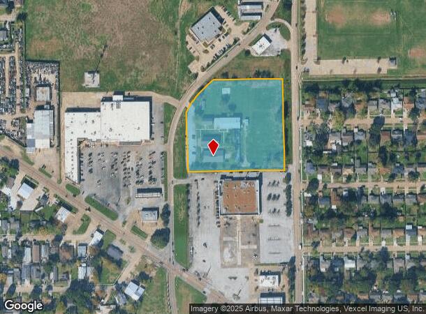
907 Preston Ave, Pasadena, TX 77503


NEARBY LISTINGS FOR SALE OR LEASE
Property Detail
907 Preston Ave
0461990000070
Abst 1107 Wcrr Co Sec 2
Commercialnec
TRS 1C & 1D ABST 1107 WCRR CO SEC 2
X
Harris
48201C0910M
Texas
0
4.59 AC
2025
Gulf Freeway/Pasadena
322800
Houston
19,893 SF
Houston-The Woodlands-Sugar Land, TX
DEMOGRAPHICS near 907 Preston Ave
1 Mile
3 Mile
5 Mile
2024 Total Population
23,542
107,612
228,328
2029 Population
23,916
109,782
233,109
Pop Growth 2024-2029
+ 1.59%
+ 2.02%
+ 2.09%
Average Age
35
35
36
2024 Total Households
7,338
34,897
74,494
HH Growth 2024-2029
+ 1.58%
+ 1.98%
+ 2.08%
Median Household Inc
$59,926
$53,428
$58,809
Avg Household Size
3.10
3.00
3.00
2024 Avg HH Vehicles
2.00
2.00
2.00
Median Home Value
$125,483
$142,723
$167,279
Median Year Built
1962
1969
1974
Nearby Places
Map Layers
Map Styles
 Street
 Aerial
- Restaurants
- Banks
- Shops
- Fitness
- Groceries
PUBLIC TRANSPORTATION
AIRPORT
William P Hobby
DRIVE
WALK
Distance
William P Hobby
23 min
10.4 mi
George Bush Intcntl/Houston
DRIVE
WALK
Distance
George Bush Intcntl/Houston
38 min
29.4 mi
Freight Ports
Port of Houston
DRIVE
WALK
Distance
Port of Houston
17 min
9.3 mi
SALE & LEASE HISTORY
LISTING DATE
SALE/LEASE

Sep 18, 2024
For Sale
Oct 16, 2024
For Lease
Dec 09, 2025
For Sale
Nearby Properties
Address
Land Use
TOTAL SIZE
Lot Size
Zoning
Address
Land Use
TOTAL SIZE
Lot Size
Zoning
Address
Land Use
TOTAL SIZE
Lot Size
Zoning
188.11 AC
Address
Land Use
TOTAL SIZE
Lot Size
Zoning
5,379,424 SF
145.51 AC
Address
Land Use
TOTAL SIZE
Lot Size
Zoning
134.46 AC
Address
Land Use
TOTAL SIZE
Lot Size
Zoning
1,456,582 SF
93.83 AC
Address
Land Use
TOTAL SIZE
Lot Size
Zoning
2,822,672 SF
33.97 AC
Address
Land Use
TOTAL SIZE
Lot Size
Zoning
167.71 AC
Address
Land Use
TOTAL SIZE
Lot Size
Zoning
19.38 AC
Address
Land Use
TOTAL SIZE
Lot Size
Zoning
153.75 AC
Address
Land Use
TOTAL SIZE
Lot Size
Zoning
486.59 AC
Address
Land Use
TOTAL SIZE
Lot Size
Zoning
155.61 AC
Address
Land Use
TOTAL SIZE
Lot Size
Zoning
3,934,000 SF
Address
Land Use
TOTAL SIZE
Lot Size
Zoning
158.48 AC
Address
Land Use
TOTAL SIZE
Lot Size
Zoning
72.68 AC
Address
Land Use
TOTAL SIZE
Lot Size
Zoning
606,550 SF
31.17 AC
Address
Land Use
TOTAL SIZE
Lot Size
Zoning
188.11 AC
Address
Land Use
TOTAL SIZE
Lot Size
Zoning
3,568,104 SF
61.61 AC
Address
Land Use
TOTAL SIZE
Lot Size
Zoning
345,420 SF
4.02 AC
Address
Land Use
TOTAL SIZE
Lot Size
Zoning
7.19 AC
Address
Land Use
TOTAL SIZE
Lot Size
Zoning
371,097 SF
10.32 AC
Address
Land Use
TOTAL SIZE
Lot Size
Zoning
411,046 SF
46.92 AC
Address
Land Use
TOTAL SIZE
Lot Size
Zoning
1,978,100 SF
50.02 AC
Address
Land Use
TOTAL SIZE
Lot Size
Zoning
265,567 SF
14.86 AC
Address
Land Use
TOTAL SIZE
Lot Size
Zoning
488,281 SF
26.48 AC
Address
Land Use
TOTAL SIZE
Lot Size
Zoning
4,580,000 SF
42.82 AC
Address
Land Use
TOTAL SIZE
Lot Size
Zoning
176.73 AC
Address
Land Use
TOTAL SIZE
Lot Size
Zoning
2,367,893 SF
39.85 AC
Address
Land Use
TOTAL SIZE
Lot Size
Zoning
403,776 SF
21.06 AC
Address
Land Use
TOTAL SIZE
Lot Size
Zoning
2,131,181 SF
118.10 AC
Address
Land Use
TOTAL SIZE
Lot Size
Zoning
359,223 SF
17.24 AC
The World's #1 Commercial Real Estate Marketplace
Connect with us
© 2025 CoStar Group
The information above has been obtained from sources believed reliable. While we do not doubt its accuracy we have not verified it and make no guarantee, warranty or representation about it. It is your responsibility to independently confirm its accuracy and completeness. Any projections, opinions, assumptions, or estimates used are for example only and do not represent the current or future performance of the property. The value of this transaction to you depends on tax and other factors which should be evaluated by your tax, financial, and legal advisors. You and your advisors should conduct a careful, independent investigation of the property to determine to your satisfaction the suitability of the property for your needs.