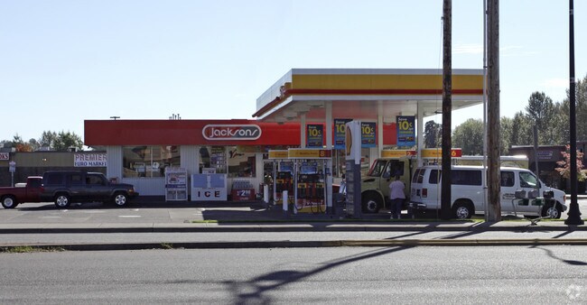
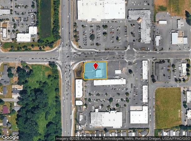
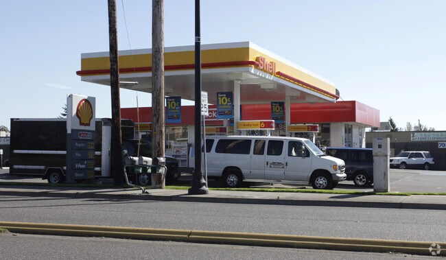
Property Record
907 W Main St, Battle Ground, WA 98604

NEARBY LISTINGS FOR SALE OR LEASE
Property Detail
907 W Main St
091055-083
#129 SEC 3 T3N R2EWM .71A FOR ASSESSOR USE ONLY PTN NE1/4 3-3-2 DAF BEG N1/4 COR SD SEC TH N 89DG 30 30 E ALG N LI SD SEC WHICH N LI IS ALSO C/L ST HY 502 427.6 FT TAP TH S 0DG 29 30 E 45 FT TO IP SET ON S LI SD HY BG POB TH S 0DG 29 30 E 150 FT TO I
Servicestationmarket
Clark
X
Washington
53011C0243D
0.71 AC
2025
Orchards
2025
Portland
040407
Portland-Vancouver-Hillsboro, OR-WA
2,932 SF
DEMOGRAPHICS near 907 W Main St
1 Mile
3 Mile
5 Mile
2024 Total Population
14,578
31,039
46,076
2029 Population
15,694
33,552
49,748
Pop Growth 2024-2029
+ 7.66%
+ 8.10%
+ 7.97%
Average Age
37
39
40
2024 Total Households
5,006
10,571
15,491
HH Growth 2024-2029
+ 7.77%
+ 8.24%
+ 8.13%
Median Household Inc
$85,136
$95,801
$101,286
Avg Household Size
2.90
2.90
2.90
2024 Avg HH Vehicles
2.00
2.00
3.00
Median Home Value
$395,754
$462,030
$515,222
Median Year Built
1999
1997
1995
Nearby Places
Map Layers
Map Styles
 Street
 Aerial
- Restaurants
- Banks
- Shops
- Fitness
- Groceries
PUBLIC TRANSPORTATION
AIRPORT
Portland International
DRIVE
WALK
Distance
Portland International
30 min
18.3 mi
Freight Ports
Port of Vancouver
DRIVE
WALK
Distance
Port of Vancouver
29 min
16.7 mi
Nearby Properties
Address
Land Use
TOTAL SIZE
Lot Size
Zoning
Address
Land Use
TOTAL SIZE
Lot Size
Zoning
128,139 SF
37.02 AC
AG-20
Address
Land Use
TOTAL SIZE
Lot Size
Zoning
146,585 SF
41.85 AC
CC
Address
Land Use
TOTAL SIZE
Lot Size
Zoning
196,625 SF
2.05 AC
MU-R
Address
Land Use
TOTAL SIZE
Lot Size
Zoning
166,003 SF
15.45 AC
RC
Address
Land Use
TOTAL SIZE
Lot Size
Zoning
114,689 SF
19.39 AC
RC
Address
Land Use
TOTAL SIZE
Lot Size
Zoning
129,044 SF
18.81 AC
R7
Address
Land Use
TOTAL SIZE
Lot Size
Zoning
204,121 SF
7.73 AC
MU-R
Address
Land Use
TOTAL SIZE
Lot Size
Zoning
150,874 SF
15.65 AC
RC
Address
Land Use
TOTAL SIZE
Lot Size
Zoning
84,614 SF
10 AC
RC
Address
Land Use
TOTAL SIZE
Lot Size
Zoning
47,476 SF
4.15 AC
RC
Address
Land Use
TOTAL SIZE
Lot Size
Zoning
74,390 SF
6.54 AC
ML
Address
Land Use
TOTAL SIZE
Lot Size
Zoning
136,286 SF
5 AC
RC
Address
Land Use
TOTAL SIZE
Lot Size
Zoning
69,785 SF
4.32 AC
RC
Address
Land Use
TOTAL SIZE
Lot Size
Zoning
57,924 SF
2.14 AC
D
Address
Land Use
TOTAL SIZE
Lot Size
Zoning
42,162 SF
4.28 AC
RC
Address
Land Use
TOTAL SIZE
Lot Size
Zoning
39,320 SF
8.59 AC
RC
Address
Land Use
TOTAL SIZE
Lot Size
Zoning
47,463 SF
1.78 AC
D
Address
Land Use
TOTAL SIZE
Lot Size
Zoning
31,118 SF
1.27 AC
D
Address
Land Use
TOTAL SIZE
Lot Size
Zoning
65,820 SF
2.09 AC
R7
Address
Land Use
TOTAL SIZE
Lot Size
Zoning
57,495 SF
1.47 AC
D
Address
Land Use
TOTAL SIZE
Lot Size
Zoning
55,480 SF
3.54 AC
R20
Address
Land Use
TOTAL SIZE
Lot Size
Zoning
76,626 SF
4.69 AC
RC-1
Address
Land Use
TOTAL SIZE
Lot Size
Zoning
60,996 SF
1.83 AC
R10
Address
Land Use
TOTAL SIZE
Lot Size
Zoning
38,344 SF
5 AC
AG-20
Address
Land Use
TOTAL SIZE
Lot Size
Zoning
48,930 SF
3.16 AC
R10
Address
Land Use
TOTAL SIZE
Lot Size
Zoning
46,060 SF
2.43 AC
R20
Address
Land Use
TOTAL SIZE
Lot Size
Zoning
768 SF
67.89 AC
R12
Address
Land Use
TOTAL SIZE
Lot Size
Zoning
107,826 SF
1.98 AC
R1-20
The World's #1 Commercial Real Estate Marketplace
Connect with us
© 2025 CoStar Group
The information above has been obtained from sources believed reliable. While we do not doubt its accuracy we have not verified it and make no guarantee, warranty or representation about it. It is your responsibility to independently confirm its accuracy and completeness. Any projections, opinions, assumptions, or estimates used are for example only and do not represent the current or future performance of the property. The value of this transaction to you depends on tax and other factors which should be evaluated by your tax, financial, and legal advisors. You and your advisors should conduct a careful, independent investigation of the property to determine to your satisfaction the suitability of the property for your needs.