Property Record
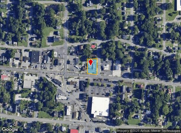
907 Waughtown St, Winston Salem, NC 27107
NEARBY LISTINGS FOR SALE OR LEASE
Property Detail
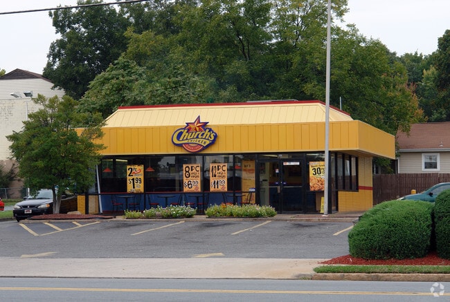
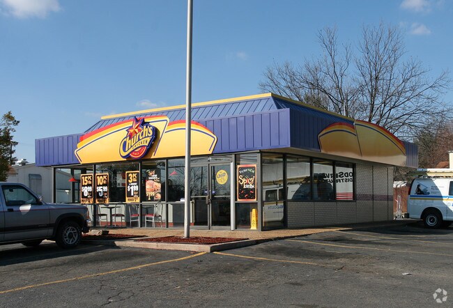
907 Waughtown St
Winston-Salem, NC
Churchs Fried Chicken
6834-96-5435
CHURCHS FRIED CHICKEN LO:003 BL:1532 BU:1
Storebuilding
Forsyth
X
North Carolina
3710683400J
3
2024
0.37 AC
2025
SE Forsyth County
001800
Greensboro/Winston-Salem
1,422 SF
DEMOGRAPHICS near 907 Waughtown St
1 Mile
3 Mile
5 Mile
2024 Total Population
11,775
61,903
138,368
2029 Population
12,320
64,817
144,646
Pop Growth 2024-2029
+ 4.63%
+ 4.71%
+ 4.54%
Average Age
32
36
38
2024 Total Households
3,240
24,876
56,859
HH Growth 2024-2029
+ 4.78%
+ 4.95%
+ 4.63%
Median Household Inc
$30,782
$40,412
$47,665
Avg Household Size
2.70
2.20
2.30
2024 Avg HH Vehicles
2.00
1.00
2.00
Median Home Value
$68,028
$142,832
$174,291
Median Year Built
1956
1970
1974
Nearby Places
Map Layers
Map Styles
 Street
 Aerial
- Restaurants
- Banks
- Shops
- Fitness
- Groceries
PUBLIC TRANSPORTATION
AIRPORT
Piedmont Triad International
DRIVE
WALK
Distance
Piedmont Triad International
31 min
19.8 mi
Freight Ports
Virginia Port Authority - Richmond
DRIVE
WALK
Distance
Virginia Port Authority - Richmond
258 min
223.4 mi
SALE & LEASE HISTORY
LISTING DATE
SALE/LEASE

Aug 23, 2024
For Sale
Nearby Properties
Address
Land Use
TOTAL SIZE
Lot Size
Zoning
Address
Land Use
TOTAL SIZE
Lot Size
Zoning
368,715 SF
4.11 AC
CI
Address
Land Use
TOTAL SIZE
Lot Size
Zoning
205,729 SF
2.35 AC
CI
Address
Land Use
TOTAL SIZE
Lot Size
Zoning
244,516 SF
4.42 AC
CI
Address
Land Use
TOTAL SIZE
Lot Size
Zoning
123,109 SF
65.07 AC
C,HB,LO-S
Address
Land Use
TOTAL SIZE
Lot Size
Zoning
297,475 SF
3.06 AC
CI-S
Address
Land Use
TOTAL SIZE
Lot Size
Zoning
315,590 SF
2 AC
CB
Address
Land Use
TOTAL SIZE
Lot Size
Zoning
156,507 SF
NULL
Address
Land Use
TOTAL SIZE
Lot Size
Zoning
121,886 SF
3.92 AC
PB-S
Address
Land Use
TOTAL SIZE
Lot Size
Zoning
100 SF
37.41 AC
C,H
Address
Land Use
TOTAL SIZE
Lot Size
Zoning
202,752 SF
3.43 AC
PB-L
Address
Land Use
TOTAL SIZE
Lot Size
Zoning
352,549 SF
2.30 AC
CB WO
Address
Land Use
TOTAL SIZE
Lot Size
Zoning
140,472 SF
1.33 AC
CB WO
Address
Land Use
TOTAL SIZE
Lot Size
Zoning
153,315 SF
2.07 AC
CI
Address
Land Use
TOTAL SIZE
Lot Size
Zoning
195,551 SF
2.07 AC
CI
Address
Land Use
TOTAL SIZE
Lot Size
Zoning
200 SF
8.16 AC
PB-S
Address
Land Use
TOTAL SIZE
Lot Size
Zoning
154,655 SF
0.76 AC
CI
Address
Land Use
TOTAL SIZE
Lot Size
Zoning
205,979 SF
1.73 AC
CB WO
Address
Land Use
TOTAL SIZE
Lot Size
Zoning
207,203 SF
4.26 AC
PB
Address
Land Use
TOTAL SIZE
Lot Size
Zoning
70,376 SF
2.86 AC
PB-S
Address
Land Use
TOTAL SIZE
Lot Size
Zoning
106,204 SF
1.13 AC
CI
Address
Land Use
TOTAL SIZE
Lot Size
Zoning
162,844 SF
57.77 AC
IP
Address
Land Use
TOTAL SIZE
Lot Size
Zoning
124,134 SF
2.14 AC
CB WO
Address
Land Use
TOTAL SIZE
Lot Size
Zoning
121,925 SF
1.49 AC
GO
Address
Land Use
TOTAL SIZE
Lot Size
Zoning
115,340 SF
2.10 AC
CI
Address
Land Use
TOTAL SIZE
Lot Size
Zoning
56,975 SF
0.26 AC
CB WO
Address
Land Use
TOTAL SIZE
Lot Size
Zoning
62,714 SF
0.55 AC
CB WO
Address
Land Use
TOTAL SIZE
Lot Size
Zoning
177,562 SF
12.59 AC
GO
Address
Land Use
TOTAL SIZE
Lot Size
Zoning
196,804 SF
2.16 AC
CB
Address
Land Use
TOTAL SIZE
Lot Size
Zoning
46,506 SF
0.55 AC
CB WO
Address
Land Use
TOTAL SIZE
Lot Size
Zoning
43,258 SF
0.29 AC
CB WO
The World's #1 Commercial Real Estate Marketplace
Connect with us
© 2025 CoStar Group
The information above has been obtained from sources believed reliable. While we do not doubt its accuracy we have not verified it and make no guarantee, warranty or representation about it. It is your responsibility to independently confirm its accuracy and completeness. Any projections, opinions, assumptions, or estimates used are for example only and do not represent the current or future performance of the property. The value of this transaction to you depends on tax and other factors which should be evaluated by your tax, financial, and legal advisors. You and your advisors should conduct a careful, independent investigation of the property to determine to your satisfaction the suitability of the property for your needs.