Property Record
907 Wrigley Dr, Wake Forest, NC 27587
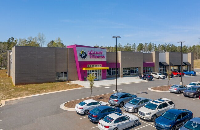

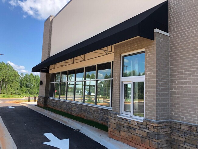
Property Detail
907 Wrigley Dr
1842.03-21-2870-000
LO1 WAKE FOREST INVESTMENTS LLC BM2020-0
Commercialnec
WAKE
HB
North Carolina
B and X Area of moderate flood hazard, usually the area between the limits of the 100-year and 500-year floods.
1
2025
4.64 AC
2025
Route 1
054204
Raleigh/Durham
28,958 SF
Raleigh-Cary, NC
NEARBY LISTINGS FOR SALE OR LEASE
DEMOGRAPHICS near 907 Wrigley Dr
1 mile
3 mile
5 mile
2025 Total Population
4,920
35,501
92,139
2030 Population
5,471
39,159
101,492
Pop Growth 2025-2030
+ 11.20%
+ 10.30%
+ 10.15%
Average Age
38
40
40
2025 Total Households
1,709
13,052
34,020
HH Growth 2025-2030
+ 11.59%
+ 10.76%
+ 10.55%
Median Household Inc
$99,119
$100,368
$111,204
Avg Household Size
2.90
2.60
2.70
2025 Avg HH Vehicles
2.00
2.00
2.00
Median Home Value
$392,307
$449,526
$471,848
Median Year Built
2002
2003
2007
Nearby Places
Map Layers
Map Styles
 Street
 Aerial
Layers
 Traffic
 Biking
Places
Listings with unknown addresses are not visible on the map
- Restaurants
- Banks
- Shops
- Fitness
- Groceries
PUBLIC TRANSPORTATION
AIRPORT
Raleigh-Durham International
Drive
Walk
Distance
Raleigh-Durham International
35 min
23.2 mi
Freight Ports
Virginia Port Authority - Richmond
Drive
Walk
Distance
Virginia Port Authority - Richmond
158 min
131.8 mi
SALE & LEASE HISTORY
LISTING DATE
SALE/LEASE

Aug 21, 2020
For Lease
Nearby Properties
Address
Land Use
TOTAL SIZE
Lot Size
Zoning
Address
Land Use
TOTAL SIZE
Lot Size
Zoning
442,480 SF
52.02 AC
GR3
Address
Land Use
TOTAL SIZE
Lot Size
Zoning
306,712 SF
14.03 AC
PUD
Address
Land Use
TOTAL SIZE
Lot Size
Zoning
283,795 SF
31.33 AC
ICD
Address
Land Use
TOTAL SIZE
Lot Size
Zoning
159,584 SF
67.12 AC
FCO GB
Address
Land Use
TOTAL SIZE
Lot Size
Zoning
136,644 SF
4.38 AC
RMX
Address
Land Use
TOTAL SIZE
Lot Size
Zoning
143,060 SF
7.19 AC
RMX
Address
Land Use
TOTAL SIZE
Lot Size
Zoning
154,602 SF
40 AC
ICD
Address
Land Use
TOTAL SIZE
Lot Size
Zoning
84,528 SF
14.44 AC
NB
Address
Land Use
TOTAL SIZE
Lot Size
Zoning
97,878 SF
26.85 AC
GR5
Address
Land Use
TOTAL SIZE
Lot Size
Zoning
216,580 SF
14.99 AC
FCO GB
Address
Land Use
TOTAL SIZE
Lot Size
Zoning
170,100 SF
15.41 AC
FCO GB
Address
Land Use
TOTAL SIZE
Lot Size
Zoning
106,593 SF
15.32 AC
HB
Address
Land Use
TOTAL SIZE
Lot Size
Zoning
107,082 SF
4.17 AC
RMX
Address
Land Use
TOTAL SIZE
Lot Size
Zoning
91,233 SF
11.04 AC
GR10
Address
Land Use
TOTAL SIZE
Lot Size
Zoning
103,310 SF
6.29 AC
RMX
Address
Land Use
TOTAL SIZE
Lot Size
Zoning
117,680 SF
11.99 AC
GR10
Address
Land Use
TOTAL SIZE
Lot Size
Zoning
160,525 SF
20.02 AC
IND
Address
Land Use
TOTAL SIZE
Lot Size
Zoning
58,211 SF
6.96 AC
NMX
Address
Land Use
TOTAL SIZE
Lot Size
Zoning
61,138 SF
36.70 AC
GR3
Address
Land Use
TOTAL SIZE
Lot Size
Zoning
364,500 SF
30.25 AC
IND
Address
Land Use
TOTAL SIZE
Lot Size
Zoning
77,343 SF
14.12 AC
GR5
Address
Land Use
TOTAL SIZE
Lot Size
Zoning
117,037 SF
13.88 AC
GR10
Address
Land Use
TOTAL SIZE
Lot Size
Zoning
172,250 SF
17.15 AC
HB
Address
Land Use
TOTAL SIZE
Lot Size
Zoning
83,797 SF
11.25 AC
HB
Address
Land Use
TOTAL SIZE
Lot Size
Zoning
105,912 SF
8.44 AC
GR10
Address
Land Use
TOTAL SIZE
Lot Size
Zoning
101,523 SF
2.82 AC
HB
Address
Land Use
TOTAL SIZE
Lot Size
Zoning
50,134 SF
149.08 AC
R-40W
Address
Land Use
TOTAL SIZE
Lot Size
Zoning
92,980 SF
145.72 AC
RMX
Address
Land Use
TOTAL SIZE
Lot Size
Zoning
117,949 SF
14.79 AC
HB
Address
Land Use
TOTAL SIZE
Lot Size
Zoning
161.31 AC
HB
The World's #1 Commercial Real Estate Marketplace
Connect with us
© 2026 CoStar Group
The information above has been obtained from sources believed reliable. While we do not doubt its accuracy we have not verified it and make no guarantee, warranty or representation about it. It is your responsibility to independently confirm its accuracy and completeness. Any projections, opinions, assumptions, or estimates used are for example only and do not represent the current or future performance of the property. The value of this transaction to you depends on tax and other factors which should be evaluated by your tax, financial, and legal advisors. You and your advisors should conduct a careful, independent investigation of the property to determine to your satisfaction the suitability of the property for your needs.