Property Record
9070 Pippin Rd, Cincinnati, OH 45251
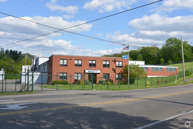

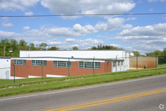
Property Detail
9070 Pippin Rd
Cincinnati, OH-KY-IN
PIPPIN RD 11.1067 ACS2 & 3 T2 ER1
510-0053-0619
Hamilton
Lightindustrial
Ohio
B and X Area of moderate flood hazard, usually the area between the limits of the 100-year and 500-year floods.
11.11 AC
2025
West
2025
Cincinnati/Dayton
021604
NEARBY LISTINGS FOR SALE OR LEASE
-
-
View all Cincinnati listings for sale on LoopNet.com
DEMOGRAPHICS near 9070 Pippin Rd
1 mile
3 mile
5 mile
2025 Total Population
11,642
91,958
176,932
2030 Population
11,705
92,429
178,053
Pop Growth 2025-2030
+ 0.54%
+ 0.51%
+ 0.63%
Average Age
39
40
41
2025 Total Households
4,404
37,142
71,238
HH Growth 2025-2030
+ 0.52%
+ 0.46%
+ 0.60%
Median Household Inc
$62,898
$63,186
$66,629
Avg Household Size
2.50
2.40
2.40
2025 Avg HH Vehicles
2.00
2.00
2.00
Median Home Value
$173,208
$179,655
$200,933
Median Year Built
1965
1963
1965
Nearby Places
Map Layers
Map Styles
 Street
 Aerial
Layers
 Traffic
 Biking
Places
Listings with unknown addresses are not visible on the map
- Restaurants
- Banks
- Shops
- Fitness
- Groceries
PUBLIC TRANSPORTATION
AIRPORT
Cincinnati/Northern Kentucky International
Drive
Walk
Distance
Cincinnati/Northern Kentucky International
45 min
24.3 mi
Nearby Properties
Address
Land Use
TOTAL SIZE
Lot Size
Zoning
Address
Land Use
TOTAL SIZE
Lot Size
Zoning
Address
Land Use
TOTAL SIZE
Lot Size
Zoning
24.69 AC
Address
Land Use
TOTAL SIZE
Lot Size
Zoning
44.58 AC
Address
Land Use
TOTAL SIZE
Lot Size
Zoning
29.78 AC
Address
Land Use
TOTAL SIZE
Lot Size
Zoning
5,984 SF
15.91 AC
Address
Land Use
TOTAL SIZE
Lot Size
Zoning
30.43 AC
Address
Land Use
TOTAL SIZE
Lot Size
Zoning
41,564 SF
13.21 AC
Address
Land Use
TOTAL SIZE
Lot Size
Zoning
59,744 SF
31.77 AC
Address
Land Use
TOTAL SIZE
Lot Size
Zoning
11.65 AC
Address
Land Use
TOTAL SIZE
Lot Size
Zoning
103.18 AC
R1A
Address
Land Use
TOTAL SIZE
Lot Size
Zoning
52,138 SF
17.43 AC
Address
Land Use
TOTAL SIZE
Lot Size
Zoning
50.02 AC
Address
Land Use
TOTAL SIZE
Lot Size
Zoning
14.19 AC
Address
Land Use
TOTAL SIZE
Lot Size
Zoning
1,302 SF
11.62 AC
Address
Land Use
TOTAL SIZE
Lot Size
Zoning
60,614 SF
13.35 AC
SF6
Address
Land Use
TOTAL SIZE
Lot Size
Zoning
4,800 SF
7.20 AC
Address
Land Use
TOTAL SIZE
Lot Size
Zoning
60.59 AC
Address
Land Use
TOTAL SIZE
Lot Size
Zoning
Address
Land Use
TOTAL SIZE
Lot Size
Zoning
Address
Land Use
TOTAL SIZE
Lot Size
Zoning
27.60 AC
Address
Land Use
TOTAL SIZE
Lot Size
Zoning
28.25 AC
Address
Land Use
TOTAL SIZE
Lot Size
Zoning
9,982 SF
36.33 AC
Address
Land Use
TOTAL SIZE
Lot Size
Zoning
Address
Land Use
TOTAL SIZE
Lot Size
Zoning
20.33 AC
SF6
Address
Land Use
TOTAL SIZE
Lot Size
Zoning
166,800 SF
15.25 AC
Address
Land Use
TOTAL SIZE
Lot Size
Zoning
49,056 SF
5.70 AC
RM20
Address
Land Use
TOTAL SIZE
Lot Size
Zoning
Address
Land Use
TOTAL SIZE
Lot Size
Zoning
3,996 SF
14.27 AC
Address
Land Use
TOTAL SIZE
Lot Size
Zoning
Address
Land Use
TOTAL SIZE
Lot Size
Zoning
9.47 AC
SF6
The World's #1 Commercial Real Estate Marketplace
Connect with us
© 2026 CoStar Group
The information above has been obtained from sources believed reliable. While we do not doubt its accuracy we have not verified it and make no guarantee, warranty or representation about it. It is your responsibility to independently confirm its accuracy and completeness. Any projections, opinions, assumptions, or estimates used are for example only and do not represent the current or future performance of the property. The value of this transaction to you depends on tax and other factors which should be evaluated by your tax, financial, and legal advisors. You and your advisors should conduct a careful, independent investigation of the property to determine to your satisfaction the suitability of the property for your needs.