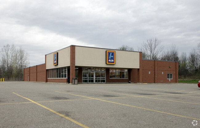
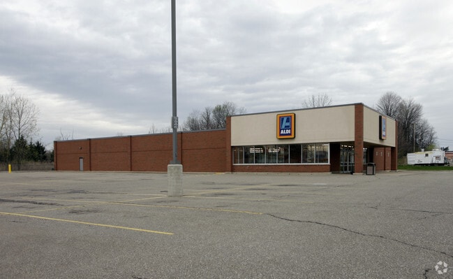
Property Record
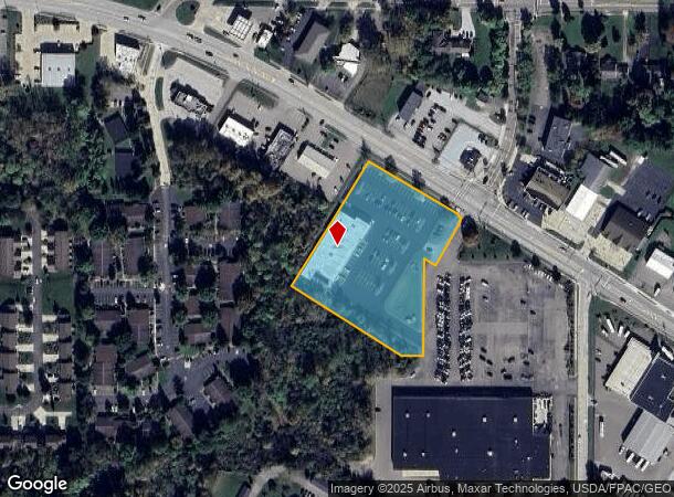
9071 State Route 14, Streetsboro, OH 44241
NEARBY LISTINGS FOR SALE OR LEASE
Property Detail
9071 State Route 14
35-055-00-00-002-007
LOT 56
Supermarket
Portage
X
Ohio
39133C0127D
56
2024
2.95 AC
2024
Portage County
600402
Cleveland
15,180 SF
Akron, OH
DEMOGRAPHICS near 9071 State Route 14
1 Mile
3 Mile
5 Mile
2024 Total Population
5,440
20,304
43,310
2029 Population
5,594
20,737
43,652
Pop Growth 2024-2029
+ 2.83%
+ 2.13%
+ 0.79%
Average Age
41
42
42
2024 Total Households
2,348
8,611
17,027
HH Growth 2024-2029
+ 2.85%
+ 2.09%
+ 0.85%
Median Household Inc
$70,018
$75,309
$90,877
Avg Household Size
2.20
2.30
2.50
2024 Avg HH Vehicles
2.00
2.00
2.00
Median Home Value
$178,302
$199,650
$261,889
Median Year Built
1982
1990
1983
Nearby Places
Map Layers
Map Styles
 Street
 Aerial
- Restaurants
- Banks
- Shops
- Fitness
- Groceries
PUBLIC TRANSPORTATION
AIRPORT
Akron-Canton Regional
DRIVE
WALK
Distance
Akron-Canton Regional
48 min
32.7 mi
Cleveland-Hopkins International
DRIVE
WALK
Distance
Cleveland-Hopkins International
50 min
36.9 mi
SALE & LEASE HISTORY
LISTING DATE
SALE/LEASE

Feb 25, 2019
For Lease
Feb 25, 2019
For Sale
Feb 03, 2023
For Sale
Nearby Properties
Address
Land Use
TOTAL SIZE
Lot Size
Zoning
Address
Land Use
TOTAL SIZE
Lot Size
Zoning
650,506 SF
57.86 AC
Address
Land Use
TOTAL SIZE
Lot Size
Zoning
435,216 SF
31.88 AC
Address
Land Use
TOTAL SIZE
Lot Size
Zoning
117,571 SF
119.98 AC
Address
Land Use
TOTAL SIZE
Lot Size
Zoning
257,381 SF
28.99 AC
Address
Land Use
TOTAL SIZE
Lot Size
Zoning
441,158 SF
74.07 AC
Address
Land Use
TOTAL SIZE
Lot Size
Zoning
368,060 SF
27.87 AC
Address
Land Use
TOTAL SIZE
Lot Size
Zoning
73,295 SF
12.75 AC
Address
Land Use
TOTAL SIZE
Lot Size
Zoning
418,878 SF
51.63 AC
Address
Land Use
TOTAL SIZE
Lot Size
Zoning
348,301 SF
27.65 AC
Address
Land Use
TOTAL SIZE
Lot Size
Zoning
340,850 SF
29.70 AC
Address
Land Use
TOTAL SIZE
Lot Size
Zoning
155,932 SF
12.94 AC
Address
Land Use
TOTAL SIZE
Lot Size
Zoning
30.10 AC
Address
Land Use
TOTAL SIZE
Lot Size
Zoning
129,487 SF
33.05 AC
Address
Land Use
TOTAL SIZE
Lot Size
Zoning
206,907 SF
1.11 AC
Address
Land Use
TOTAL SIZE
Lot Size
Zoning
149,850 SF
24.08 AC
Address
Land Use
TOTAL SIZE
Lot Size
Zoning
22,052 SF
12.52 AC
Address
Land Use
TOTAL SIZE
Lot Size
Zoning
170,490 SF
17.74 AC
Address
Land Use
TOTAL SIZE
Lot Size
Zoning
87,010 SF
22.96 AC
Address
Land Use
TOTAL SIZE
Lot Size
Zoning
251,864 SF
22.07 AC
Address
Land Use
TOTAL SIZE
Lot Size
Zoning
88,934 SF
19.65 AC
Address
Land Use
TOTAL SIZE
Lot Size
Zoning
142,832 SF
20.95 AC
Address
Land Use
TOTAL SIZE
Lot Size
Zoning
194,632 SF
19.41 AC
Address
Land Use
TOTAL SIZE
Lot Size
Zoning
88,898 SF
5.98 AC
Address
Land Use
TOTAL SIZE
Lot Size
Zoning
168,429 SF
14.81 AC
Address
Land Use
TOTAL SIZE
Lot Size
Zoning
145,400 SF
30.70 AC
Address
Land Use
TOTAL SIZE
Lot Size
Zoning
61,694 SF
5.10 AC
Address
Land Use
TOTAL SIZE
Lot Size
Zoning
175,496 SF
30 AC
Address
Land Use
TOTAL SIZE
Lot Size
Zoning
150,755 SF
15.98 AC
Address
Land Use
TOTAL SIZE
Lot Size
Zoning
150,504 SF
13.95 AC
Address
Land Use
TOTAL SIZE
Lot Size
Zoning
50,000 SF
5.35 AC
The World's #1 Commercial Real Estate Marketplace
Connect with us
© 2025 CoStar Group
The information above has been obtained from sources believed reliable. While we do not doubt its accuracy we have not verified it and make no guarantee, warranty or representation about it. It is your responsibility to independently confirm its accuracy and completeness. Any projections, opinions, assumptions, or estimates used are for example only and do not represent the current or future performance of the property. The value of this transaction to you depends on tax and other factors which should be evaluated by your tax, financial, and legal advisors. You and your advisors should conduct a careful, independent investigation of the property to determine to your satisfaction the suitability of the property for your needs.