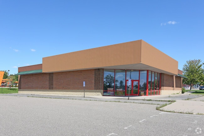
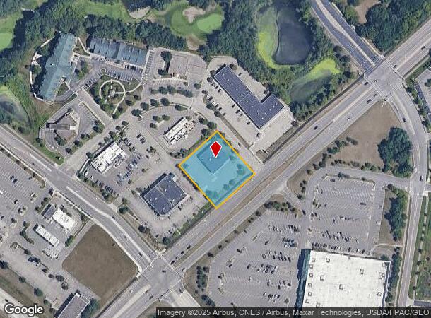
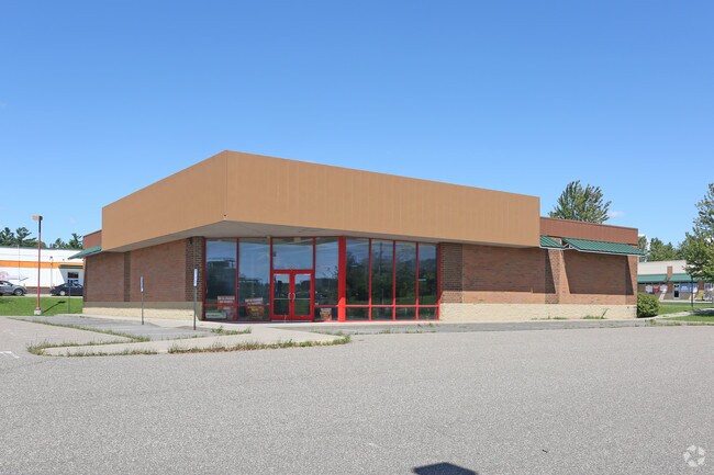
Property Record
9079 Buchanan Trl, Inver Grove Heights, MN 55076

NEARBY LISTINGS FOR SALE OR LEASE
-
-
View all Inver Grove Heights listings for lease on LoopNet.com
Property Detail
9079 Buchanan Trl
Minneapolis-St. Paul-Bloomington, MN-WI
Arbor Pointe 15Th Addition
20-11865-01-010
ARBOR POINTE 15TH ADDITION 1 1
Commercialnec
Dakota
X
Minnesota
27037C0110E
10
2024
1.03 AC
2024
Eagan
060509
Minneapolis/St Paul
6,935 SF
DEMOGRAPHICS near 9079 Buchanan Trl
1 Mile
3 Mile
5 Mile
2024 Total Population
4,533
26,555
94,989
2029 Population
4,582
27,237
98,792
Pop Growth 2024-2029
+ 1.08%
+ 2.57%
+ 4.00%
Average Age
44
42
40
2024 Total Households
2,004
10,415
35,866
HH Growth 2024-2029
+ 1.05%
+ 2.45%
+ 3.91%
Median Household Inc
$104,155
$92,184
$94,996
Avg Household Size
2.20
2.50
2.60
2024 Avg HH Vehicles
2.00
2.00
2.00
Median Home Value
$359,625
$323,942
$328,876
Median Year Built
1996
1989
1987
Nearby Places
Map Layers
Map Styles
 Street
 Aerial
- Restaurants
- Banks
- Shops
- Fitness
- Groceries
PUBLIC TRANSPORTATION
AIRPORT
Minneapolis-St Paul International/Wold-Chamberlain
DRIVE
WALK
Distance
Minneapolis-St Paul International/Wold-Chamberlain
19 min
12.4 mi
SALE & LEASE HISTORY
LISTING DATE
SALE/LEASE

Mar 29, 2017
For Lease
Mar 29, 2017
For Lease
Mar 11, 2020
For Lease
Mar 11, 2020
For Sale
Feb 21, 2019
For Sale
Feb 02, 2018
For Lease
Dec 22, 2016
For Lease
Aug 23, 2017
For Sale
Nearby Properties
Address
Land Use
TOTAL SIZE
Lot Size
Zoning
Address
Land Use
TOTAL SIZE
Lot Size
Zoning
Address
Land Use
TOTAL SIZE
Lot Size
Zoning
6,566 SF
48.32 AC
Address
Land Use
TOTAL SIZE
Lot Size
Zoning
605,774 SF
44.50 AC
Address
Land Use
TOTAL SIZE
Lot Size
Zoning
228,810 SF
6.30 AC
Address
Land Use
TOTAL SIZE
Lot Size
Zoning
212,331 SF
9.27 AC
Address
Land Use
TOTAL SIZE
Lot Size
Zoning
169,237 SF
23.38 AC
Address
Land Use
TOTAL SIZE
Lot Size
Zoning
138,609 SF
3.76 AC
Address
Land Use
TOTAL SIZE
Lot Size
Zoning
150,469 SF
10.73 AC
Address
Land Use
TOTAL SIZE
Lot Size
Zoning
28,461 SF
16.13 AC
Address
Land Use
TOTAL SIZE
Lot Size
Zoning
128,798 SF
4.22 AC
Address
Land Use
TOTAL SIZE
Lot Size
Zoning
97,792 SF
16.39 AC
Address
Land Use
TOTAL SIZE
Lot Size
Zoning
95,693 SF
3.64 AC
Address
Land Use
TOTAL SIZE
Lot Size
Zoning
108,000 SF
6.44 AC
Address
Land Use
TOTAL SIZE
Lot Size
Zoning
72,350 SF
1.86 AC
Address
Land Use
TOTAL SIZE
Lot Size
Zoning
96,000 SF
6.41 AC
Address
Land Use
TOTAL SIZE
Lot Size
Zoning
76,452 SF
13.76 AC
Address
Land Use
TOTAL SIZE
Lot Size
Zoning
134,918 SF
15.19 AC
Address
Land Use
TOTAL SIZE
Lot Size
Zoning
85,104 SF
11.75 AC
Address
Land Use
TOTAL SIZE
Lot Size
Zoning
141,090 SF
16.79 AC
Address
Land Use
TOTAL SIZE
Lot Size
Zoning
48,987 SF
5.04 AC
Address
Land Use
TOTAL SIZE
Lot Size
Zoning
71,296 SF
4.99 AC
Address
Land Use
TOTAL SIZE
Lot Size
Zoning
86,363 SF
22.51 AC
Address
Land Use
TOTAL SIZE
Lot Size
Zoning
479,206 SF
24.35 AC
Address
Land Use
TOTAL SIZE
Lot Size
Zoning
68,824 SF
2.14 AC
Address
Land Use
TOTAL SIZE
Lot Size
Zoning
47,122 SF
2.44 AC
Address
Land Use
TOTAL SIZE
Lot Size
Zoning
68,980 SF
9.07 AC
Address
Land Use
TOTAL SIZE
Lot Size
Zoning
91,338 SF
12.21 AC
Address
Land Use
TOTAL SIZE
Lot Size
Zoning
Address
Land Use
TOTAL SIZE
Lot Size
Zoning
46,128 SF
25.93 AC
Address
Land Use
TOTAL SIZE
Lot Size
Zoning
129,600 SF
8.49 AC
The World's #1 Commercial Real Estate Marketplace
Connect with us
© 2025 CoStar Group
The information above has been obtained from sources believed reliable. While we do not doubt its accuracy we have not verified it and make no guarantee, warranty or representation about it. It is your responsibility to independently confirm its accuracy and completeness. Any projections, opinions, assumptions, or estimates used are for example only and do not represent the current or future performance of the property. The value of this transaction to you depends on tax and other factors which should be evaluated by your tax, financial, and legal advisors. You and your advisors should conduct a careful, independent investigation of the property to determine to your satisfaction the suitability of the property for your needs.