Property Record
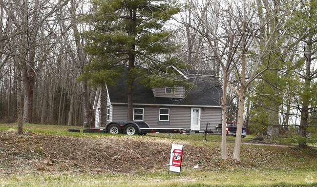
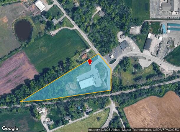
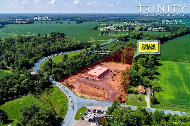
9079 S State Route 123, Blanchester, OH 45107
NEARBY LISTINGS FOR SALE OR LEASE
Property Detail
9079 S State Route 123
18-03-377-002
Route 123
Commercialnec
ROUTE 123
X
Warren
39165C0270E
Ohio
2024
4.30 AC
2024
Outlying Warren County
964900
Cincinnati/Dayton
1,340 SF
Cincinnati, OH-KY-IN
DEMOGRAPHICS near 9079 S State Route 123
1 Mile
3 Mile
5 Mile
2024 Total Population
1,440
6,726
10,641
2029 Population
1,455
6,877
10,927
Pop Growth 2024-2029
+ 1.04%
+ 2.25%
+ 2.69%
Average Age
40
41
41
2024 Total Households
561
2,616
4,021
HH Growth 2024-2029
+ 0.89%
+ 2.10%
+ 2.56%
Median Household Inc
$61,447
$58,642
$69,198
Avg Household Size
2.50
2.50
2.60
2024 Avg HH Vehicles
2.00
2.00
2.00
Median Home Value
$149,450
$152,712
$187,662
Median Year Built
1972
1973
1976
Nearby Places
Map Layers
Map Styles
 Street
 Aerial
- Restaurants
- Banks
- Shops
- Fitness
- Groceries
SALE & LEASE HISTORY
LISTING DATE
SALE/LEASE

Sep 01, 2022
For Sale
Nearby Properties
Address
Land Use
TOTAL SIZE
Lot Size
Zoning
Address
Land Use
TOTAL SIZE
Lot Size
Zoning
114,436 SF
46.31 AC
PUB
Address
Land Use
TOTAL SIZE
Lot Size
Zoning
71,601 SF
2.19 AC
PUB
Address
Land Use
TOTAL SIZE
Lot Size
Zoning
66,729 SF
5.67 AC
PUB
Address
Land Use
TOTAL SIZE
Lot Size
Zoning
269,586 SF
41.92 AC
I1
Address
Land Use
TOTAL SIZE
Lot Size
Zoning
72,415 SF
11.18 AC
B5
Address
Land Use
TOTAL SIZE
Lot Size
Zoning
6,864 SF
4.27 AC
PUB
Address
Land Use
TOTAL SIZE
Lot Size
Zoning
2,200 SF
5.09 AC
PD
Address
Land Use
TOTAL SIZE
Lot Size
Zoning
30,789 SF
5 AC
Address
Land Use
TOTAL SIZE
Lot Size
Zoning
202.08 AC
RR
Address
Land Use
TOTAL SIZE
Lot Size
Zoning
42,706 SF
5.41 AC
R6
Address
Land Use
TOTAL SIZE
Lot Size
Zoning
24,726 SF
3.53 AC
R6
Address
Land Use
TOTAL SIZE
Lot Size
Zoning
173.25 AC
A3
Address
Land Use
TOTAL SIZE
Lot Size
Zoning
98,620 SF
13.86 AC
I1
Address
Land Use
TOTAL SIZE
Lot Size
Zoning
2,688 SF
39.70 AC
I2
Address
Land Use
TOTAL SIZE
Lot Size
Zoning
2,639 SF
130 AC
A3
Address
Land Use
TOTAL SIZE
Lot Size
Zoning
17,278 SF
1.74 AC
R6
Address
Land Use
TOTAL SIZE
Lot Size
Zoning
12,112 SF
3.84 AC
Address
Land Use
TOTAL SIZE
Lot Size
Zoning
125.97 AC
RR
Address
Land Use
TOTAL SIZE
Lot Size
Zoning
6,559 SF
27.66 AC
R1
Address
Land Use
TOTAL SIZE
Lot Size
Zoning
119.86 AC
A3
Address
Land Use
TOTAL SIZE
Lot Size
Zoning
5,961 SF
1.56 AC
Address
Land Use
TOTAL SIZE
Lot Size
Zoning
115.38 AC
RR
Address
Land Use
TOTAL SIZE
Lot Size
Zoning
4,746 SF
3.03 AC
R6
Address
Land Use
TOTAL SIZE
Lot Size
Zoning
114.50 AC
A3
Address
Land Use
TOTAL SIZE
Lot Size
Zoning
111.01 AC
A3
Address
Land Use
TOTAL SIZE
Lot Size
Zoning
10,050 SF
1.02 AC
B5
Address
Land Use
TOTAL SIZE
Lot Size
Zoning
112.27 AC
A3
Address
Land Use
TOTAL SIZE
Lot Size
Zoning
103.41 AC
RR
Address
Land Use
TOTAL SIZE
Lot Size
Zoning
100 AC
A3
The World's #1 Commercial Real Estate Marketplace
Connect with us
© 2026 CoStar Group
The information above has been obtained from sources believed reliable. While we do not doubt its accuracy we have not verified it and make no guarantee, warranty or representation about it. It is your responsibility to independently confirm its accuracy and completeness. Any projections, opinions, assumptions, or estimates used are for example only and do not represent the current or future performance of the property. The value of this transaction to you depends on tax and other factors which should be evaluated by your tax, financial, and legal advisors. You and your advisors should conduct a careful, independent investigation of the property to determine to your satisfaction the suitability of the property for your needs.