Property Record
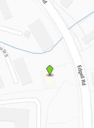
908 Edgell Rd, Framingham, MA 01701

Property Detail
908 Edgell Rd
FRAM-000037-000035-003278
Middlesex
Storebuilding
Massachusetts
B2
3278
C and X Area of minimal flood hazard, usually depicted on FIRMs as above the 500-year flood level.
0.32 AC
2025
Framingham/Natick
2025
Boston
383904
Boston-Cambridge-Newton, MA-NH
3,000 SF
NEARBY LISTINGS FOR SALE OR LEASE
DEMOGRAPHICS near 908 Edgell Rd
1 mile
3 mile
5 mile
2025 Total Population
7,470
55,295
140,272
2030 Population
7,804
57,613
146,261
Pop Growth 2025-2030
+ 4.47%
+ 4.19%
+ 4.27%
Average Age
45
42
41
2025 Total Households
2,969
21,441
53,796
HH Growth 2025-2030
+ 4.65%
+ 4.35%
+ 4.41%
Median Household Inc
$106,561
$121,128
$115,911
Avg Household Size
2.50
2.40
2.50
2025 Avg HH Vehicles
2.00
2.00
2.00
Median Home Value
$695,366
$725,034
$732,929
Median Year Built
1965
1966
1968
Nearby Places
Map Layers
Map Styles
 Street
 Aerial
Layers
 Traffic
 Biking
Places
Listings with unknown addresses are not visible on the map
- Restaurants
- Banks
- Shops
- Fitness
- Groceries
PUBLIC TRANSPORTATION
COMMUTER RAIL
Framingham (Framingham/Worcester Line - Massachusetts Bay Transportation Authority Commuter Rail (Purple Line))
Drive
Walk
Distance
Framingham (Framingham/Worcester Line - Massachusetts Bay Transportation Authority Commuter Rail (Purple Line))
8 min
4.2 mi
Framingham Amtrak (Lake Shore Limited - Amtrak)
Drive
Walk
Distance
Framingham Amtrak (Lake Shore Limited - Amtrak)
9 min
4.3 mi
AIRPORT
Worcester Regional
Drive
Walk
Distance
Worcester Regional
45 min
25.8 mi
General Edward Lawrence Logan International
Drive
Walk
Distance
General Edward Lawrence Logan International
40 min
27.1 mi
Freight Ports
Port of Boston
Drive
Walk
Distance
Port of Boston
39 min
25.4 mi
Nearby Properties
Address
Land Use
TOTAL SIZE
Lot Size
Zoning
Address
Land Use
TOTAL SIZE
Lot Size
Zoning
478,440 SF
11.97 AC
B
Address
Land Use
TOTAL SIZE
Lot Size
Zoning
396,002 SF
44.44 AC
R1
Address
Land Use
TOTAL SIZE
Lot Size
Zoning
340,840 SF
4.25 AC
B
Address
Land Use
TOTAL SIZE
Lot Size
Zoning
137,000 SF
18.96 AC
R1
Address
Land Use
TOTAL SIZE
Lot Size
Zoning
24.78 AC
LID
Address
Land Use
TOTAL SIZE
Lot Size
Zoning
837,977 SF
18.57 AC
M1
Address
Land Use
TOTAL SIZE
Lot Size
Zoning
493,918 SF
28.90 AC
R1
Address
Land Use
TOTAL SIZE
Lot Size
Zoning
293,180 SF
5.10 AC
B
Address
Land Use
TOTAL SIZE
Lot Size
Zoning
264,247 SF
6.09 AC
M1
Address
Land Use
TOTAL SIZE
Lot Size
Zoning
273,474 SF
7.46 AC
B
Address
Land Use
TOTAL SIZE
Lot Size
Zoning
444,182 SF
32.91 AC
TP
Address
Land Use
TOTAL SIZE
Lot Size
Zoning
136,919 SF
13.42 AC
M
Address
Land Use
TOTAL SIZE
Lot Size
Zoning
256,830 SF
12.61 AC
B
Address
Land Use
TOTAL SIZE
Lot Size
Zoning
207,522 SF
10.11 AC
B
Address
Land Use
TOTAL SIZE
Lot Size
Zoning
182,524 SF
3.60 AC
B2
Address
Land Use
TOTAL SIZE
Lot Size
Zoning
231,897 SF
7.90 AC
B
Address
Land Use
TOTAL SIZE
Lot Size
Zoning
182,736 SF
7.30 AC
B2
Address
Land Use
TOTAL SIZE
Lot Size
Zoning
139,397 SF
9.15 AC
M
Address
Land Use
TOTAL SIZE
Lot Size
Zoning
350,935 SF
25.51 AC
M
Address
Land Use
TOTAL SIZE
Lot Size
Zoning
183,338 SF
4.85 AC
B2
Address
Land Use
TOTAL SIZE
Lot Size
Zoning
114,000 SF
31.53 AC
PRD
Address
Land Use
TOTAL SIZE
Lot Size
Zoning
112,000 SF
15.11 AC
G
Address
Land Use
TOTAL SIZE
Lot Size
Zoning
239,454 SF
12.65 AC
R3
Address
Land Use
TOTAL SIZE
Lot Size
Zoning
134,628 SF
8.26 AC
M1
Address
Land Use
TOTAL SIZE
Lot Size
Zoning
135,535 SF
16.01 AC
B
Address
Land Use
TOTAL SIZE
Lot Size
Zoning
239,614 SF
5.82 AC
M
Address
Land Use
TOTAL SIZE
Lot Size
Zoning
91,461 SF
22.63 AC
R1
Address
Land Use
TOTAL SIZE
Lot Size
Zoning
135,542 SF
6.39 AC
B
Address
Land Use
TOTAL SIZE
Lot Size
Zoning
126,828 SF
8.81 AC
R4
Address
Land Use
TOTAL SIZE
Lot Size
Zoning
117,056 SF
10.97 AC
M1
The World's #1 Commercial Real Estate Marketplace
Connect with us
© 2026 CoStar Group
The information above has been obtained from sources believed reliable. While we do not doubt its accuracy we have not verified it and make no guarantee, warranty or representation about it. It is your responsibility to independently confirm its accuracy and completeness. Any projections, opinions, assumptions, or estimates used are for example only and do not represent the current or future performance of the property. The value of this transaction to you depends on tax and other factors which should be evaluated by your tax, financial, and legal advisors. You and your advisors should conduct a careful, independent investigation of the property to determine to your satisfaction the suitability of the property for your needs.