Property Record
908 York Rd, Towson, MD 21204
NEARBY LISTINGS FOR SALE OR LEASE
Property Detail
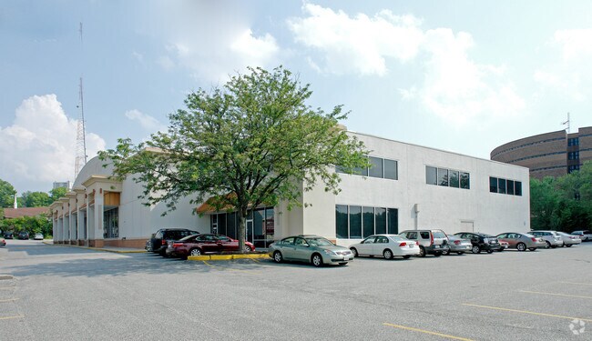
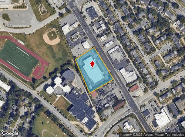
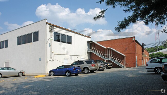
908 York Rd
09-0925450410
2.13 AC WS YORK RD
Storebuilding
Baltimore
X
Maryland
2400100265G
2.13 AC
2024
Towson
2025
Baltimore
490303
Baltimore-Columbia-Towson, MD
34,346 SF
DEMOGRAPHICS near 908 York Rd
1 Mile
3 Mile
5 Mile
2024 Total Population
20,305
103,911
269,755
2029 Population
20,367
102,731
262,534
Pop Growth 2024-2029
+ 0.31%
(1.14%)
(2.68%)
Average Age
41
40
41
2024 Total Households
9,115
41,266
109,363
HH Growth 2024-2029
+ 0.78%
(1.08%)
(2.81%)
Median Household Inc
$72,713
$91,980
$81,963
Avg Household Size
1.90
2.30
2.30
2024 Avg HH Vehicles
1.00
2.00
2.00
Median Home Value
$384,843
$384,926
$327,449
Median Year Built
1979
1960
1960
Nearby Places
Map Layers
Map Styles
 Street
 Aerial
- Restaurants
- Banks
- Shops
- Fitness
- Groceries
PUBLIC TRANSPORTATION
COMMUTER RAIL
Penn Station (Penn Line - Maryland Area Regional Commuter Trains (The MARC))
DRIVE
WALK
Distance
Penn Station (Penn Line - Maryland Area Regional Commuter Trains (The MARC))
20 min
7.6 mi
Camden Station (Camden Line - Maryland Area Regional Commuter Trains (The MARC))
DRIVE
WALK
Distance
Camden Station (Camden Line - Maryland Area Regional Commuter Trains (The MARC))
26 min
9.5 mi
AIRPORT
Baltimore/Washington International Thurgood Marshall
DRIVE
WALK
Distance
Baltimore/Washington International Thurgood Marshall
39 min
24.7 mi
Freight Ports
Port of Baltimore
DRIVE
WALK
Distance
Port of Baltimore
25 min
9.1 mi
Nearby Properties
Address
Land Use
TOTAL SIZE
Lot Size
Zoning
Address
Land Use
TOTAL SIZE
Lot Size
Zoning
363,750 SF
87 SF
Address
Land Use
TOTAL SIZE
Lot Size
Zoning
940,291 SF
23.80 AC
BMCT
Address
Land Use
TOTAL SIZE
Lot Size
Zoning
1,165,880 SF
55.70 AC
DR2
Address
Land Use
TOTAL SIZE
Lot Size
Zoning
712,387 SF
2.20 AC
BM-CT
Address
Land Use
TOTAL SIZE
Lot Size
Zoning
723,067 SF
80.37 AC
OR2
Address
Land Use
TOTAL SIZE
Lot Size
Zoning
23.09 AC
DR16
Address
Land Use
TOTAL SIZE
Lot Size
Zoning
731,797 SF
5.32 AC
RAE2
Address
Land Use
TOTAL SIZE
Lot Size
Zoning
296,575 SF
0.01 AC
DR16
Address
Land Use
TOTAL SIZE
Lot Size
Zoning
561,042 SF
38.91 AC
DR2
Address
Land Use
TOTAL SIZE
Lot Size
Zoning
725,588 SF
43.12 AC
BLCCC
Address
Land Use
TOTAL SIZE
Lot Size
Zoning
230,316 SF
9.93 AC
DR2
Address
Land Use
TOTAL SIZE
Lot Size
Zoning
189,300 SF
1.83 AC
BM
Address
Land Use
TOTAL SIZE
Lot Size
Zoning
643,976 SF
4.54 AC
RAE2
Address
Land Use
TOTAL SIZE
Lot Size
Zoning
30.89 AC
DR16
Address
Land Use
TOTAL SIZE
Lot Size
Zoning
12.75 AC
DR16
Address
Land Use
TOTAL SIZE
Lot Size
Zoning
0.01 AC
DR5,5
Address
Land Use
TOTAL SIZE
Lot Size
Zoning
318,948 SF
7.35 AC
BM
Address
Land Use
TOTAL SIZE
Lot Size
Zoning
585,866 SF
1.24 AC
BM-CT
Address
Land Use
TOTAL SIZE
Lot Size
Zoning
184,968 SF
4.25 AC
Address
Land Use
TOTAL SIZE
Lot Size
Zoning
204,974 SF
5.87 AC
DR16
Address
Land Use
TOTAL SIZE
Lot Size
Zoning
578,808 SF
30.10 AC
Address
Land Use
TOTAL SIZE
Lot Size
Zoning
523,464 SF
3.43 AC
RAE2
Address
Land Use
TOTAL SIZE
Lot Size
Zoning
2.70 AC
BM-CT
Address
Land Use
TOTAL SIZE
Lot Size
Zoning
15.49 AC
DR16
Address
Land Use
TOTAL SIZE
Lot Size
Zoning
2.88 AC
Address
Land Use
TOTAL SIZE
Lot Size
Zoning
11.56 AC
DR16
Address
Land Use
TOTAL SIZE
Lot Size
Zoning
4.94 AC
DR16
Address
Land Use
TOTAL SIZE
Lot Size
Zoning
10.63 AC
DR16
Address
Land Use
TOTAL SIZE
Lot Size
Zoning
2.75 AC
BM-CT
Address
Land Use
TOTAL SIZE
Lot Size
Zoning
17.08 AC
DR16
The World's #1 Commercial Real Estate Marketplace
Connect with us
© 2025 CoStar Group
The information above has been obtained from sources believed reliable. While we do not doubt its accuracy we have not verified it and make no guarantee, warranty or representation about it. It is your responsibility to independently confirm its accuracy and completeness. Any projections, opinions, assumptions, or estimates used are for example only and do not represent the current or future performance of the property. The value of this transaction to you depends on tax and other factors which should be evaluated by your tax, financial, and legal advisors. You and your advisors should conduct a careful, independent investigation of the property to determine to your satisfaction the suitability of the property for your needs.