Property Record
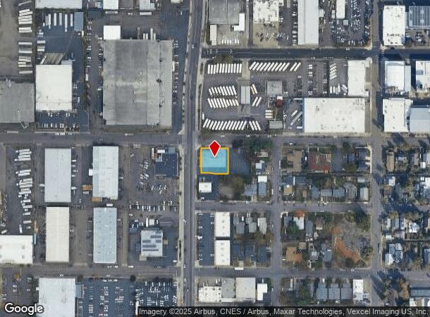
909 Garfield St, Eugene, OR 97402


NEARBY LISTINGS FOR SALE OR LEASE
Property Detail
909 Garfield St
Eugene-Springfield, OR
West Moreland
1234010
TL 01901
Industrialgeneral
Lane
X
Oregon
41039C1136F
1901
2025
0.25 AC
2025
Lane County
004403
Portland
DEMOGRAPHICS near 909 Garfield St
1 Mile
3 Mile
5 Mile
2024 Total Population
12,725
108,968
211,294
2029 Population
12,691
109,320
211,670
Pop Growth 2024-2029
(0.27%)
+ 0.32%
+ 0.18%
Average Age
38
39
40
2024 Total Households
6,135
45,600
87,936
HH Growth 2024-2029
(0.34%)
+ 0.33%
+ 0.17%
Median Household Inc
$43,587
$52,262
$60,117
Avg Household Size
2.00
2.10
2.20
2024 Avg HH Vehicles
1.00
2.00
2.00
Median Home Value
$336,753
$385,926
$374,495
Median Year Built
1969
1974
1976
Nearby Places
Map Layers
Map Styles
 Street
 Aerial
- Restaurants
- Banks
- Shops
- Fitness
- Groceries
PUBLIC TRANSPORTATION
COMMUTER RAIL
DRIVE
WALK
Distance
5 min
1.9 mi
AIRPORT
Mahlon Sweet Field
DRIVE
WALK
Distance
Mahlon Sweet Field
14 min
7.7 mi
SALE & LEASE HISTORY
LISTING DATE
SALE/LEASE

Dec 20, 2022
For Sale
Nearby Properties
Address
Land Use
TOTAL SIZE
Lot Size
Zoning
Address
Land Use
TOTAL SIZE
Lot Size
Zoning
110.25 AC
PL
Address
Land Use
TOTAL SIZE
Lot Size
Zoning
15.37 AC
PL
Address
Land Use
TOTAL SIZE
Lot Size
Zoning
71.87 AC
PL
Address
Land Use
TOTAL SIZE
Lot Size
Zoning
1.56 AC
C-2
Address
Land Use
TOTAL SIZE
Lot Size
Zoning
1.86 AC
C-2
Address
Land Use
TOTAL SIZE
Lot Size
Zoning
24 AC
C-2
Address
Land Use
TOTAL SIZE
Lot Size
Zoning
44.56 AC
PL
Address
Land Use
TOTAL SIZE
Lot Size
Zoning
13.82 AC
PL
Address
Land Use
TOTAL SIZE
Lot Size
Zoning
9.81 AC
C-2
Address
Land Use
TOTAL SIZE
Lot Size
Zoning
3.99 AC
I-3
Address
Land Use
TOTAL SIZE
Lot Size
Zoning
5.87 AC
C-2
Address
Land Use
TOTAL SIZE
Lot Size
Zoning
2.76 AC
C-3
Address
Land Use
TOTAL SIZE
Lot Size
Zoning
3.10 AC
S-WS
Address
Land Use
TOTAL SIZE
Lot Size
Zoning
2.56 AC
C-2
Address
Land Use
TOTAL SIZE
Lot Size
Zoning
1.23 AC
C-3
Address
Land Use
TOTAL SIZE
Lot Size
Zoning
16.80 AC
PL
Address
Land Use
TOTAL SIZE
Lot Size
Zoning
2.77 AC
C-2
Address
Land Use
TOTAL SIZE
Lot Size
Zoning
1.21 AC
C-2
Address
Land Use
TOTAL SIZE
Lot Size
Zoning
Address
Land Use
TOTAL SIZE
Lot Size
Zoning
14.54 AC
C-2
Address
Land Use
TOTAL SIZE
Lot Size
Zoning
2.15 AC
PL
Address
Land Use
TOTAL SIZE
Lot Size
Zoning
25.78 AC
C-2
Address
Land Use
TOTAL SIZE
Lot Size
Zoning
12.12 AC
C-2
Address
Land Use
TOTAL SIZE
Lot Size
Zoning
4.31 AC
C-2
Address
Land Use
TOTAL SIZE
Lot Size
Zoning
2.59 AC
C-2
Address
Land Use
TOTAL SIZE
Lot Size
Zoning
22.83 AC
PL
Address
Land Use
TOTAL SIZE
Lot Size
Zoning
45.78 AC
I-3
Address
Land Use
TOTAL SIZE
Lot Size
Zoning
6.94 AC
PL
Address
Land Use
TOTAL SIZE
Lot Size
Zoning
75.36 AC
PL
Address
Land Use
TOTAL SIZE
Lot Size
Zoning
8.69 AC
R-1
The World's #1 Commercial Real Estate Marketplace
Connect with us
© 2026 CoStar Group
The information above has been obtained from sources believed reliable. While we do not doubt its accuracy we have not verified it and make no guarantee, warranty or representation about it. It is your responsibility to independently confirm its accuracy and completeness. Any projections, opinions, assumptions, or estimates used are for example only and do not represent the current or future performance of the property. The value of this transaction to you depends on tax and other factors which should be evaluated by your tax, financial, and legal advisors. You and your advisors should conduct a careful, independent investigation of the property to determine to your satisfaction the suitability of the property for your needs.