Property Record
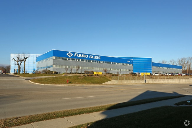
Alley Church Woodward, Highland Park, MI 48203
NEARBY LISTINGS FOR SALE OR LEASE
Property Detail
Alley Church Woodward
Detroit-Warren-Dearborn, MI
Incl Of Wilcox's
43-002-03-0391-004
PROPERTY EXEMPT FROM AD VALOREM TAXES AND ASSESSED ON THE SPECIAL ACT ROLL PURSUANT TO PA 261 OF 2003 EXPIRING 12/30/2027. 7666.2 N. 23 FT. OF W. 20 FT. OF W'LY. 40 FT. OF E'LY. 120 FT. OF CHURCH LOT IN BLK. 3, STEVEN'S AND CANDLER'S SUB BLOCK 3 T1S
Residentialacreage
Wayne
X
Michigan
26163C0125E
0391
2024
0.06 AC
2025
Southern I-275
509000
Detroit
DEMOGRAPHICS near Alley Church Woodward
1 Mile
3 Mile
5 Mile
2024 Total Population
4,823
56,705
150,812
2029 Population
4,625
54,285
144,836
Pop Growth 2024-2029
(4.11%)
(4.27%)
(3.96%)
Average Age
44
44
43
2024 Total Households
2,115
23,358
61,012
HH Growth 2024-2029
(4.11%)
(4.14%)
(3.92%)
Median Household Inc
$134,782
$114,929
$108,191
Avg Household Size
2.30
2.40
2.40
2024 Avg HH Vehicles
2.00
2.00
2.00
Median Home Value
$445,717
$381,356
$332,795
Median Year Built
1966
1977
1978
Nearby Places
Map Layers
Map Styles
 Street
 Aerial
- Restaurants
- Banks
- Shops
- Fitness
- Groceries
PUBLIC TRANSPORTATION
COMMUTER RAIL
Detroit (Wolverine - Amtrak)
DRIVE
WALK
Distance
Detroit (Wolverine - Amtrak)
10 min
5.1 mi
Royal Oak Amtrak (Wolverine - Amtrak)
DRIVE
WALK
Distance
Royal Oak Amtrak (Wolverine - Amtrak)
13 min
5.7 mi
AIRPORT
Windsor International
DRIVE
WALK
Distance
Windsor International
34 min
17.0 mi
Detroit Metro Wayne County
DRIVE
WALK
Distance
Detroit Metro Wayne County
38 min
25.7 mi
Freight Ports
Port of Toledo
DRIVE
WALK
Distance
Port of Toledo
84 min
66.5 mi
SALE & LEASE HISTORY
LISTING DATE
SALE/LEASE

Sep 25, 2016
For Lease
Sep 23, 2016
For Sale
Nearby Properties
Address
Land Use
TOTAL SIZE
Lot Size
Zoning
Address
Land Use
TOTAL SIZE
Lot Size
Zoning
3,529,575 SF
84.46 AC
B4
Address
Land Use
TOTAL SIZE
Lot Size
Zoning
331,559 SF
11.42 AC
M4
Address
Land Use
TOTAL SIZE
Lot Size
Zoning
564,958 SF
9.69 AC
M4
Address
Land Use
TOTAL SIZE
Lot Size
Zoning
199,592 SF
17.02 AC
B3
Address
Land Use
TOTAL SIZE
Lot Size
Zoning
303,615 SF
22.07 AC
MZ
Address
Land Use
TOTAL SIZE
Lot Size
Zoning
446,500 SF
27.90 AC
Address
Land Use
TOTAL SIZE
Lot Size
Zoning
123,844 SF
1.81 AC
R2
Address
Land Use
TOTAL SIZE
Lot Size
Zoning
156,250 SF
8.79 AC
B4
Address
Land Use
TOTAL SIZE
Lot Size
Zoning
119,418 SF
13.81 AC
B4
Address
Land Use
TOTAL SIZE
Lot Size
Zoning
292,032 SF
20.25 AC
B4
Address
Land Use
TOTAL SIZE
Lot Size
Zoning
116,060 SF
6.95 AC
R2
Address
Land Use
TOTAL SIZE
Lot Size
Zoning
353,800 SF
15.70 AC
Address
Land Use
TOTAL SIZE
Lot Size
Zoning
301,000 SF
Address
Land Use
TOTAL SIZE
Lot Size
Zoning
150,689 SF
4.87 AC
R5
Address
Land Use
TOTAL SIZE
Lot Size
Zoning
500,072 SF
12.50 AC
SD2
Address
Land Use
TOTAL SIZE
Lot Size
Zoning
641,836 SF
20.69 AC
M4
Address
Land Use
TOTAL SIZE
Lot Size
Zoning
181,798 SF
10.48 AC
B4
Address
Land Use
TOTAL SIZE
Lot Size
Zoning
63,216 SF
2.87 AC
R5
Address
Land Use
TOTAL SIZE
Lot Size
Zoning
66,870 SF
2.77 AC
Address
Land Use
TOTAL SIZE
Lot Size
Zoning
23,852 SF
130.56 AC
R1
Address
Land Use
TOTAL SIZE
Lot Size
Zoning
2,216,908 SF
44.80 AC
Address
Land Use
TOTAL SIZE
Lot Size
Zoning
217,000 SF
11.91 AC
Address
Land Use
TOTAL SIZE
Lot Size
Zoning
110,000 SF
1.36 AC
Address
Land Use
TOTAL SIZE
Lot Size
Zoning
147,717 SF
8.61 AC
PD
Address
Land Use
TOTAL SIZE
Lot Size
Zoning
7.10 AC
Address
Land Use
TOTAL SIZE
Lot Size
Zoning
300,000 SF
17.73 AC
Address
Land Use
TOTAL SIZE
Lot Size
Zoning
224,519 SF
9.98 AC
Address
Land Use
TOTAL SIZE
Lot Size
Zoning
91,233 SF
11.36 AC
Address
Land Use
TOTAL SIZE
Lot Size
Zoning
135,520 SF
8.78 AC
R-3
Address
Land Use
TOTAL SIZE
Lot Size
Zoning
The World's #1 Commercial Real Estate Marketplace
Connect with us
© 2025 CoStar Group
The information above has been obtained from sources believed reliable. While we do not doubt its accuracy we have not verified it and make no guarantee, warranty or representation about it. It is your responsibility to independently confirm its accuracy and completeness. Any projections, opinions, assumptions, or estimates used are for example only and do not represent the current or future performance of the property. The value of this transaction to you depends on tax and other factors which should be evaluated by your tax, financial, and legal advisors. You and your advisors should conduct a careful, independent investigation of the property to determine to your satisfaction the suitability of the property for your needs.