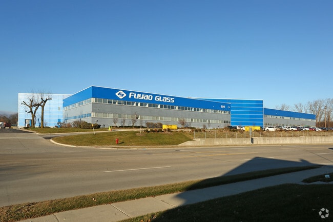
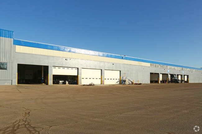
Property Record
909 N Sheldon Rd, Plymouth, MI 48170
NEARBY LISTINGS FOR SALE OR LEASE
Property Detail
909 N Sheldon Rd
Detroit-Warren-Dearborn, MI
Masserman Springdale
49-012-99-0001-000
PROPERTY EXEMPT FROM AD VALOREM TAXES AND ASSESSED ON THE SPECIAL ACT ROLL PURSUANT TO PA 261 OF 2003 EXPIRING 12/30/2027.
Industrialgeneral
Wayne
X
Michigan
26163C0038E
0391
2025
34.16 AC
2025
Southern I-275
509000
Detroit
528,100 SF
DEMOGRAPHICS near 909 N Sheldon Rd
1 Mile
3 Mile
5 Mile
2024 Total Population
4,823
56,705
150,812
2029 Population
4,625
54,285
144,836
Pop Growth 2024-2029
(4.11%)
(4.27%)
(3.96%)
Average Age
44
44
43
2024 Total Households
2,115
23,358
61,012
HH Growth 2024-2029
(4.11%)
(4.14%)
(3.92%)
Median Household Inc
$134,782
$114,929
$108,191
Avg Household Size
2.30
2.40
2.40
2024 Avg HH Vehicles
2.00
2.00
2.00
Median Home Value
$445,717
$381,356
$332,795
Median Year Built
1966
1977
1978
Nearby Places
Map Layers
Map Styles
 Street
 Aerial
- Restaurants
- Banks
- Shops
- Fitness
- Groceries
PUBLIC TRANSPORTATION
AIRPORT
Detroit Metro Wayne County
DRIVE
WALK
Distance
Detroit Metro Wayne County
27 min
21.2 mi
Windsor International
DRIVE
WALK
Distance
Windsor International
52 min
35.7 mi
Freight Ports
Port of Toledo
DRIVE
WALK
Distance
Port of Toledo
77 min
62.8 mi
SALE & LEASE HISTORY
LISTING DATE
SALE/LEASE

Sep 25, 2016
For Lease
Sep 23, 2016
For Sale
Nearby Properties
Address
Land Use
TOTAL SIZE
Lot Size
Zoning
Address
Land Use
TOTAL SIZE
Lot Size
Zoning
1,005,040 SF
Address
Land Use
TOTAL SIZE
Lot Size
Zoning
234,403 SF
74.21 AC
OS
Address
Land Use
TOTAL SIZE
Lot Size
Zoning
250,699 SF
16.89 AC
SH
Address
Land Use
TOTAL SIZE
Lot Size
Zoning
37.30 AC
MR
Address
Land Use
TOTAL SIZE
Lot Size
Zoning
517,265 SF
116.72 AC
Address
Land Use
TOTAL SIZE
Lot Size
Zoning
192,478 SF
IND
Address
Land Use
TOTAL SIZE
Lot Size
Zoning
21.71 AC
MR
Address
Land Use
TOTAL SIZE
Lot Size
Zoning
334,346 SF
55.65 AC
TAR
Address
Land Use
TOTAL SIZE
Lot Size
Zoning
114,894 SF
4.94 AC
ARC
Address
Land Use
TOTAL SIZE
Lot Size
Zoning
306,061 SF
26.36 AC
TAR
Address
Land Use
TOTAL SIZE
Lot Size
Zoning
117.35 AC
Address
Land Use
TOTAL SIZE
Lot Size
Zoning
361,807 SF
18.77 AC
M-2
Address
Land Use
TOTAL SIZE
Lot Size
Zoning
225,164 SF
25.66 AC
IND
Address
Land Use
TOTAL SIZE
Lot Size
Zoning
283,710 SF
IND
Address
Land Use
TOTAL SIZE
Lot Size
Zoning
9,706 SF
40.41 AC
RM-1
Address
Land Use
TOTAL SIZE
Lot Size
Zoning
221,508 SF
26.03 AC
IND
Address
Land Use
TOTAL SIZE
Lot Size
Zoning
113,292 SF
15.79 AC
IND
Address
Land Use
TOTAL SIZE
Lot Size
Zoning
99,826 SF
ORT
Address
Land Use
TOTAL SIZE
Lot Size
Zoning
123,225 SF
9 AC
CJ/ARC
Address
Land Use
TOTAL SIZE
Lot Size
Zoning
954,882 SF
47.92 AC
LI-2
Address
Land Use
TOTAL SIZE
Lot Size
Zoning
46.60 AC
R-3
Address
Land Use
TOTAL SIZE
Lot Size
Zoning
78,164 SF
5.51 AC
PUD
Address
Land Use
TOTAL SIZE
Lot Size
Zoning
103,075 SF
8.15 AC
PUD
Address
Land Use
TOTAL SIZE
Lot Size
Zoning
19.68 AC
RM-1
Address
Land Use
TOTAL SIZE
Lot Size
Zoning
135,586 SF
8.08 AC
IND
Address
Land Use
TOTAL SIZE
Lot Size
Zoning
191,759 SF
26.11 AC
ORT
Address
Land Use
TOTAL SIZE
Lot Size
Zoning
285,680 SF
IND
Address
Land Use
TOTAL SIZE
Lot Size
Zoning
14,023 SF
17.32 AC
RM-1
Address
Land Use
TOTAL SIZE
Lot Size
Zoning
484,535 SF
30.20 AC
IND
Address
Land Use
TOTAL SIZE
Lot Size
Zoning
122,116 SF
4.99 AC
PUD
The World's #1 Commercial Real Estate Marketplace
Connect with us
© 2026 CoStar Group
The information above has been obtained from sources believed reliable. While we do not doubt its accuracy we have not verified it and make no guarantee, warranty or representation about it. It is your responsibility to independently confirm its accuracy and completeness. Any projections, opinions, assumptions, or estimates used are for example only and do not represent the current or future performance of the property. The value of this transaction to you depends on tax and other factors which should be evaluated by your tax, financial, and legal advisors. You and your advisors should conduct a careful, independent investigation of the property to determine to your satisfaction the suitability of the property for your needs.