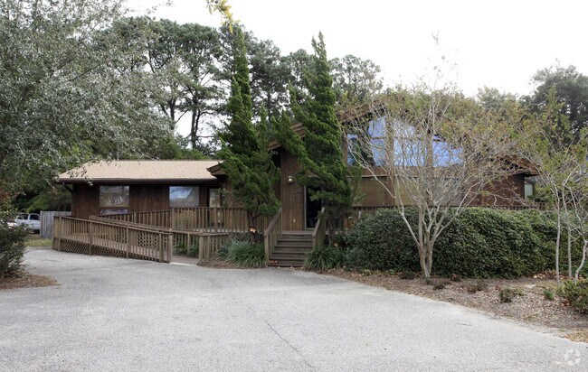
Property Record
909 Tall Pine Rd, Mount Pleasant, SC 29464


NEARBY LISTINGS FOR SALE OR LEASE
Property Detail
909 Tall Pine Rd
Charleston-North Charleston, SC
The Groves
517-03-00-064
SUBDIVISION NAME -THE GROVES DESCRIPTION -LT 13 BLK N
Commercialnec
Charleston
X
South Carolina
45019C0517K
13
2025
0.40 AC
2024
East Islands/Mt Pleasant
004607
Charleston/N Charleston
2,477 SF
DEMOGRAPHICS near 909 Tall Pine Rd
1 mile
3 mile
5 mile
2024 Total Population
8,009
39,300
114,973
2029 Population
8,522
42,285
125,366
Pop Growth 2024-2029
+ 6.41%
+ 7.60%
+ 9.04%
Average Age
42
42
40
2024 Total Households
3,712
17,534
50,188
HH Growth 2024-2029
+ 6.41%
+ 7.59%
+ 9.10%
Median Household Inc
$104,780
$94,338
$88,640
Avg Household Size
2.10
2.20
2.20
2024 Avg HH Vehicles
2.00
2.00
2.00
Median Home Value
$683,776
$615,185
$638,660
Median Year Built
1986
1989
1988
Nearby Places
Map Layers
Map Styles
 Street
 Aerial
Transit
 Traffic
 Biking
Places
Listings with unknown addresses are not visible on the map
- Restaurants
- Banks
- Shops
- Fitness
- Groceries
PUBLIC TRANSPORTATION
COMMUTER RAIL
Drive
Walk
Distance
16 min
9.6 mi
AIRPORT
Charleston AFB/International
Drive
Walk
Distance
Charleston AFB/International
27 min
16.1 mi
Freight Ports
Columbus Street Terminal
Drive
Walk
Distance
Columbus Street Terminal
7 min
4.0 mi
Nearby Properties
Address
Land Use
TOTAL SIZE
Lot Size
Zoning
Address
Land Use
TOTAL SIZE
Lot Size
Zoning
247,883 SF
16.26 AC
Address
Land Use
TOTAL SIZE
Lot Size
Zoning
2,592 SF
13.64 AC
Address
Land Use
TOTAL SIZE
Lot Size
Zoning
Address
Land Use
TOTAL SIZE
Lot Size
Zoning
39,150 SF
7.76 AC
Address
Land Use
TOTAL SIZE
Lot Size
Zoning
Address
Land Use
TOTAL SIZE
Lot Size
Zoning
85,408 SF
9.39 AC
Address
Land Use
TOTAL SIZE
Lot Size
Zoning
Address
Land Use
TOTAL SIZE
Lot Size
Zoning
1,282 SF
8.42 AC
Address
Land Use
TOTAL SIZE
Lot Size
Zoning
8,740 SF
0.58 AC
Address
Land Use
TOTAL SIZE
Lot Size
Zoning
15,957 SF
3.80 AC
Address
Land Use
TOTAL SIZE
Lot Size
Zoning
31,094 SF
5.97 AC
Address
Land Use
TOTAL SIZE
Lot Size
Zoning
12,358 SF
15.08 AC
Address
Land Use
TOTAL SIZE
Lot Size
Zoning
6,035 SF
0.64 AC
CHARLESTON
Address
Land Use
TOTAL SIZE
Lot Size
Zoning
34,713 SF
13.51 AC
Address
Land Use
TOTAL SIZE
Lot Size
Zoning
Address
Land Use
TOTAL SIZE
Lot Size
Zoning
1,222 SF
13.62 AC
Address
Land Use
TOTAL SIZE
Lot Size
Zoning
37,472 SF
9.04 AC
Address
Land Use
TOTAL SIZE
Lot Size
Zoning
4,980 SF
0.32 AC
CHARLESTON
Address
Land Use
TOTAL SIZE
Lot Size
Zoning
9,993 SF
0.15 AC
LAR3
Address
Land Use
TOTAL SIZE
Lot Size
Zoning
19,994 SF
2.04 AC
Address
Land Use
TOTAL SIZE
Lot Size
Zoning
1,872 SF
4.48 AC
Address
Land Use
TOTAL SIZE
Lot Size
Zoning
6,613 SF
1.22 AC
CHARLESTON
Address
Land Use
TOTAL SIZE
Lot Size
Zoning
4,834 SF
0.24 AC
CHARLESTON
Address
Land Use
TOTAL SIZE
Lot Size
Zoning
4,910 SF
0.43 AC
CHARLESTON
Address
Land Use
TOTAL SIZE
Lot Size
Zoning
1,064 SF
20.39 AC
Address
Land Use
TOTAL SIZE
Lot Size
Zoning
3,624 SF
0.22 AC
CHARLESTON
Address
Land Use
TOTAL SIZE
Lot Size
Zoning
3,772 SF
0.30 AC
CHARLESTON
Address
Land Use
TOTAL SIZE
Lot Size
Zoning
2,460 SF
60.39 AC
Address
Land Use
TOTAL SIZE
Lot Size
Zoning
7,499 SF
0.54 AC
Address
Land Use
TOTAL SIZE
Lot Size
Zoning
4,750 SF
0.33 AC
CHARLESTON
The World's #1 Commercial Real Estate Marketplace
Connect with us
© 2026 CoStar Group
The information above has been obtained from sources believed reliable. While we do not doubt its accuracy we have not verified it and make no guarantee, warranty or representation about it. It is your responsibility to independently confirm its accuracy and completeness. Any projections, opinions, assumptions, or estimates used are for example only and do not represent the current or future performance of the property. The value of this transaction to you depends on tax and other factors which should be evaluated by your tax, financial, and legal advisors. You and your advisors should conduct a careful, independent investigation of the property to determine to your satisfaction the suitability of the property for your needs.