Property Record
9094 E Brainerd Rd, Chattanooga, TN 37421


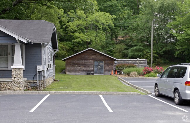
Property Detail
9094 E Brainerd Rd
Chattanooga, TN-GA
LTS 11&12 PT 13 31&32 RYALL SPRINGS PB 8 PG 31 3274 06 07
171C-C-005
Hamilton
Restaurantbuilding
Tennessee
AE The base floodplain where base flood elevations are provided. AE Zones are now used on new format FIRMs instead of A1-A30 Zones.
11,12
2025
1.21 AC
2025
Outlying Hamilton County
011325
Chattanooga
1,704 SF
NEARBY LISTINGS FOR SALE OR LEASE
DEMOGRAPHICS near 9094 E Brainerd Rd
1 mile
3 mile
5 mile
2025 Total Population
5,395
42,653
87,941
2030 Population
5,621
44,436
91,767
Pop Growth 2025-2030
+ 4.19%
+ 4.18%
+ 4.35%
Average Age
42
42
41
2025 Total Households
1,980
16,328
34,363
HH Growth 2025-2030
+ 4.34%
+ 4.42%
+ 4.56%
Median Household Inc
$134,747
$100,734
$84,365
Avg Household Size
2.70
2.50
2.40
2025 Avg HH Vehicles
2.00
2.00
2.00
Median Home Value
$377,972
$371,814
$342,367
Median Year Built
1989
1994
1992
Nearby Places
Map Layers
Map Styles
 Street
 Aerial
Transit
 Traffic
 Biking
Places
Listings with unknown addresses are not visible on the map
- Restaurants
- Banks
- Shops
- Fitness
- Groceries
PUBLIC TRANSPORTATION
AIRPORT
Lovell Field
Drive
Walk
Distance
Lovell Field
15 min
6.8 mi
Freight Ports
Georgia Ports - Savannah
Drive
Walk
Distance
Georgia Ports - Savannah
404 min
356.9 mi
Nearby Properties
Address
Land Use
TOTAL SIZE
Lot Size
Zoning
Address
Land Use
TOTAL SIZE
Lot Size
Zoning
440,611 SF
27.46 AC
C2
Address
Land Use
TOTAL SIZE
Lot Size
Zoning
117,007 SF
23.87 AC
R4
Address
Land Use
TOTAL SIZE
Lot Size
Zoning
4,418 SF
18.01 AC
R3
Address
Land Use
TOTAL SIZE
Lot Size
Zoning
43,488 SF
27.72 AC
R3
Address
Land Use
TOTAL SIZE
Lot Size
Zoning
25,436 SF
21.34 AC
R3
Address
Land Use
TOTAL SIZE
Lot Size
Zoning
43,576 SF
6.66 AC
C2
Address
Land Use
TOTAL SIZE
Lot Size
Zoning
3,472 SF
14.01 AC
Address
Land Use
TOTAL SIZE
Lot Size
Zoning
97,000 SF
18.78 AC
Address
Land Use
TOTAL SIZE
Lot Size
Zoning
25,165 SF
21.90 AC
Address
Land Use
TOTAL SIZE
Lot Size
Zoning
15,808 SF
19.50 AC
R2
Address
Land Use
TOTAL SIZE
Lot Size
Zoning
4,390 SF
36.30 AC
R3
Address
Land Use
TOTAL SIZE
Lot Size
Zoning
110,710 SF
6.69 AC
M1
Address
Land Use
TOTAL SIZE
Lot Size
Zoning
238,806 SF
24.84 AC
Address
Land Use
TOTAL SIZE
Lot Size
Zoning
183,036 SF
11.49 AC
R4
Address
Land Use
TOTAL SIZE
Lot Size
Zoning
66,390 SF
4.37 AC
C2
Address
Land Use
TOTAL SIZE
Lot Size
Zoning
21,280 SF
7.67 AC
Address
Land Use
TOTAL SIZE
Lot Size
Zoning
152,982 SF
24.72 AC
R1
Address
Land Use
TOTAL SIZE
Lot Size
Zoning
117,663 SF
13.51 AC
C4
Address
Land Use
TOTAL SIZE
Lot Size
Zoning
71,293 SF
8.16 AC
C2
Address
Land Use
TOTAL SIZE
Lot Size
Zoning
43.48 AC
R4
Address
Land Use
TOTAL SIZE
Lot Size
Zoning
46,724 SF
2.44 AC
C2
Address
Land Use
TOTAL SIZE
Lot Size
Zoning
90,493 SF
1.88 AC
Address
Land Use
TOTAL SIZE
Lot Size
Zoning
111,196 SF
9.67 AC
C2
Address
Land Use
TOTAL SIZE
Lot Size
Zoning
27,144 SF
5.62 AC
R3
Address
Land Use
TOTAL SIZE
Lot Size
Zoning
57,700 SF
21.13 AC
R1
Address
Land Use
TOTAL SIZE
Lot Size
Zoning
191,461 SF
14.18 AC
Address
Land Use
TOTAL SIZE
Lot Size
Zoning
82,704 SF
3.53 AC
C4
Address
Land Use
TOTAL SIZE
Lot Size
Zoning
147,332 SF
9.44 AC
R4
Address
Land Use
TOTAL SIZE
Lot Size
Zoning
86,931 SF
9.49 AC
C4
Address
Land Use
TOTAL SIZE
Lot Size
Zoning
47,278 SF
20.79 AC
R1
The World's #1 Commercial Real Estate Marketplace
Connect with us
© 2026 CoStar Group
The information above has been obtained from sources believed reliable. While we do not doubt its accuracy we have not verified it and make no guarantee, warranty or representation about it. It is your responsibility to independently confirm its accuracy and completeness. Any projections, opinions, assumptions, or estimates used are for example only and do not represent the current or future performance of the property. The value of this transaction to you depends on tax and other factors which should be evaluated by your tax, financial, and legal advisors. You and your advisors should conduct a careful, independent investigation of the property to determine to your satisfaction the suitability of the property for your needs.