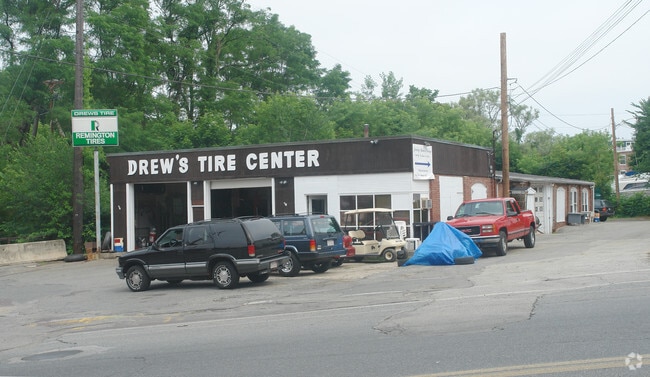
Property Record
91 Elm St, Amesbury, MA 01913

Property Detail
91 Elm St
Officebuilding
ESSEX
R8
Massachusetts
A Areas with a 1% annual chance of flooding and a 26% chance of flooding over the life of a 30-year mortgage.
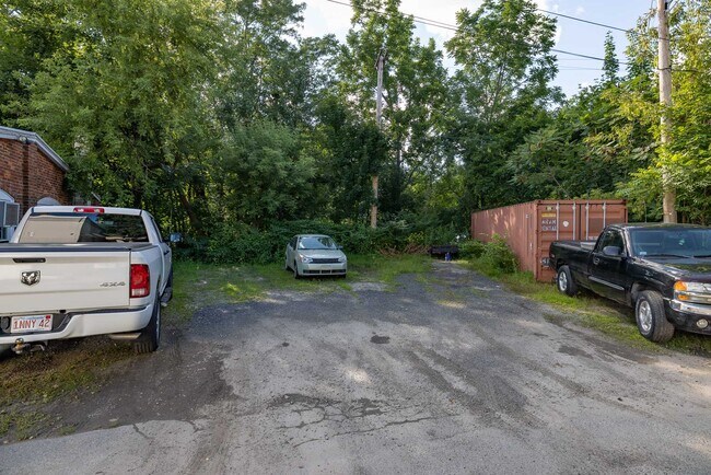
0.80 AC
2025
Amesbury/Ipswich
2025
Boston
266100
Boston-Cambridge-Newton, MA-NH
3,600 SF
AMES-000040-000000-000271
NEARBY LISTINGS FOR SALE OR LEASE
DEMOGRAPHICS near 91 Elm St
1 mile
3 mile
5 mile
2025 Total Population
10,153
26,446
61,976
2030 Population
10,388
27,122
63,674
Pop Growth 2025-2030
+ 2.31%
+ 2.56%
+ 2.74%
Average Age
43
43
45
2025 Total Households
4,464
10,992
25,958
HH Growth 2025-2030
+ 2.24%
+ 2.51%
+ 2.66%
Median Household Inc
$93,694
$103,714
$107,275
Avg Household Size
2.20
2.30
2.30
2025 Avg HH Vehicles
2.00
2.00
2.00
Median Home Value
$498,434
$589,488
$643,069
Median Year Built
1959
1972
1974
Nearby Places
Map Layers
Map Styles
 Street
 Aerial
Transit
 Traffic
 Biking
Places
Listings with unknown addresses are not visible on the map
- Restaurants
- Banks
- Shops
- Fitness
- Groceries
PUBLIC TRANSPORTATION
COMMUTER RAIL
Newburyport (Newburyport/Rockport Line - Massachusetts Bay Transportation Authority Commuter Rail (Purple Line))
Drive
Walk
Distance
Newburyport (Newburyport/Rockport Line - Massachusetts Bay Transportation Authority Commuter Rail (Purple Line))
13 min
6.9 mi
Exeter (Downeaster - Amtrak)
Drive
Walk
Distance
Exeter (Downeaster - Amtrak)
19 min
9.8 mi
AIRPORT
Portsmouth International at Pease
Drive
Walk
Distance
Portsmouth International at Pease
30 min
19.8 mi
Manchester Boston Regional
Drive
Walk
Distance
Manchester Boston Regional
59 min
41.5 mi
Freight Ports
Port of Boston
Drive
Walk
Distance
Port of Boston
58 min
41.7 mi
SALE & LEASE HISTORY
LISTING DATE
SALE/LEASE

Feb 04, 2022
For Sale
Nearby Properties
Address
Land Use
TOTAL SIZE
Lot Size
Zoning
Address
Land Use
TOTAL SIZE
Lot Size
Zoning
55,934 SF
35.25 AC
A
Address
Land Use
TOTAL SIZE
Lot Size
Zoning
26.44 AC
OP
Address
Land Use
TOTAL SIZE
Lot Size
Zoning
504,280 SF
80.02 AC
I3
Address
Land Use
TOTAL SIZE
Lot Size
Zoning
176,157 SF
25.53 AC
OSC
Address
Land Use
TOTAL SIZE
Lot Size
Zoning
2,362 SF
342.02 AC
Address
Land Use
TOTAL SIZE
Lot Size
Zoning
145,676 SF
17.42 AC
OSC
Address
Land Use
TOTAL SIZE
Lot Size
Zoning
9.31 AC
R8
Address
Land Use
TOTAL SIZE
Lot Size
Zoning
94,943 SF
15.52 AC
RCZD
Address
Land Use
TOTAL SIZE
Lot Size
Zoning
191,775 SF
23.50 AC
C
Address
Land Use
TOTAL SIZE
Lot Size
Zoning
79,991 SF
2.66 AC
IC
Address
Land Use
TOTAL SIZE
Lot Size
Zoning
2.47 AC
R8
Address
Land Use
TOTAL SIZE
Lot Size
Zoning
4.30 AC
R40
Address
Land Use
TOTAL SIZE
Lot Size
Zoning
3.68 AC
R40
Address
Land Use
TOTAL SIZE
Lot Size
Zoning
274,050 SF
29.02 AC
I
Address
Land Use
TOTAL SIZE
Lot Size
Zoning
78,886 SF
75.81 AC
C2
Address
Land Use
TOTAL SIZE
Lot Size
Zoning
147,462 SF
10.60 AC
I
Address
Land Use
TOTAL SIZE
Lot Size
Zoning
112,559 SF
11.27 AC
Address
Land Use
TOTAL SIZE
Lot Size
Zoning
61,320 SF
35.32 AC
OSC
Address
Land Use
TOTAL SIZE
Lot Size
Zoning
118,008 SF
11.04 AC
Address
Land Use
TOTAL SIZE
Lot Size
Zoning
126,144 SF
5.41 AC
I
Address
Land Use
TOTAL SIZE
Lot Size
Zoning
39,728 SF
2.25 AC
Address
Land Use
TOTAL SIZE
Lot Size
Zoning
3,394 SF
4 AC
Address
Land Use
TOTAL SIZE
Lot Size
Zoning
58,391 SF
14.11 AC
OSC
Address
Land Use
TOTAL SIZE
Lot Size
Zoning
5.98 AC
R8
Address
Land Use
TOTAL SIZE
Lot Size
Zoning
14.35 AC
R20
Address
Land Use
TOTAL SIZE
Lot Size
Zoning
424,000 SF
42.54 AC
I
Address
Land Use
TOTAL SIZE
Lot Size
Zoning
37,886 SF
0.78 AC
IC
Address
Land Use
TOTAL SIZE
Lot Size
Zoning
3 AC
OP
Address
Land Use
TOTAL SIZE
Lot Size
Zoning
1.18 AC
R8
Address
Land Use
TOTAL SIZE
Lot Size
Zoning
33,675 SF
27.18 AC
C3
The World's #1 Commercial Real Estate Marketplace
Connect with us
© 2026 CoStar Group
The information above has been obtained from sources believed reliable. While we do not doubt its accuracy we have not verified it and make no guarantee, warranty or representation about it. It is your responsibility to independently confirm its accuracy and completeness. Any projections, opinions, assumptions, or estimates used are for example only and do not represent the current or future performance of the property. The value of this transaction to you depends on tax and other factors which should be evaluated by your tax, financial, and legal advisors. You and your advisors should conduct a careful, independent investigation of the property to determine to your satisfaction the suitability of the property for your needs.