Property Record
91 Peck Hill Rd, Johnston, RI 02919


NEARBY LISTINGS FOR SALE OR LEASE
Property Detail
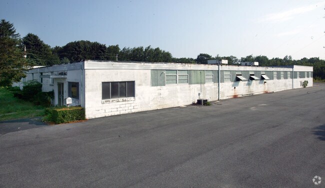
91 Peck Hill Rd
JOHN-000043-000000-000163
Providence
Commercialbuilding
Rhode Island
X
163
44007C0295G
3 AC
2025
Johnston
2025
Providence
012200
Providence-Warwick, RI-MA
20,048 SF
DEMOGRAPHICS near 91 Peck Hill Rd
1 Mile
3 Mile
5 Mile
2024 Total Population
617
10,407
60,553
2029 Population
619
10,471
60,733
Pop Growth 2024-2029
+ 0.32%
+ 0.61%
+ 0.30%
Average Age
46
44
44
2024 Total Households
216
3,866
24,198
HH Growth 2024-2029
+ 0.46%
+ 0.52%
+ 0.20%
Median Household Inc
$118,627
$115,798
$88,312
Avg Household Size
2.50
2.60
2.40
2024 Avg HH Vehicles
2.00
2.00
2.00
Median Home Value
$364,912
$420,302
$352,991
Median Year Built
1982
1983
1974
Nearby Places
Map Layers
Map Styles
 Street
 Aerial
- Restaurants
- Banks
- Shops
- Fitness
- Groceries
PUBLIC TRANSPORTATION
COMMUTER RAIL
Providence (Providence/Stoughton Line - Massachusetts Bay Transportation Authority Commuter Rail (Purple Line))
DRIVE
WALK
Distance
Providence (Providence/Stoughton Line - Massachusetts Bay Transportation Authority Commuter Rail (Purple Line))
19 min
9.7 mi
AIRPORT
Rhode Island Tf Green International
DRIVE
WALK
Distance
Rhode Island Tf Green International
24 min
12.1 mi
Worcester Regional
DRIVE
WALK
Distance
Worcester Regional
71 min
49.8 mi
Freight Ports
Port of Davisville, RI
DRIVE
WALK
Distance
Port of Davisville, RI
35 min
21.4 mi
Nearby Properties
Address
Land Use
TOTAL SIZE
Lot Size
Zoning
Address
Land Use
TOTAL SIZE
Lot Size
Zoning
32.30 AC
I
Address
Land Use
TOTAL SIZE
Lot Size
Zoning
0.97 AC
A12
Address
Land Use
TOTAL SIZE
Lot Size
Zoning
96.12 AC
I
Address
Land Use
TOTAL SIZE
Lot Size
Zoning
122,836 SF
15.10 AC
R40
Address
Land Use
TOTAL SIZE
Lot Size
Zoning
60,039 SF
18.41 AC
A80
Address
Land Use
TOTAL SIZE
Lot Size
Zoning
8,742 SF
16.26 AC
R40
Address
Land Use
TOTAL SIZE
Lot Size
Zoning
21.86 AC
I
Address
Land Use
TOTAL SIZE
Lot Size
Zoning
22,445 SF
5 AC
A80
Address
Land Use
TOTAL SIZE
Lot Size
Zoning
32.59 AC
M2
Address
Land Use
TOTAL SIZE
Lot Size
Zoning
80,000 SF
10 AC
M1
Address
Land Use
TOTAL SIZE
Lot Size
Zoning
4.78 AC
A80
Address
Land Use
TOTAL SIZE
Lot Size
Zoning
4.57 AC
B2
Address
Land Use
TOTAL SIZE
Lot Size
Zoning
40,586 SF
3.40 AC
RS-1
Address
Land Use
TOTAL SIZE
Lot Size
Zoning
236,551 SF
19.49 AC
M2
Address
Land Use
TOTAL SIZE
Lot Size
Zoning
55.25 AC
A80
Address
Land Use
TOTAL SIZE
Lot Size
Zoning
77,132 SF
4.50 AC
M2
Address
Land Use
TOTAL SIZE
Lot Size
Zoning
48,750 SF
2.26 AC
M2
Address
Land Use
TOTAL SIZE
Lot Size
Zoning
49,072 SF
6.73 AC
PD
Address
Land Use
TOTAL SIZE
Lot Size
Zoning
23.22 AC
IL
Address
Land Use
TOTAL SIZE
Lot Size
Zoning
17.78 AC
I
Address
Land Use
TOTAL SIZE
Lot Size
Zoning
45,809 SF
1.97 AC
PD
Address
Land Use
TOTAL SIZE
Lot Size
Zoning
55,416 SF
3.95 AC
M2
Address
Land Use
TOTAL SIZE
Lot Size
Zoning
50,886 SF
5.28 AC
BG
Address
Land Use
TOTAL SIZE
Lot Size
Zoning
20,266 SF
5 AC
A20
Address
Land Use
TOTAL SIZE
Lot Size
Zoning
41,649 SF
2.42 AC
M2
Address
Land Use
TOTAL SIZE
Lot Size
Zoning
19,286 SF
2.01 AC
PD
Address
Land Use
TOTAL SIZE
Lot Size
Zoning
12,974 SF
4.30 AC
B2
Address
Land Use
TOTAL SIZE
Lot Size
Zoning
19,742 SF
17.08 AC
M2
Address
Land Use
TOTAL SIZE
Lot Size
Zoning
29,120 SF
14.19 AC
M1
Address
Land Use
TOTAL SIZE
Lot Size
Zoning
1.42 AC
M2
The World's #1 Commercial Real Estate Marketplace
Connect with us
© 2025 CoStar Group
The information above has been obtained from sources believed reliable. While we do not doubt its accuracy we have not verified it and make no guarantee, warranty or representation about it. It is your responsibility to independently confirm its accuracy and completeness. Any projections, opinions, assumptions, or estimates used are for example only and do not represent the current or future performance of the property. The value of this transaction to you depends on tax and other factors which should be evaluated by your tax, financial, and legal advisors. You and your advisors should conduct a careful, independent investigation of the property to determine to your satisfaction the suitability of the property for your needs.