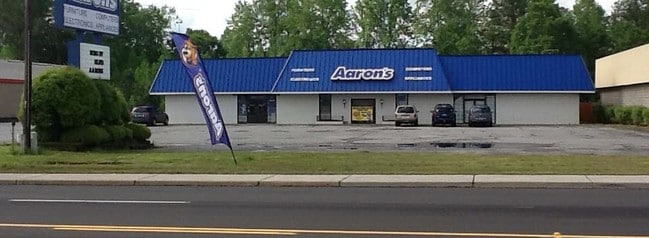
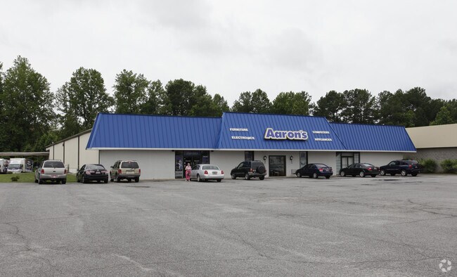
Property Record
910 E Main St, Laurens, SC 29360

Property Detail
910 E Main St
Greenville-Anderson-Greer, SC
US HWY 76 BETWEEN LAURENS-CL
444-00-00-054
Laurens
Commercialnec
South Carolina
B and X Area of moderate flood hazard, usually the area between the limits of the 100-year and 500-year floods.
1.75 AC
2025
Laurens County
2025
Greenville/Spartanburg
920302
NEARBY LISTINGS FOR SALE OR LEASE
DEMOGRAPHICS near 910 E Main St
1 mile
3 mile
5 mile
2024 Total Population
1,081
12,068
18,725
2029 Population
1,110
12,564
19,501
Pop Growth 2024-2029
+ 2.68%
+ 4.11%
+ 4.14%
Average Age
39
40
41
2024 Total Households
464
4,809
7,470
HH Growth 2024-2029
+ 3.23%
+ 4.30%
+ 4.36%
Median Household Inc
$29,687
$50,365
$52,902
Avg Household Size
2.20
2.40
2.40
2024 Avg HH Vehicles
2.00
2.00
2.00
Median Home Value
$85,832
$110,885
$142,761
Median Year Built
1983
1979
1979
Nearby Places
Map Layers
Map Styles
 Street
 Aerial
Transit
 Traffic
 Biking
Places
Listings with unknown addresses are not visible on the map
- Restaurants
- Banks
- Shops
- Fitness
- Groceries
PUBLIC TRANSPORTATION
AIRPORT
Greenville Spartanburg International
Drive
Walk
Distance
Greenville Spartanburg International
55 min
41.1 mi
SALE & LEASE HISTORY
LISTING DATE
SALE/LEASE

Jun 18, 2018
For Sale
Nearby Properties
Address
Land Use
TOTAL SIZE
Lot Size
Zoning
Address
Land Use
TOTAL SIZE
Lot Size
Zoning
118.30 AC
Address
Land Use
TOTAL SIZE
Lot Size
Zoning
349.22 AC
Address
Land Use
TOTAL SIZE
Lot Size
Zoning
47.02 AC
LA
Address
Land Use
TOTAL SIZE
Lot Size
Zoning
10 AC
LA
Address
Land Use
TOTAL SIZE
Lot Size
Zoning
0.61 AC
Address
Land Use
TOTAL SIZE
Lot Size
Zoning
4.14 AC
LA
Address
Land Use
TOTAL SIZE
Lot Size
Zoning
5.69 AC
Address
Land Use
TOTAL SIZE
Lot Size
Zoning
6.20 AC
LA
Address
Land Use
TOTAL SIZE
Lot Size
Zoning
4.27 AC
Address
Land Use
TOTAL SIZE
Lot Size
Zoning
3.02 AC
LA
Address
Land Use
TOTAL SIZE
Lot Size
Zoning
1.94 AC
LA
Address
Land Use
TOTAL SIZE
Lot Size
Zoning
0.77 AC
LA
Address
Land Use
TOTAL SIZE
Lot Size
Zoning
6.22 AC
LA
Address
Land Use
TOTAL SIZE
Lot Size
Zoning
Address
Land Use
TOTAL SIZE
Lot Size
Zoning
8.47 AC
LA
Address
Land Use
TOTAL SIZE
Lot Size
Zoning
0.78 AC
LA
Address
Land Use
TOTAL SIZE
Lot Size
Zoning
8.59 AC
Address
Land Use
TOTAL SIZE
Lot Size
Zoning
2.36 AC
LA
Address
Land Use
TOTAL SIZE
Lot Size
Zoning
1.96 AC
LA
Address
Land Use
TOTAL SIZE
Lot Size
Zoning
3.12 AC
Address
Land Use
TOTAL SIZE
Lot Size
Zoning
2.15 AC
LA
The World's #1 Commercial Real Estate Marketplace
Connect with us
© 2026 CoStar Group
The information above has been obtained from sources believed reliable. While we do not doubt its accuracy we have not verified it and make no guarantee, warranty or representation about it. It is your responsibility to independently confirm its accuracy and completeness. Any projections, opinions, assumptions, or estimates used are for example only and do not represent the current or future performance of the property. The value of this transaction to you depends on tax and other factors which should be evaluated by your tax, financial, and legal advisors. You and your advisors should conduct a careful, independent investigation of the property to determine to your satisfaction the suitability of the property for your needs.