Property Record
910 Grove St, China Grove, NC 28023

Property Detail
910 Grove St
Charlotte-Concord-Gastonia, NC-SC
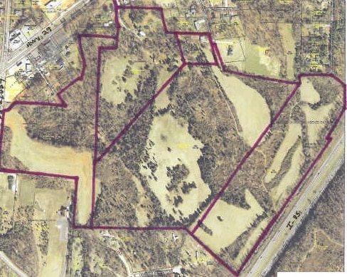
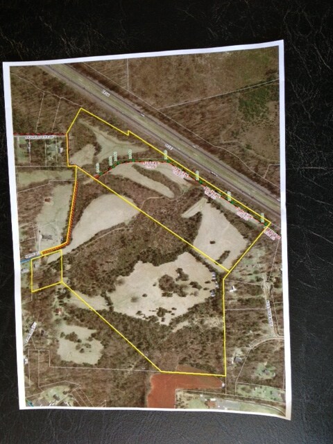
19.81AC
124-102
ROWAN
Industrialacreage
North Carolina
AE The base floodplain where base flood elevations are provided. AE Zones are now used on new format FIRMs instead of A1-A30 Zones.
19.81 AC
2025
Rowan County
2025
Charlotte
051700
NEARBY LISTINGS FOR SALE OR LEASE
DEMOGRAPHICS near 910 Grove St
1 mile
3 mile
5 mile
2025 Total Population
2,779
15,266
43,717
2030 Population
2,916
15,960
45,805
Pop Growth 2025-2030
+ 4.93%
+ 4.55%
+ 4.78%
Average Age
40
41
40
2025 Total Households
1,111
6,007
16,593
HH Growth 2025-2030
+ 5.04%
+ 4.69%
+ 4.95%
Median Household Inc
$47,909
$60,868
$64,394
Avg Household Size
2.50
2.50
2.50
2025 Avg HH Vehicles
2.00
2.00
2.00
Median Home Value
$212,667
$249,172
$254,550
Median Year Built
1978
1981
1984
Nearby Places
Map Layers
Map Styles
 Street
 Aerial
Transit
 Traffic
 Biking
Places
Listings with unknown addresses are not visible on the map
- Restaurants
- Banks
- Shops
- Fitness
- Groceries
PUBLIC TRANSPORTATION
COMMUTER RAIL
Kannapolis Station (Piedmont - North Carolina by Train (NC Train))
Drive
Walk
Distance
Kannapolis Station (Piedmont - North Carolina by Train (NC Train))
13 min
7.0 mi
Salisbury Station (Piedmont - North Carolina by Train (NC Train))
Drive
Walk
Distance
Salisbury Station (Piedmont - North Carolina by Train (NC Train))
15 min
9.9 mi
AIRPORT
Concord-Padgett Regional
Drive
Walk
Distance
Concord-Padgett Regional
29 min
20.1 mi
Freight Ports
Port of Wilmington
Drive
Walk
Distance
Port of Wilmington
268 min
207.9 mi
SALE & LEASE HISTORY
LISTING DATE
SALE/LEASE

Sep 24, 2016
For Sale
Jul 09, 2018
For Sale
Nearby Properties
Address
Land Use
TOTAL SIZE
Lot Size
Zoning
Address
Land Use
TOTAL SIZE
Lot Size
Zoning
1,806 SF
197.72 AC
Address
Land Use
TOTAL SIZE
Lot Size
Zoning
728,000 SF
51.80 AC
Address
Land Use
TOTAL SIZE
Lot Size
Zoning
673,920 SF
44.85 AC
Address
Land Use
TOTAL SIZE
Lot Size
Zoning
32,128 SF
16.30 AC
R3:SINGLE
Address
Land Use
TOTAL SIZE
Lot Size
Zoning
231,232 SF
41.58 AC
Address
Land Use
TOTAL SIZE
Lot Size
Zoning
55,888 SF
39.43 AC
Address
Land Use
TOTAL SIZE
Lot Size
Zoning
230,000 SF
55.37 AC
Address
Land Use
TOTAL SIZE
Lot Size
Zoning
269,700 SF
76.24 AC
Address
Land Use
TOTAL SIZE
Lot Size
Zoning
35,850 SF
34 AC
Address
Land Use
TOTAL SIZE
Lot Size
Zoning
21,906 SF
7.50 AC
OI:OFFICE
Address
Land Use
TOTAL SIZE
Lot Size
Zoning
12,900 SF
31.61 AC
Address
Land Use
TOTAL SIZE
Lot Size
Zoning
58,300 SF
14.53 AC
R8:SINGLE
Address
Land Use
TOTAL SIZE
Lot Size
Zoning
19,951 SF
9.12 AC
OI:OFFICE
Address
Land Use
TOTAL SIZE
Lot Size
Zoning
8,941 SF
2.36 AC
Address
Land Use
TOTAL SIZE
Lot Size
Zoning
1,640 SF
21.46 AC
Address
Land Use
TOTAL SIZE
Lot Size
Zoning
36,092 SF
3.67 AC
Address
Land Use
TOTAL SIZE
Lot Size
Zoning
30,284 SF
12.51 AC
Address
Land Use
TOTAL SIZE
Lot Size
Zoning
2,642 SF
26.47 AC
Address
Land Use
TOTAL SIZE
Lot Size
Zoning
27,467 SF
52.01 AC
R1:SINGLE
Address
Land Use
TOTAL SIZE
Lot Size
Zoning
17,259 SF
0.90 AC
Address
Land Use
TOTAL SIZE
Lot Size
Zoning
2,552 SF
80.44 AC
Address
Land Use
TOTAL SIZE
Lot Size
Zoning
40,162 SF
7.28 AC
HB:HIGHWAY
Address
Land Use
TOTAL SIZE
Lot Size
Zoning
12,977 SF
2.98 AC
Address
Land Use
TOTAL SIZE
Lot Size
Zoning
22,124 SF
8.90 AC
Address
Land Use
TOTAL SIZE
Lot Size
Zoning
17,467 SF
3.16 AC
OI:OFFICE
Address
Land Use
TOTAL SIZE
Lot Size
Zoning
117,230 SF
8 AC
Address
Land Use
TOTAL SIZE
Lot Size
Zoning
11,970 SF
1.37 AC
CB:CENTRAL
Address
Land Use
TOTAL SIZE
Lot Size
Zoning
12,030 SF
2.08 AC
HB:HIGHWAY
Address
Land Use
TOTAL SIZE
Lot Size
Zoning
26,204 SF
7.08 AC
Address
Land Use
TOTAL SIZE
Lot Size
Zoning
1,620 SF
103.79 AC
The World's #1 Commercial Real Estate Marketplace
Connect with us
© 2026 CoStar Group
The information above has been obtained from sources believed reliable. While we do not doubt its accuracy we have not verified it and make no guarantee, warranty or representation about it. It is your responsibility to independently confirm its accuracy and completeness. Any projections, opinions, assumptions, or estimates used are for example only and do not represent the current or future performance of the property. The value of this transaction to you depends on tax and other factors which should be evaluated by your tax, financial, and legal advisors. You and your advisors should conduct a careful, independent investigation of the property to determine to your satisfaction the suitability of the property for your needs.