Property Record
910 N Watson Rd, Arlington, TX 76011


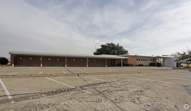
Property Detail
910 N Watson Rd
Dallas-Fort Worth-Arlington, TX
GOODWIN, JESSE SURVEY ABSTRACT 595 TRACT 4B
03903052
TARRANT
Residentialacreage
Texas
B and X Area of moderate flood hazard, usually the area between the limits of the 100-year and 500-year floods.
49.66 AC
0
Arlington/Mansfield
2025
Dallas/Ft Worth
113005
NEARBY LISTINGS FOR SALE OR LEASE
DEMOGRAPHICS near 910 N Watson Rd
1 mile
3 mile
5 mile
2025 Total Population
4,120
108,717
284,611
2030 Population
4,193
114,296
298,313
Pop Growth 2025-2030
+ 1.77%
+ 5.13%
+ 4.81%
Average Age
34
35
35
2025 Total Households
2,031
44,125
106,882
HH Growth 2025-2030
+ 2.02%
+ 5.31%
+ 5.01%
Median Household Inc
$54,709
$56,791
$59,661
Avg Household Size
2.00
2.40
2.60
2025 Avg HH Vehicles
1.00
2.00
2.00
Median Home Value
$320,000
$265,124
$273,823
Median Year Built
1985
1983
1982
Nearby Places
Map Layers
Map Styles
 Street
 Aerial
Transit
 Traffic
 Biking
Places
Listings with unknown addresses are not visible on the map
- Restaurants
- Banks
- Shops
- Fitness
- Groceries
PUBLIC TRANSPORTATION
COMMUTER RAIL
Centreport Station (TRINITY RAILWAY - Dallas Area Rapid Transit (DART))
Drive
Walk
Distance
Centreport Station (TRINITY RAILWAY - Dallas Area Rapid Transit (DART))
10 min
5.9 mi
West Tex Yard Limit (TRINITY RAILWAY - Dallas Area Rapid Transit (DART))
Drive
Walk
Distance
West Tex Yard Limit (TRINITY RAILWAY - Dallas Area Rapid Transit (DART))
14 min
7.4 mi
AIRPORT
Dallas-Fort Worth International
Drive
Walk
Distance
Dallas-Fort Worth International
19 min
12.1 mi
Dallas Love Field
Drive
Walk
Distance
Dallas Love Field
28 min
19.6 mi
Freight Ports
Port of Shreveport
Drive
Walk
Distance
Port of Shreveport
229 min
212.0 mi
Nearby Properties
Address
Land Use
TOTAL SIZE
Lot Size
Zoning
Address
Land Use
TOTAL SIZE
Lot Size
Zoning
1,700,000 SF
8.23 AC
Address
Land Use
TOTAL SIZE
Lot Size
Zoning
3,015,800 SF
72.86 AC
Address
Land Use
TOTAL SIZE
Lot Size
Zoning
1,400,000 SF
15.30 AC
Address
Land Use
TOTAL SIZE
Lot Size
Zoning
640,583 SF
Address
Land Use
TOTAL SIZE
Lot Size
Zoning
269,257 SF
21.33 AC
Address
Land Use
TOTAL SIZE
Lot Size
Zoning
378,182 SF
5.02 AC
Address
Land Use
TOTAL SIZE
Lot Size
Zoning
287,560 SF
3.28 AC
Address
Land Use
TOTAL SIZE
Lot Size
Zoning
5,995,915 SF
248.78 AC
Address
Land Use
TOTAL SIZE
Lot Size
Zoning
458,819 SF
15.88 AC
Address
Land Use
TOTAL SIZE
Lot Size
Zoning
485,911 SF
54.76 AC
Address
Land Use
TOTAL SIZE
Lot Size
Zoning
522,294 SF
18.35 AC
Address
Land Use
TOTAL SIZE
Lot Size
Zoning
578,395 SF
6.22 AC
Address
Land Use
TOTAL SIZE
Lot Size
Zoning
548,806 SF
5.56 AC
Address
Land Use
TOTAL SIZE
Lot Size
Zoning
1,261,810 SF
80.53 AC
Address
Land Use
TOTAL SIZE
Lot Size
Zoning
324,303 SF
23.15 AC
Address
Land Use
TOTAL SIZE
Lot Size
Zoning
450,535 SF
27.23 AC
Address
Land Use
TOTAL SIZE
Lot Size
Zoning
139,821 SF
Address
Land Use
TOTAL SIZE
Lot Size
Zoning
342,583 SF
23.87 AC
Address
Land Use
TOTAL SIZE
Lot Size
Zoning
339,965 SF
15.59 AC
Address
Land Use
TOTAL SIZE
Lot Size
Zoning
358,350 SF
13.15 AC
Address
Land Use
TOTAL SIZE
Lot Size
Zoning
539,000 SF
3.91 AC
Address
Land Use
TOTAL SIZE
Lot Size
Zoning
300,915 SF
24.90 AC
Address
Land Use
TOTAL SIZE
Lot Size
Zoning
285,194 SF
15.91 AC
Address
Land Use
TOTAL SIZE
Lot Size
Zoning
313,349 SF
15.39 AC
Address
Land Use
TOTAL SIZE
Lot Size
Zoning
137,878 SF
189.88 AC
Address
Land Use
TOTAL SIZE
Lot Size
Zoning
334,660 SF
17.59 AC
Address
Land Use
TOTAL SIZE
Lot Size
Zoning
362,847 SF
19.88 AC
Address
Land Use
TOTAL SIZE
Lot Size
Zoning
266,448 SF
17 AC
Z97
Address
Land Use
TOTAL SIZE
Lot Size
Zoning
555,428 SF
14.57 AC
Address
Land Use
TOTAL SIZE
Lot Size
Zoning
209,751 SF
6.65 AC
The World's #1 Commercial Real Estate Marketplace
Connect with us
© 2026 CoStar Group
The information above has been obtained from sources believed reliable. While we do not doubt its accuracy we have not verified it and make no guarantee, warranty or representation about it. It is your responsibility to independently confirm its accuracy and completeness. Any projections, opinions, assumptions, or estimates used are for example only and do not represent the current or future performance of the property. The value of this transaction to you depends on tax and other factors which should be evaluated by your tax, financial, and legal advisors. You and your advisors should conduct a careful, independent investigation of the property to determine to your satisfaction the suitability of the property for your needs.