Property Record
910 Nw 50Th Ave, Ocala, FL 34482


Save to a Folder
{{folder.Name}}
{{folder.ListingIds.length}} Properties
{{folder.ListingIds.length}} Property
Create a New Folder
Property Detail
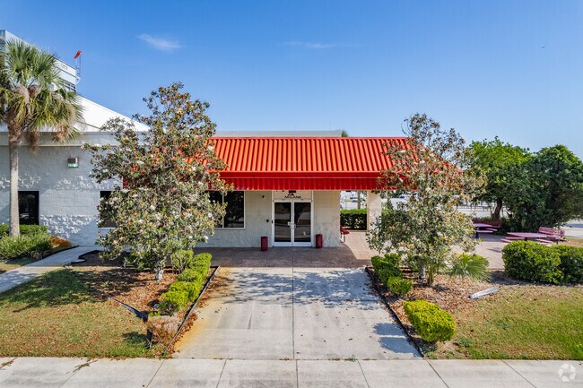
910 Nw 50Th Ave
21645-000-01
SEC 09 TWP 15 RGE 21 COM AT NE COR OF NE 1/4 OF SEC 16 TH S 89-46-54 W 1324.38 FT TH N 00.1742 E 708.03 FT TO POB TH N 00-17-42 E 1936.23 FT TH N 89-47-55 E 1306.01 FT TH S 00-06-11 E 1321.89 FT TH N 89-42-18 W 281.34 FT TH S 00-09-44 E 313.01 FT TH
Warehouse
MARION
M1
Florida
B and X Area of moderate flood hazard, usually the area between the limits of the 100-year and 500-year floods.
47.47 AC
2025
Outlying Marion County
2025
Ocala
002504
Ocala, FL
403,023 SF
NEARBY LISTINGS FOR SALE OR LEASE
DEMOGRAPHICS near 910 Nw 50Th Ave
1 mile
3 mile
5 mile
2025 Total Population
3,334
23,050
60,541
2030 Population
3,745
25,904
68,245
Pop Growth 2025-2030
+ 12.33%
+ 12.38%
+ 12.73%
Average Age
52
44
42
2025 Total Households
1,515
9,627
24,827
HH Growth 2025-2030
+ 12.48%
+ 12.91%
+ 13.16%
Median Household Inc
$48,792
$51,702
$54,799
Avg Household Size
2.00
2.20
2.30
2025 Avg HH Vehicles
1.00
1.00
2.00
Median Home Value
$257,161
$266,280
$265,902
Median Year Built
1993
1993
1991
Nearby Places
Map Layers
Map Styles
 Street
 Aerial
Layers
 Traffic
 Biking
Places
Listings with unknown addresses are not visible on the map
- Restaurants
- Banks
- Shops
- Fitness
- Groceries
PUBLIC TRANSPORTATION
AIRPORT
Gainesville Regional
Drive
Walk
Distance
Gainesville Regional
61 min
42.5 mi
SALE & LEASE HISTORY
LISTING DATE
SALE/LEASE

Sep 29, 2016
For Sale
Sep 29, 2016
For Sale
Sep 29, 2016
For Sale
Sep 24, 2016
For Sale
Oct 27, 2016
For Lease
Mar 22, 2017
For Sale
Mar 21, 2017
For Sale
Mar 21, 2017
For Lease
Mar 21, 2017
For Sale
Jul 25, 2017
For Lease
Nearby Properties
Address
Land Use
TOTAL SIZE
Lot Size
Zoning
Address
Land Use
TOTAL SIZE
Lot Size
Zoning
2,015,469 SF
169.30 AC
M1
Address
Land Use
TOTAL SIZE
Lot Size
Zoning
704,765 SF
71.04 AC
GU
Address
Land Use
TOTAL SIZE
Lot Size
Zoning
493,261 SF
126.01 AC
R3
Address
Land Use
TOTAL SIZE
Lot Size
Zoning
85,986 SF
15.68 AC
PUD
Address
Land Use
TOTAL SIZE
Lot Size
Zoning
446,764 SF
138.06 AC
GU
Address
Land Use
TOTAL SIZE
Lot Size
Zoning
1,085,670 SF
87.92 AC
M1
Address
Land Use
TOTAL SIZE
Lot Size
Zoning
612,196 SF
50.06 AC
M1
Address
Land Use
TOTAL SIZE
Lot Size
Zoning
617,520 SF
46.08 AC
M2
Address
Land Use
TOTAL SIZE
Lot Size
Zoning
441,040 SF
150.01 AC
M1
Address
Land Use
TOTAL SIZE
Lot Size
Zoning
458,983 SF
35.14 AC
M1
Address
Land Use
TOTAL SIZE
Lot Size
Zoning
135,945 SF
22.30 AC
PD
Address
Land Use
TOTAL SIZE
Lot Size
Zoning
444,381 SF
60 AC
M1
Address
Land Use
TOTAL SIZE
Lot Size
Zoning
152,355 SF
973.50 AC
GU
Address
Land Use
TOTAL SIZE
Lot Size
Zoning
403,023 SF
47.47 AC
M1
Address
Land Use
TOTAL SIZE
Lot Size
Zoning
62,164 SF
27.64 AC
PD
Address
Land Use
TOTAL SIZE
Lot Size
Zoning
92,049 SF
15.75 AC
R3
Address
Land Use
TOTAL SIZE
Lot Size
Zoning
65,570 SF
18.96 AC
PD
Address
Land Use
TOTAL SIZE
Lot Size
Zoning
350,895 SF
27.85 AC
M1
Address
Land Use
TOTAL SIZE
Lot Size
Zoning
422,369 SF
51.11 AC
M2
Address
Land Use
TOTAL SIZE
Lot Size
Zoning
60,816 SF
13.67 AC
PD
Address
Land Use
TOTAL SIZE
Lot Size
Zoning
604,920 SF
42.92 AC
M1
Address
Land Use
TOTAL SIZE
Lot Size
Zoning
194,275 SF
13.43 AC
M1
Address
Land Use
TOTAL SIZE
Lot Size
Zoning
392,617 SF
23.83 AC
M1
Address
Land Use
TOTAL SIZE
Lot Size
Zoning
113,501 SF
68.56 AC
INST
Address
Land Use
TOTAL SIZE
Lot Size
Zoning
482,618 SF
34.54 AC
M2
Address
Land Use
TOTAL SIZE
Lot Size
Zoning
364,404 SF
31.83 AC
M1
Address
Land Use
TOTAL SIZE
Lot Size
Zoning
92,095 SF
216.43 AC
M1
Address
Land Use
TOTAL SIZE
Lot Size
Zoning
360,450 SF
20 AC
M1
Address
Land Use
TOTAL SIZE
Lot Size
Zoning
146,091 SF
43.91 AC
M1
Address
Land Use
TOTAL SIZE
Lot Size
Zoning
124,812 SF
27.07 AC
PUD
The World's #1 Commercial Real Estate Marketplace
Connect with us
© 2026 CoStar Group
The information above has been obtained from sources believed reliable. While we do not doubt its accuracy we have not verified it and make no guarantee, warranty or representation about it. It is your responsibility to independently confirm its accuracy and completeness. Any projections, opinions, assumptions, or estimates used are for example only and do not represent the current or future performance of the property. The value of this transaction to you depends on tax and other factors which should be evaluated by your tax, financial, and legal advisors. You and your advisors should conduct a careful, independent investigation of the property to determine to your satisfaction the suitability of the property for your needs.