Property Record
910 S Post Rd, Indianapolis, IN 46239
This Property Is For Sale
NEARBY LISTINGS FOR SALE OR LEASE
Property Detail
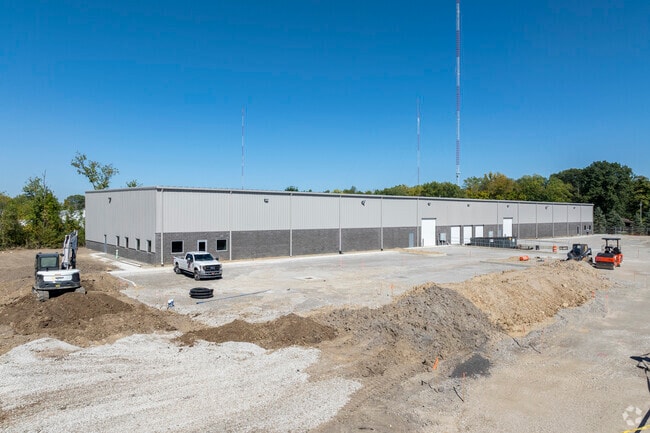
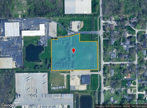
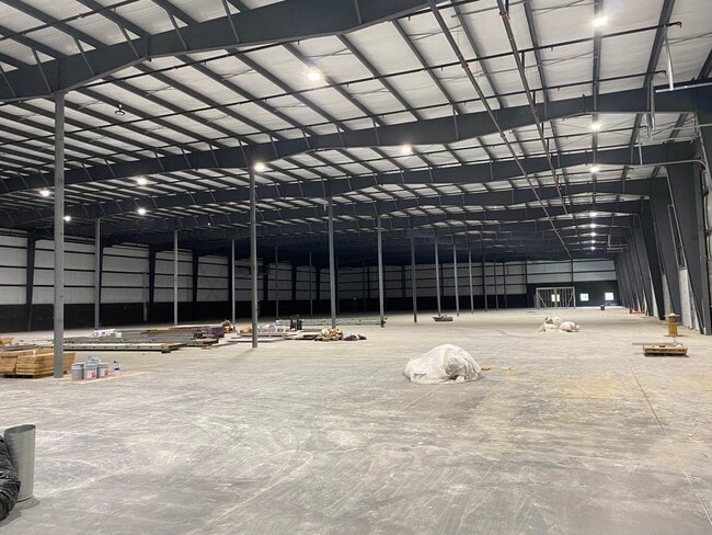
910 S Post Rd
Indianapolis
Wolters Industrial Commercial Plat
Indianapolis-Carmel-Greenwood, IN
WOLTERS INDUSTRIAL COMMERCIAL PLAT L3
49-09-07-112-004.002-700
Marion
Lightindustrial
Indiana
0
3
2024
5.21 AC
361601
Washington Square
DEMOGRAPHICS near 910 S Post Rd
1 mile
3 mile
5 mile
2024 Total Population
2,509
43,837
157,411
2029 Population
2,447
42,881
156,049
Pop Growth 2024-2029
(2.47%)
(2.18%)
(0.87%)
Average Age
39
39
38
2024 Total Households
994
16,981
61,188
HH Growth 2024-2029
(2.62%)
(2.21%)
(0.97%)
Median Household Inc
$50,796
$61,293
$57,926
Avg Household Size
2.50
2.50
2.50
2024 Avg HH Vehicles
2.00
2.00
2.00
Median Home Value
$175,364
$174,960
$168,997
Median Year Built
1988
1973
1968
Nearby Places
Map Layers
Map Styles
 Street
 Aerial
Transit
 Traffic
 Biking
Places
Listings with unknown addresses are not visible on the map
- Restaurants
- Banks
- Shops
- Fitness
- Groceries
PUBLIC TRANSPORTATION
COMMUTER RAIL
Indianapolis (Cardinal - Amtrak)
Drive
Walk
Distance
Indianapolis (Cardinal - Amtrak)
16 min
9.2 mi
AIRPORT
Indianapolis International
Drive
Walk
Distance
Indianapolis International
38 min
21.3 mi
Freight Ports
Port of Toledo
Drive
Walk
Distance
Port of Toledo
267 min
224.7 mi
Nearby Properties
Address
Land Use
TOTAL SIZE
Lot Size
Zoning
Address
Land Use
TOTAL SIZE
Lot Size
Zoning
47.10 AC
ZO01
Address
Land Use
TOTAL SIZE
Lot Size
Zoning
584,250 SF
42.54 AC
ZO01
Address
Land Use
TOTAL SIZE
Lot Size
Zoning
9,888 SF
124.20 AC
ZO01
Address
Land Use
TOTAL SIZE
Lot Size
Zoning
768,000 SF
29.62 AC
ZO03
Address
Land Use
TOTAL SIZE
Lot Size
Zoning
4,379 SF
11.48 AC
ZO01
Address
Land Use
TOTAL SIZE
Lot Size
Zoning
3,132 SF
20.50 AC
Address
Land Use
TOTAL SIZE
Lot Size
Zoning
133,257 SF
93.03 AC
ZO01
Address
Land Use
TOTAL SIZE
Lot Size
Zoning
1,768 SF
30.88 AC
ZO01
Address
Land Use
TOTAL SIZE
Lot Size
Zoning
76,663 SF
1.91 AC
ZO01
Address
Land Use
TOTAL SIZE
Lot Size
Zoning
213,102 SF
14.51 AC
Address
Land Use
TOTAL SIZE
Lot Size
Zoning
234,064 SF
29.49 AC
ZO01
Address
Land Use
TOTAL SIZE
Lot Size
Zoning
198,375 SF
24.52 AC
ZO01
Address
Land Use
TOTAL SIZE
Lot Size
Zoning
8,054 SF
20.62 AC
Address
Land Use
TOTAL SIZE
Lot Size
Zoning
5,560 SF
10.88 AC
ZO01
Address
Land Use
TOTAL SIZE
Lot Size
Zoning
46,800 SF
49.64 AC
ZO01
Address
Land Use
TOTAL SIZE
Lot Size
Zoning
170,000 SF
11.29 AC
ZO01
Address
Land Use
TOTAL SIZE
Lot Size
Zoning
3,832 SF
12.77 AC
ZO01
Address
Land Use
TOTAL SIZE
Lot Size
Zoning
616,065 SF
51.20 AC
ZO01
Address
Land Use
TOTAL SIZE
Lot Size
Zoning
169,094 SF
10.43 AC
ZO01
Address
Land Use
TOTAL SIZE
Lot Size
Zoning
67,252 SF
7.50 AC
ZO01
Address
Land Use
TOTAL SIZE
Lot Size
Zoning
1,538 SF
14.49 AC
ZO01
Address
Land Use
TOTAL SIZE
Lot Size
Zoning
140,976 SF
15.46 AC
ZO01
Address
Land Use
TOTAL SIZE
Lot Size
Zoning
53,988 SF
13.35 AC
ZO01
Address
Land Use
TOTAL SIZE
Lot Size
Zoning
409,096 SF
26.01 AC
Address
Land Use
TOTAL SIZE
Lot Size
Zoning
113,863 SF
13.60 AC
Address
Land Use
TOTAL SIZE
Lot Size
Zoning
115,550 SF
11.58 AC
ZO01
Address
Land Use
TOTAL SIZE
Lot Size
Zoning
13,712 SF
26.10 AC
ZO01
Address
Land Use
TOTAL SIZE
Lot Size
Zoning
1,825,713 SF
147.81 AC
ZO01
Address
Land Use
TOTAL SIZE
Lot Size
Zoning
107,656 SF
7.66 AC
Address
Land Use
TOTAL SIZE
Lot Size
Zoning
160,410 SF
13.71 AC
The World's #1 Commercial Real Estate Marketplace
Connect with us
© 2026 CoStar Group
The information above has been obtained from sources believed reliable. While we do not doubt its accuracy we have not verified it and make no guarantee, warranty or representation about it. It is your responsibility to independently confirm its accuracy and completeness. Any projections, opinions, assumptions, or estimates used are for example only and do not represent the current or future performance of the property. The value of this transaction to you depends on tax and other factors which should be evaluated by your tax, financial, and legal advisors. You and your advisors should conduct a careful, independent investigation of the property to determine to your satisfaction the suitability of the property for your needs.