Property Record
910 S Us Highway 1, Vero Beach, FL 32962

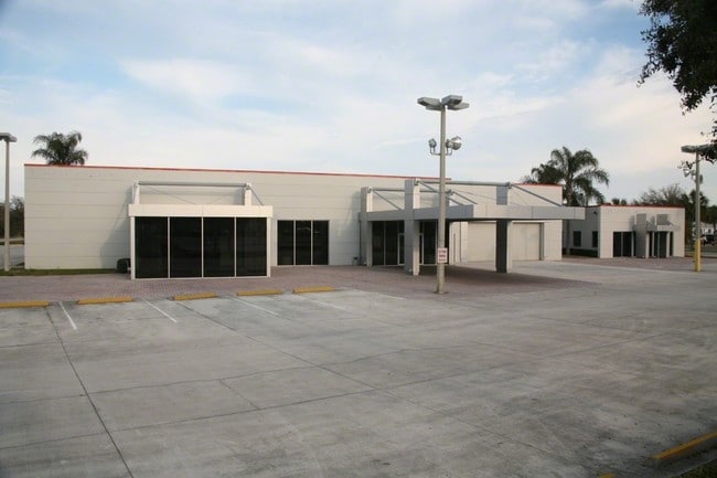

Property Detail
910 S Us Highway 1
33-40-30-00000-3000-00007.0
SEC 30 TWP 33 RNG 40 MORE PART DESC AS FOLL BEG AT A POINT ON THE N LINE OF THE NW QTR OF SEC 30 WHERE SAID LINE IS INTERSEC BY THE E ROW LINE OF US HWY 1 AS SAID ELY ROW LINE EXISTED PRIOR TO NOVEMBER 7 1953 AND FROM SAID POINT RUN E OF SAID N SEC L
Vehiclerentalsvehiclesales
Indian River
CG
Florida
B and X Area of moderate flood hazard, usually the area between the limits of the 100-year and 500-year floods.
2.46 AC
2025
Fort Pierce/Port St Lucie
2025
Other Market Areas
050605
Sebastian-Vero Beach-West Vero Corridor, FL
728 SF
NEARBY LISTINGS FOR SALE OR LEASE
DEMOGRAPHICS near 910 S Us Highway 1
1 mile
3 mile
5 mile
2025 Total Population
5,319
46,504
89,713
2030 Population
5,666
49,524
96,511
Pop Growth 2025-2030
+ 6.52%
+ 6.49%
+ 7.58%
Average Age
54
48
47
2025 Total Households
2,621
20,344
39,294
HH Growth 2025-2030
+ 6.64%
+ 6.53%
+ 7.45%
Median Household Inc
$71,536
$69,526
$69,731
Avg Household Size
2.00
2.20
2.20
2025 Avg HH Vehicles
1.00
2.00
2.00
Median Home Value
$311,045
$313,587
$343,394
Median Year Built
1986
1987
1985
Nearby Places
Map Layers
Map Styles
 Street
 Aerial
Layers
 Traffic
 Biking
Places
Listings with unknown addresses are not visible on the map
- Restaurants
- Banks
- Shops
- Fitness
- Groceries
Nearby Properties
Address
Land Use
TOTAL SIZE
Lot Size
Zoning
Address
Land Use
TOTAL SIZE
Lot Size
Zoning
22,183 SF
21.04 AC
RS-3
Address
Land Use
TOTAL SIZE
Lot Size
Zoning
10,600 SF
36.80 AC
RS-6
Address
Land Use
TOTAL SIZE
Lot Size
Zoning
313,820 SF
21.83 AC
RM-10 EX
Address
Land Use
TOTAL SIZE
Lot Size
Zoning
231,651 SF
16.23 AC
RM-10
Address
Land Use
TOTAL SIZE
Lot Size
Zoning
165,453 SF
29.42 AC
RM-6
Address
Land Use
TOTAL SIZE
Lot Size
Zoning
150,160 SF
13.12 AC
PD
Address
Land Use
TOTAL SIZE
Lot Size
Zoning
168,782 SF
17.84 AC
CG
Address
Land Use
TOTAL SIZE
Lot Size
Zoning
9,312 SF
73.67 AC
RS-6
Address
Land Use
TOTAL SIZE
Lot Size
Zoning
85,023 SF
16.44 AC
CG
Address
Land Use
TOTAL SIZE
Lot Size
Zoning
169,566 SF
12.93 AC
RM-8
Address
Land Use
TOTAL SIZE
Lot Size
Zoning
328 SF
74.87 AC
RS-3
Address
Land Use
TOTAL SIZE
Lot Size
Zoning
5,086 SF
19.65 AC
RS-6
Address
Land Use
TOTAL SIZE
Lot Size
Zoning
61,164 SF
8.94 AC
CG
Address
Land Use
TOTAL SIZE
Lot Size
Zoning
924 SF
30.87 AC
RS-6
Address
Land Use
TOTAL SIZE
Lot Size
Zoning
19,059 SF
8.35 AC
CG
Address
Land Use
TOTAL SIZE
Lot Size
Zoning
122,038 SF
10.02 AC
RM-10
Address
Land Use
TOTAL SIZE
Lot Size
Zoning
6,927 SF
1.92 AC
RS-3
Address
Land Use
TOTAL SIZE
Lot Size
Zoning
1.28 AC
RS-3
Address
Land Use
TOTAL SIZE
Lot Size
Zoning
12,082 SF
4.28 AC
CG
Address
Land Use
TOTAL SIZE
Lot Size
Zoning
60,490 SF
14.92 AC
RS-6
Address
Land Use
TOTAL SIZE
Lot Size
Zoning
7,850 SF
0.79 AC
RS-3
Address
Land Use
TOTAL SIZE
Lot Size
Zoning
71,201 SF
3.29 AC
CH
Address
Land Use
TOTAL SIZE
Lot Size
Zoning
61,107 SF
8.90 AC
RM-10
Address
Land Use
TOTAL SIZE
Lot Size
Zoning
5,510 SF
0.42 AC
RS-3
Address
Land Use
TOTAL SIZE
Lot Size
Zoning
416 SF
5.34 AC
CH
Address
Land Use
TOTAL SIZE
Lot Size
Zoning
6,191 SF
2.71 AC
CH
Address
Land Use
TOTAL SIZE
Lot Size
Zoning
160.93 AC
INDUSTRIAL
Address
Land Use
TOTAL SIZE
Lot Size
Zoning
1,300 SF
5.41 AC
IL
Address
Land Use
TOTAL SIZE
Lot Size
Zoning
600 SF
6.49 AC
CH
Address
Land Use
TOTAL SIZE
Lot Size
Zoning
6,445 SF
1.01 AC
RS-3
The World's #1 Commercial Real Estate Marketplace
Connect with us
© 2026 CoStar Group
The information above has been obtained from sources believed reliable. While we do not doubt its accuracy we have not verified it and make no guarantee, warranty or representation about it. It is your responsibility to independently confirm its accuracy and completeness. Any projections, opinions, assumptions, or estimates used are for example only and do not represent the current or future performance of the property. The value of this transaction to you depends on tax and other factors which should be evaluated by your tax, financial, and legal advisors. You and your advisors should conduct a careful, independent investigation of the property to determine to your satisfaction the suitability of the property for your needs.