Property Record
910 Saint Andrews Dr, Murfreesboro, TN 37128


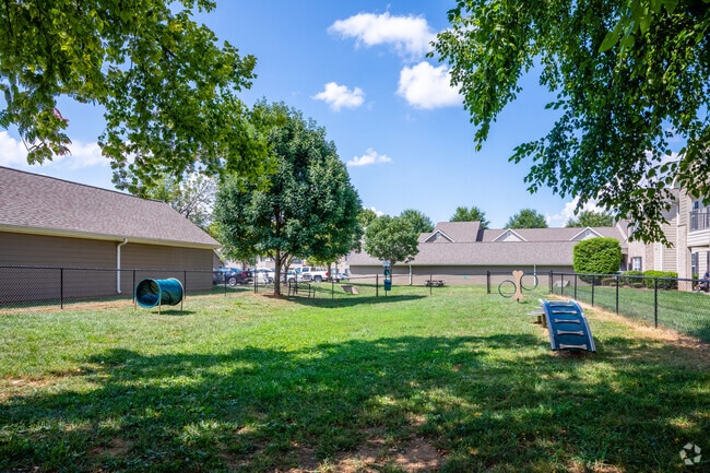
Property Detail
910 Saint Andrews Dr
101-001.08-000
ST ANDREWS APARTMENTS PB 28 PG 178 PER EJ/ NEW PLAT NO CHANGE EXCEPT FOR ZONING?
Apartment
Rutherford
RM16
Tennessee
B and X Area of moderate flood hazard, usually the area between the limits of the 100-year and 500-year floods.
1
2025
15.43 AC
2025
Outer Rutherford County
040909
Nashville
864 SF
Nashville-Davidson--Murfreesboro--Franklin, TN
NEARBY LISTINGS FOR SALE OR LEASE
-
-
View all Murfreesboro listings for sale on LoopNet.com
DEMOGRAPHICS near 910 Saint Andrews Dr
1 mile
3 mile
5 mile
2025 Total Population
13,555
64,927
145,952
2030 Population
14,449
70,185
158,061
Pop Growth 2025-2030
+ 6.60%
+ 8.10%
+ 8.30%
Average Age
35
36
36
2025 Total Households
5,325
24,695
56,057
HH Growth 2025-2030
+ 6.61%
+ 8.20%
+ 8.45%
Median Household Inc
$82,982
$86,783
$78,888
Avg Household Size
2.50
2.60
2.50
2025 Avg HH Vehicles
2.00
2.00
2.00
Median Home Value
$374,318
$408,803
$422,784
Median Year Built
2001
2007
2000
Nearby Places
Map Layers
Map Styles
 Street
 Aerial
Transit
 Traffic
 Biking
Places
Listings with unknown addresses are not visible on the map
- Restaurants
- Banks
- Shops
- Fitness
- Groceries
PUBLIC TRANSPORTATION
AIRPORT
Nashville International
Drive
Walk
Distance
Nashville International
34 min
27.1 mi
Freight Ports
Port of Mobile
Drive
Walk
Distance
Port of Mobile
488 min
446.0 mi
Nearby Properties
Address
Land Use
TOTAL SIZE
Lot Size
Zoning
Address
Land Use
TOTAL SIZE
Lot Size
Zoning
969,473 SF
43.50 AC
Address
Land Use
TOTAL SIZE
Lot Size
Zoning
812,152 SF
85.61 AC
Address
Land Use
TOTAL SIZE
Lot Size
Zoning
369,709 SF
76.83 AC
Address
Land Use
TOTAL SIZE
Lot Size
Zoning
30,630 SF
8.50 AC
Address
Land Use
TOTAL SIZE
Lot Size
Zoning
104,174 SF
11.06 AC
Address
Land Use
TOTAL SIZE
Lot Size
Zoning
12,391 SF
20.36 AC
Address
Land Use
TOTAL SIZE
Lot Size
Zoning
295,095 SF
80 AC
Address
Land Use
TOTAL SIZE
Lot Size
Zoning
167,712 SF
24.60 AC
Address
Land Use
TOTAL SIZE
Lot Size
Zoning
5,260 SF
21.91 AC
Address
Land Use
TOTAL SIZE
Lot Size
Zoning
140,618 SF
25.82 AC
Address
Land Use
TOTAL SIZE
Lot Size
Zoning
4,454 SF
22.26 AC
Address
Land Use
TOTAL SIZE
Lot Size
Zoning
8,458 SF
30.33 AC
Address
Land Use
TOTAL SIZE
Lot Size
Zoning
208,990 SF
51.06 AC
Address
Land Use
TOTAL SIZE
Lot Size
Zoning
3,114 SF
32.12 AC
Address
Land Use
TOTAL SIZE
Lot Size
Zoning
6,000 SF
23.52 AC
Address
Land Use
TOTAL SIZE
Lot Size
Zoning
231,649 SF
19.95 AC
Address
Land Use
TOTAL SIZE
Lot Size
Zoning
1,990 SF
28.14 AC
Address
Land Use
TOTAL SIZE
Lot Size
Zoning
7,510 SF
22.83 AC
Address
Land Use
TOTAL SIZE
Lot Size
Zoning
1,792 SF
17.48 AC
Address
Land Use
TOTAL SIZE
Lot Size
Zoning
79,122 SF
15 AC
Address
Land Use
TOTAL SIZE
Lot Size
Zoning
17,330 SF
10.20 AC
Address
Land Use
TOTAL SIZE
Lot Size
Zoning
10,760 SF
19.48 AC
Address
Land Use
TOTAL SIZE
Lot Size
Zoning
5,094 SF
19.53 AC
RM16
Address
Land Use
TOTAL SIZE
Lot Size
Zoning
7,704 SF
17.15 AC
CF
Address
Land Use
TOTAL SIZE
Lot Size
Zoning
9,072 SF
18 AC
Address
Land Use
TOTAL SIZE
Lot Size
Zoning
408,067 SF
33.01 AC
CH
Address
Land Use
TOTAL SIZE
Lot Size
Zoning
13,818 SF
7.43 AC
Address
Land Use
TOTAL SIZE
Lot Size
Zoning
12,794 SF
20.44 AC
RM16
Address
Land Use
TOTAL SIZE
Lot Size
Zoning
160,540 SF
20.19 AC
Address
Land Use
TOTAL SIZE
Lot Size
Zoning
5,308 SF
14.95 AC
The World's #1 Commercial Real Estate Marketplace
Connect with us
© 2026 CoStar Group
The information above has been obtained from sources believed reliable. While we do not doubt its accuracy we have not verified it and make no guarantee, warranty or representation about it. It is your responsibility to independently confirm its accuracy and completeness. Any projections, opinions, assumptions, or estimates used are for example only and do not represent the current or future performance of the property. The value of this transaction to you depends on tax and other factors which should be evaluated by your tax, financial, and legal advisors. You and your advisors should conduct a careful, independent investigation of the property to determine to your satisfaction the suitability of the property for your needs.