Property Record
910 Scheller Ave, Morgan Hill, CA 95037
Property Detail
910 Scheller Ave
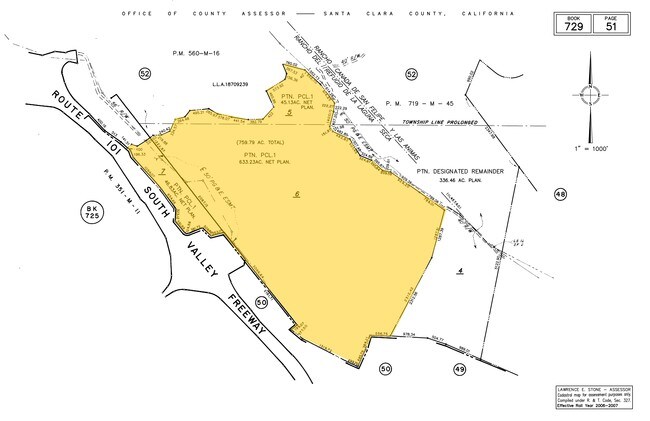
729-51-005
SANTA CLARA
Parkinglot
California
R1B3
45.13 AC
D Areas with possible but undetermined flood hazards.
Outlying Santa Clara Cnty
2024
South Bay/San Jose
2025
San Jose-Sunnyvale-Santa Clara, CA
512312
NEARBY LISTINGS FOR SALE OR LEASE
DEMOGRAPHICS near 910 Scheller Ave
1 mile
3 mile
5 mile
2025 Total Population
0
9,612
42,367
2030 Population
0
9,814
43,322
Pop Growth 2025-2030
0.00%
+ 2.10%
+ 2.25%
Average Age
0
41
40
2025 Total Households
0
3,001
13,649
HH Growth 2025-2030
0.00%
+ 2.27%
+ 2.30%
Median Household Inc
$0
$193,181
$156,661
Avg Household Size
.00
3.10
3.00
2025 Avg HH Vehicles
.00
2.00
2.00
Median Home Value
$0
$1,079,265
$1,061,965
Median Year Built
0
1996
1988
Nearby Places
Map Layers
Map Styles
 Street
 Aerial
Transit
 Traffic
 Biking
Places
Listings with unknown addresses are not visible on the map
- Restaurants
- Banks
- Shops
- Fitness
- Groceries
PUBLIC TRANSPORTATION
COMMUTER RAIL
Morgan Hill Caltrain Station Southbound (South Santa Clara County Connector - Caltrain (Caltrain))
Drive
Walk
Distance
Morgan Hill Caltrain Station Southbound (South Santa Clara County Connector - Caltrain (Caltrain))
29 min
8.8 mi
AIRPORT
Norman Y Mineta San Jose International
Drive
Walk
Distance
Norman Y Mineta San Jose International
44 min
23.2 mi
Freight Ports
Port of Redwood City
Drive
Walk
Distance
Port of Redwood City
65 min
41.3 mi
Nearby Properties
Address
Land Use
TOTAL SIZE
Lot Size
Zoning
Address
Land Use
TOTAL SIZE
Lot Size
Zoning
7.53 AC
CT
Address
Land Use
TOTAL SIZE
Lot Size
Zoning
76,845 SF
2.43 AC
A140
Address
Land Use
TOTAL SIZE
Lot Size
Zoning
400 SF
756.21 AC
A(PD)
Address
Land Use
TOTAL SIZE
Lot Size
Zoning
151,242 SF
10.44 AC
ML
Address
Land Use
TOTAL SIZE
Lot Size
Zoning
120,000 SF
6.86 AC
ML
Address
Land Use
TOTAL SIZE
Lot Size
Zoning
155,353 SF
9.21 AC
IPUD
Address
Land Use
TOTAL SIZE
Lot Size
Zoning
4.93 AC
ML
Address
Land Use
TOTAL SIZE
Lot Size
Zoning
127,732 SF
4.74 AC
HC
Address
Land Use
TOTAL SIZE
Lot Size
Zoning
127,732 SF
6.26 AC
CT
Address
Land Use
TOTAL SIZE
Lot Size
Zoning
22,385 SF
2.45 AC
CT
Address
Land Use
TOTAL SIZE
Lot Size
Zoning
4,734 SF
20.32 AC
PVD
Address
Land Use
TOTAL SIZE
Lot Size
Zoning
108,631 SF
13.90 AC
A-20A
Address
Land Use
TOTAL SIZE
Lot Size
Zoning
584 SF
21.16 AC
PUD
Address
Land Use
TOTAL SIZE
Lot Size
Zoning
2.44 AC
ML
Address
Land Use
TOTAL SIZE
Lot Size
Zoning
80,041 SF
6.88 AC
PUD
Address
Land Use
TOTAL SIZE
Lot Size
Zoning
72,510 SF
6.56 AC
PUD
Address
Land Use
TOTAL SIZE
Lot Size
Zoning
127,180 SF
7.24 AC
ML
Address
Land Use
TOTAL SIZE
Lot Size
Zoning
49,493 SF
2.39 AC
HC-P
Address
Land Use
TOTAL SIZE
Lot Size
Zoning
64,818 SF
2.34 AC
HC
Address
Land Use
TOTAL SIZE
Lot Size
Zoning
20,533 SF
3.51 AC
HC
Address
Land Use
TOTAL SIZE
Lot Size
Zoning
132.94 AC
A
Address
Land Use
TOTAL SIZE
Lot Size
Zoning
38,755 SF
2.18 AC
PUD
Address
Land Use
TOTAL SIZE
Lot Size
Zoning
34,944 SF
2.68 AC
M
Address
Land Use
TOTAL SIZE
Lot Size
Zoning
26,520 SF
2.23 AC
M
Address
Land Use
TOTAL SIZE
Lot Size
Zoning
3.06 AC
R1B1
Address
Land Use
TOTAL SIZE
Lot Size
Zoning
38,335 SF
2.91 AC
HC
Address
Land Use
TOTAL SIZE
Lot Size
Zoning
63,333 SF
5 AC
M
Address
Land Use
TOTAL SIZE
Lot Size
Zoning
25,186 SF
1.93 AC
M
Address
Land Use
TOTAL SIZE
Lot Size
Zoning
14.53 AC
PUD
The World's #1 Commercial Real Estate Marketplace
Connect with us
© 2026 CoStar Group
The information above has been obtained from sources believed reliable. While we do not doubt its accuracy we have not verified it and make no guarantee, warranty or representation about it. It is your responsibility to independently confirm its accuracy and completeness. Any projections, opinions, assumptions, or estimates used are for example only and do not represent the current or future performance of the property. The value of this transaction to you depends on tax and other factors which should be evaluated by your tax, financial, and legal advisors. You and your advisors should conduct a careful, independent investigation of the property to determine to your satisfaction the suitability of the property for your needs.