Property Record
910 W 1000 N, Salt Lake City, UT 84116

NEARBY LISTINGS FOR SALE OR LEASE
-
-
-
-
-
26 S Rio Grande St #2072, Salt Lake City, UT 84101
Salt Lake City, UT 84101
Negotiable
150 - 34,750 SF
Retail
-
-
-
View all Salt Lake City listings for sale on LoopNet.com
Property Detail
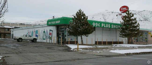
910 W 1000 N
Salt Lake City, UT
Kinney & Gourlays Improved City Plat
08-26-259-019-0000
ALL OF LOTS 17 THRU 22, BLK 68, KINNEY & GOURLAYS IMPROVED CITY PLAT, TOG WITH VACATED STREET, ABUTTING ON THE S & 1/2 OF THE VACATED ALLEY ABUTTING ON THE N OF SD PROP. 1.08 AC MOR L. 6046-2152 6461-1982,1984 6521-237 6761-1045 7103-77 7189-2137 894
Officebuilding
Salt Lake
X
Utah
49011C0525E
17-22
2024
1.08 AC
2025
Airport/International Ctr
114700
Salt Lake City
14,820 SF
DEMOGRAPHICS near 910 W 1000 N
1 Mile
3 Mile
5 Mile
2024 Total Population
11,788
89,553
186,286
2029 Population
11,845
92,134
191,183
Pop Growth 2024-2029
+ 0.48%
+ 2.88%
+ 2.63%
Average Age
36
37
36
2024 Total Households
4,137
39,324
77,883
HH Growth 2024-2029
+ 0.48%
+ 3.58%
+ 2.95%
Median Household Inc
$63,025
$58,698
$62,603
Avg Household Size
2.70
2.10
2.20
2024 Avg HH Vehicles
2.00
1.00
2.00
Median Home Value
$340,074
$387,534
$442,749
Median Year Built
1956
1980
1973
Nearby Places
Map Layers
Map Styles
 Street
 Aerial
- Restaurants
- Banks
- Shops
- Fitness
- Groceries
PUBLIC TRANSPORTATION
COMMUTER RAIL
DRIVE
WALK
Distance
6 min
2.0 mi
DRIVE
WALK
Distance
5 min
2.0 mi
AIRPORT
Salt Lake City International
DRIVE
WALK
Distance
Salt Lake City International
11 min
7.0 mi
Nearby Properties
Address
Land Use
TOTAL SIZE
Lot Size
Zoning
Address
Land Use
TOTAL SIZE
Lot Size
Zoning
1,115,174 SF
9.72 AC
D-4
Address
Land Use
TOTAL SIZE
Lot Size
Zoning
352,836 SF
20.05 AC
PL
Address
Land Use
TOTAL SIZE
Lot Size
Zoning
350,000 SF
10 AC
U1
Address
Land Use
TOTAL SIZE
Lot Size
Zoning
56,741 SF
1.70 AC
D-1
Address
Land Use
TOTAL SIZE
Lot Size
Zoning
87,933 SF
4.90 AC
D-1
Address
Land Use
TOTAL SIZE
Lot Size
Zoning
2,566,335 SF
10.01 AC
D-1
Address
Land Use
TOTAL SIZE
Lot Size
Zoning
205,570 SF
5.63 AC
UI
Address
Land Use
TOTAL SIZE
Lot Size
Zoning
1,849,748 SF
6.88 AC
D-1
Address
Land Use
TOTAL SIZE
Lot Size
Zoning
1,330,058 SF
5.02 AC
D2
Address
Land Use
TOTAL SIZE
Lot Size
Zoning
836,183 SF
5.89 AC
TSA-UC
Address
Land Use
TOTAL SIZE
Lot Size
Zoning
807,940 SF
0.69 AC
D1
Address
Land Use
TOTAL SIZE
Lot Size
Zoning
712,539 SF
0.01 AC
D1
Address
Land Use
TOTAL SIZE
Lot Size
Zoning
1,256,042 SF
3.50 AC
D-1
Address
Land Use
TOTAL SIZE
Lot Size
Zoning
82,851 SF
9.76 AC
PL2
Address
Land Use
TOTAL SIZE
Lot Size
Zoning
588,291 SF
1.28 AC
D-1
Address
Land Use
TOTAL SIZE
Lot Size
Zoning
434,481 SF
10 AC
D-1
Address
Land Use
TOTAL SIZE
Lot Size
Zoning
157,938 SF
12 AC
1205
Address
Land Use
TOTAL SIZE
Lot Size
Zoning
146,422 SF
2.62 AC
UI
Address
Land Use
TOTAL SIZE
Lot Size
Zoning
449,528 SF
1.64 AC
2000
Address
Land Use
TOTAL SIZE
Lot Size
Zoning
543,780 SF
0.33 AC
D1
Address
Land Use
TOTAL SIZE
Lot Size
Zoning
454,036 SF
1.64 AC
D-1
Address
Land Use
TOTAL SIZE
Lot Size
Zoning
0.01 AC
D-4
Address
Land Use
TOTAL SIZE
Lot Size
Zoning
737,755 SF
1.63 AC
D-1
Address
Land Use
TOTAL SIZE
Lot Size
Zoning
22,022 SF
308 AC
AIRPRT
Address
Land Use
TOTAL SIZE
Lot Size
Zoning
37,536 SF
10 AC
PL
Address
Land Use
TOTAL SIZE
Lot Size
Zoning
366,584 SF
1.95 AC
TSAUC
Address
Land Use
TOTAL SIZE
Lot Size
Zoning
617,901 SF
2.73 AC
TSA-UC
Address
Land Use
TOTAL SIZE
Lot Size
Zoning
695,737 SF
1.70 AC
D-1
Address
Land Use
TOTAL SIZE
Lot Size
Zoning
248,345 SF
50 AC
PL
Address
Land Use
TOTAL SIZE
Lot Size
Zoning
256,771 SF
2.33 AC
R-MU
The World's #1 Commercial Real Estate Marketplace
Connect with us
© 2026 CoStar Group
The information above has been obtained from sources believed reliable. While we do not doubt its accuracy we have not verified it and make no guarantee, warranty or representation about it. It is your responsibility to independently confirm its accuracy and completeness. Any projections, opinions, assumptions, or estimates used are for example only and do not represent the current or future performance of the property. The value of this transaction to you depends on tax and other factors which should be evaluated by your tax, financial, and legal advisors. You and your advisors should conduct a careful, independent investigation of the property to determine to your satisfaction the suitability of the property for your needs.