Property Record
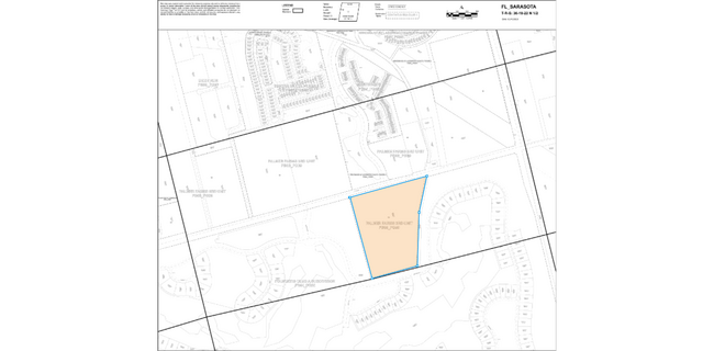
9100 Fruitville Rd, Sarasota, FL 34240

NEARBY LISTINGS FOR SALE OR LEASE
Property Detail
9100 Fruitville Rd
0221-01-3102
Palmer Farms 3Rd Unit
Pasture
FROM NW COR BLK 31 TH ELY ALG S R/W FRUITVILLE RD 4119.6 FOR POB TH N 88 DEG 46 MIN 15 SEC E ALG R/W 1235 FT TO W LINE CANAL 26 TH S 25 DEG 17 MIN 26 SEC W 577.73 FT TH S 15 DEG 41 MIN 36 SEC W ALG
AE
Sarasota
12115C0159G
Florida
2024
28.64 AC
2025
Sarasota Outlying
001405
Tampa/St Petersburg
10,214 SF
North Port-Sarasota-Bradenton, FL
DEMOGRAPHICS near 9100 Fruitville Rd
1 Mile
3 Mile
5 Mile
2024 Total Population
1,836
11,669
51,500
2029 Population
2,248
13,807
59,613
Pop Growth 2024-2029
+ 22.44%
+ 18.32%
+ 15.75%
Average Age
47
45
47
2024 Total Households
725
4,423
21,520
HH Growth 2024-2029
+ 22.62%
+ 18.58%
+ 15.62%
Median Household Inc
$113,749
$115,317
$89,544
Avg Household Size
2.40
2.50
2.30
2024 Avg HH Vehicles
2.00
2.00
2.00
Median Home Value
$564,846
$504,237
$399,124
Median Year Built
2010
2007
1996
Nearby Places
Map Layers
Map Styles
 Street
 Aerial
- Restaurants
- Banks
- Shops
- Fitness
- Groceries
PUBLIC TRANSPORTATION
AIRPORT
Sarasota/Bradenton International
DRIVE
WALK
Distance
Sarasota/Bradenton International
27 min
15.2 mi
Freight Ports
Port Manatee
DRIVE
WALK
Distance
Port Manatee
39 min
27.7 mi
SALE & LEASE HISTORY
LISTING DATE
SALE/LEASE

Apr 27, 2023
For Sale
Nearby Properties
Address
Land Use
TOTAL SIZE
Lot Size
Zoning
Address
Land Use
TOTAL SIZE
Lot Size
Zoning
92,398 SF
178.58 AC
OUE1
Address
Land Use
TOTAL SIZE
Lot Size
Zoning
343,370 SF
10.77 AC
VPD
Address
Land Use
TOTAL SIZE
Lot Size
Zoning
343,100 SF
13.67 AC
VPD
Address
Land Use
TOTAL SIZE
Lot Size
Zoning
332,686 SF
37.78 AC
VPD
Address
Land Use
TOTAL SIZE
Lot Size
Zoning
268,645 SF
9.38 AC
VPD
Address
Land Use
TOTAL SIZE
Lot Size
Zoning
122,380 SF
26.49 AC
VPD
Address
Land Use
TOTAL SIZE
Lot Size
Zoning
374,477 SF
15.55 AC
PED
Address
Land Use
TOTAL SIZE
Lot Size
Zoning
120,140 SF
5.09 AC
VPD
Address
Land Use
TOTAL SIZE
Lot Size
Zoning
86,651 SF
22.68 AC
PED
Address
Land Use
TOTAL SIZE
Lot Size
Zoning
119,960 SF
27.91 AC
PID
Address
Land Use
TOTAL SIZE
Lot Size
Zoning
49,034 SF
396.35 AC
RE2
Address
Land Use
TOTAL SIZE
Lot Size
Zoning
107,734 SF
32.85 AC
GU
Address
Land Use
TOTAL SIZE
Lot Size
Zoning
146,176 SF
33.37 AC
PID
Address
Land Use
TOTAL SIZE
Lot Size
Zoning
1,491 SF
28.15 AC
PED
Address
Land Use
TOTAL SIZE
Lot Size
Zoning
63,371 SF
10.52 AC
PCD
Address
Land Use
TOTAL SIZE
Lot Size
Zoning
45,554 SF
10.75 AC
CN
Address
Land Use
TOTAL SIZE
Lot Size
Zoning
23,409 SF
1.06 AC
VPD
Address
Land Use
TOTAL SIZE
Lot Size
Zoning
988 SF
15.96 AC
PED
Address
Land Use
TOTAL SIZE
Lot Size
Zoning
57,301 SF
10.56 AC
OUR
Address
Land Use
TOTAL SIZE
Lot Size
Zoning
36,133 SF
32.43 AC
RSF1
Address
Land Use
TOTAL SIZE
Lot Size
Zoning
159.37 AC
VPD
Address
Land Use
TOTAL SIZE
Lot Size
Zoning
103,220 SF
11.54 AC
PID
Address
Land Use
TOTAL SIZE
Lot Size
Zoning
80,650 SF
3.96 AC
PID
Address
Land Use
TOTAL SIZE
Lot Size
Zoning
43,374 SF
1.98 AC
PID
Address
Land Use
TOTAL SIZE
Lot Size
Zoning
28,370 SF
138.76 AC
OUE2
Address
Land Use
TOTAL SIZE
Lot Size
Zoning
29,495 SF
4.60 AC
OPI
Address
Land Use
TOTAL SIZE
Lot Size
Zoning
82,694 SF
10.76 AC
ILW
Address
Land Use
TOTAL SIZE
Lot Size
Zoning
148.26 AC
HPD
Address
Land Use
TOTAL SIZE
Lot Size
Zoning
21,709 SF
11.18 AC
PID
Address
Land Use
TOTAL SIZE
Lot Size
Zoning
25,780 SF
8.17 AC
GU
The World's #1 Commercial Real Estate Marketplace
Connect with us
© 2026 CoStar Group
The information above has been obtained from sources believed reliable. While we do not doubt its accuracy we have not verified it and make no guarantee, warranty or representation about it. It is your responsibility to independently confirm its accuracy and completeness. Any projections, opinions, assumptions, or estimates used are for example only and do not represent the current or future performance of the property. The value of this transaction to you depends on tax and other factors which should be evaluated by your tax, financial, and legal advisors. You and your advisors should conduct a careful, independent investigation of the property to determine to your satisfaction the suitability of the property for your needs.