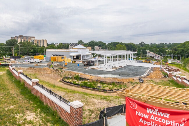
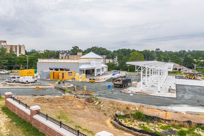
Property Record
9100 Riggs Rd, Adelphi, MD 20783

Property Detail
9100 Riggs Rd
17-1869726
PARCEL 1
Storebuilding
PRINCE GEORGE'S
LCD
Maryland
B and X Area of moderate flood hazard, usually the area between the limits of the 100-year and 500-year floods.
1-3
2024
3.52 AC
2025
College Park
807305
Washington, DC
5,676 SF
Washington-Arlington-Alexandria, DC-VA-MD-WV
NEARBY LISTINGS FOR SALE OR LEASE
DEMOGRAPHICS near 9100 Riggs Rd
1 mile
3 mile
5 mile
2025 Total Population
25,639
200,105
509,503
2030 Population
25,895
203,378
522,200
Pop Growth 2025-2030
+ 1.00%
+ 1.64%
+ 2.49%
Average Age
36
36
38
2025 Total Households
7,514
64,251
180,119
HH Growth 2025-2030
+ 1.09%
+ 1.73%
+ 2.84%
Median Household Inc
$76,459
$86,976
$95,733
Avg Household Size
3.30
2.80
2.70
2025 Avg HH Vehicles
2.00
2.00
2.00
Median Home Value
$410,759
$520,534
$481,403
Median Year Built
1965
1963
1962
Nearby Places
Map Layers
Map Styles
 Street
 Aerial
Transit
 Traffic
 Biking
Places
Listings with unknown addresses are not visible on the map
- Restaurants
- Banks
- Shops
- Fitness
- Groceries
PUBLIC TRANSPORTATION
COMMUTER RAIL
Drive
Walk
Distance
10 min
3.5 mi
Drive
Walk
Distance
9 min
5.4 mi
AIRPORT
Ronald Reagan Washington Ntl
Drive
Walk
Distance
Ronald Reagan Washington Ntl
28 min
14.2 mi
Baltimore/Washington International Thurgood Marshall
Drive
Walk
Distance
Baltimore/Washington International Thurgood Marshall
37 min
27.2 mi
Washington Dulles International
Drive
Walk
Distance
Washington Dulles International
50 min
33.4 mi
Freight Ports
Port of Baltimore
Drive
Walk
Distance
Port of Baltimore
41 min
29.9 mi
Nearby Properties
Address
Land Use
TOTAL SIZE
Lot Size
Zoning
Address
Land Use
TOTAL SIZE
Lot Size
Zoning
2,043 SF
1,011.13 AC
RR
Address
Land Use
TOTAL SIZE
Lot Size
Zoning
13.01 AC
RR
Address
Land Use
TOTAL SIZE
Lot Size
Zoning
610.61 AC
RE2
Address
Land Use
TOTAL SIZE
Lot Size
Zoning
639,347 SF
2.28 AC
RTOLE
Address
Land Use
TOTAL SIZE
Lot Size
Zoning
1,201,133 SF
41.56 AC
RTOHC
Address
Land Use
TOTAL SIZE
Lot Size
Zoning
917,092 SF
17.19 AC
R10
Address
Land Use
TOTAL SIZE
Lot Size
Zoning
398,693 SF
2.57 AC
LTOE
Address
Land Use
TOTAL SIZE
Lot Size
Zoning
74,664 SF
1.83 AC
RTOLE
Address
Land Use
TOTAL SIZE
Lot Size
Zoning
3.53 AC
RTOLE
Address
Land Use
TOTAL SIZE
Lot Size
Zoning
330,003 SF
1.74 AC
RTOLE
Address
Land Use
TOTAL SIZE
Lot Size
Zoning
1,146,407 SF
60.25 AC
AG
Address
Land Use
TOTAL SIZE
Lot Size
Zoning
2.05 AC
RTOLE
Address
Land Use
TOTAL SIZE
Lot Size
Zoning
8,060 SF
1.63 AC
LTOE
Address
Land Use
TOTAL SIZE
Lot Size
Zoning
508 SF
7.27 AC
LTOE
Address
Land Use
TOTAL SIZE
Lot Size
Zoning
3.64 AC
RTOHC
Address
Land Use
TOTAL SIZE
Lot Size
Zoning
578,232 SF
1.43 AC
RTOHC
Address
Land Use
TOTAL SIZE
Lot Size
Zoning
0.79 AC
RTOLE
Address
Land Use
TOTAL SIZE
Lot Size
Zoning
330,555 SF
2.12 AC
NAC
Address
Land Use
TOTAL SIZE
Lot Size
Zoning
590 SF
20.11 AC
LTOE
Address
Land Use
TOTAL SIZE
Lot Size
Zoning
386,567 SF
29.70 AC
R60
Address
Land Use
TOTAL SIZE
Lot Size
Zoning
396 SF
6.80 AC
RTOHE
Address
Land Use
TOTAL SIZE
Lot Size
Zoning
9,184 SF
2.50 AC
LTOE
Address
Land Use
TOTAL SIZE
Lot Size
Zoning
132,330 SF
3.20 AC
RTOLE
Address
Land Use
TOTAL SIZE
Lot Size
Zoning
468 SF
9.75 AC
RMF48
Address
Land Use
TOTAL SIZE
Lot Size
Zoning
458,546 SF
8.56 AC
R10
Address
Land Use
TOTAL SIZE
Lot Size
Zoning
309,374 SF
2.01 AC
RTOLE
Address
Land Use
TOTAL SIZE
Lot Size
Zoning
4.30 AC
RTOHE
Address
Land Use
TOTAL SIZE
Lot Size
Zoning
190,067 SF
0.72 AC
LTOE
Address
Land Use
TOTAL SIZE
Lot Size
Zoning
2.42 AC
RTOHC
Address
Land Use
TOTAL SIZE
Lot Size
Zoning
569,794 SF
5.70 AC
RMF48
The World's #1 Commercial Real Estate Marketplace
Connect with us
© 2026 CoStar Group
The information above has been obtained from sources believed reliable. While we do not doubt its accuracy we have not verified it and make no guarantee, warranty or representation about it. It is your responsibility to independently confirm its accuracy and completeness. Any projections, opinions, assumptions, or estimates used are for example only and do not represent the current or future performance of the property. The value of this transaction to you depends on tax and other factors which should be evaluated by your tax, financial, and legal advisors. You and your advisors should conduct a careful, independent investigation of the property to determine to your satisfaction the suitability of the property for your needs.