Property Record
9101 E Us 40 64133 Hwy, Kansas City, MO 64133
NEARBY LISTINGS FOR SALE OR LEASE
Property Detail
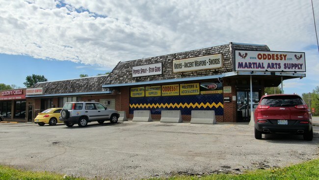
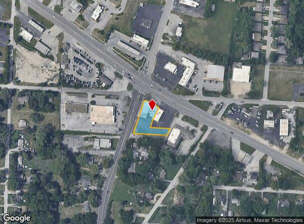
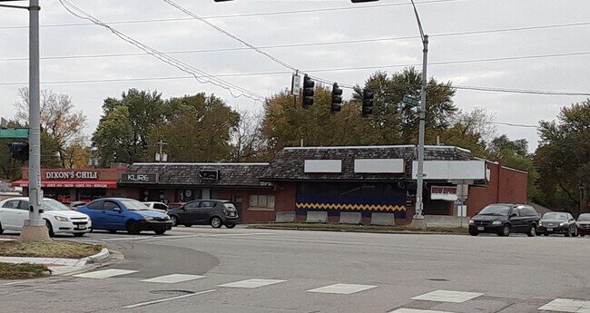
9101 E Us 40 64133 Hwy
Kansas City, MO-KS
Ashland Ridge
32-220-03-20-00-0-00-000
ASHLAND RIDGE--- ALL TH PT OF LOTS 76-78 DAF: BEG AT NE COR LOT 76 TH N 88 DEG 28 MIN 47 SEC W 120.12 TH N 16 DEG 57 MI N 07 SEC E 46.36 TO A PT ON TH SLY WALL OF BLDG TH N 63 DEG
Storebuilding
Jackson
X
Missouri
29095C0286G
76
2024
0.38 AC
2025
East Jackson County
012501
Kansas City
6,238 SF
DEMOGRAPHICS near 9101 E Us 40 64133 Hwy
1 Mile
3 Mile
5 Mile
2024 Total Population
4,475
61,386
198,527
2029 Population
4,442
61,377
199,782
Pop Growth 2024-2029
(0.74%)
(0.01%)
+ 0.63%
Average Age
41
39
39
2024 Total Households
1,884
25,040
79,632
HH Growth 2024-2029
(0.96%)
(0.16%)
+ 0.43%
Median Household Inc
$52,196
$50,782
$47,329
Avg Household Size
2.30
2.30
2.40
2024 Avg HH Vehicles
2.00
2.00
2.00
Median Home Value
$134,966
$124,475
$124,771
Median Year Built
1957
1959
1958
Nearby Places
Map Layers
Map Styles
 Street
 Aerial
- Restaurants
- Banks
- Shops
- Fitness
- Groceries
PUBLIC TRANSPORTATION
AIRPORT
Kansas City International
DRIVE
WALK
Distance
Kansas City International
30 min
29.6 mi
SALE & LEASE HISTORY
LISTING DATE
SALE/LEASE

Sep 28, 2016
For Sale
Sep 25, 2016
For Lease
Oct 25, 2023
For Sale
Oct 23, 2023
For Lease
Oct 22, 2021
For Lease
Oct 18, 2022
For Lease
Jul 26, 2018
For Sale
Jan 02, 2019
For Sale
Aug 31, 2017
For Sale
Aug 17, 2017
For Sale
Nearby Properties
Address
Land Use
TOTAL SIZE
Lot Size
Zoning
Address
Land Use
TOTAL SIZE
Lot Size
Zoning
963,895 SF
20.27 AC
Address
Land Use
TOTAL SIZE
Lot Size
Zoning
474,624 SF
18.82 AC
Address
Land Use
TOTAL SIZE
Lot Size
Zoning
519,315 SF
28.47 AC
Address
Land Use
TOTAL SIZE
Lot Size
Zoning
Address
Land Use
TOTAL SIZE
Lot Size
Zoning
480,594 SF
44 SF
Address
Land Use
TOTAL SIZE
Lot Size
Zoning
455,100 SF
42.02 AC
Address
Land Use
TOTAL SIZE
Lot Size
Zoning
213,615 SF
15.50 AC
Address
Land Use
TOTAL SIZE
Lot Size
Zoning
74,801 SF
8.93 AC
Address
Land Use
TOTAL SIZE
Lot Size
Zoning
210,008 SF
16.89 AC
Address
Land Use
TOTAL SIZE
Lot Size
Zoning
608,833 SF
40.53 AC
Address
Land Use
TOTAL SIZE
Lot Size
Zoning
220,176 SF
8.61 AC
Address
Land Use
TOTAL SIZE
Lot Size
Zoning
138,353 SF
23.03 AC
Address
Land Use
TOTAL SIZE
Lot Size
Zoning
49,964 SF
39.88 AC
Address
Land Use
TOTAL SIZE
Lot Size
Zoning
139,713 SF
15.70 AC
Address
Land Use
TOTAL SIZE
Lot Size
Zoning
134,082 SF
1.79 AC
Address
Land Use
TOTAL SIZE
Lot Size
Zoning
42,188 SF
7.82 AC
Address
Land Use
TOTAL SIZE
Lot Size
Zoning
Address
Land Use
TOTAL SIZE
Lot Size
Zoning
70,555 SF
32.97 AC
Address
Land Use
TOTAL SIZE
Lot Size
Zoning
9,768 SF
0.87 AC
Address
Land Use
TOTAL SIZE
Lot Size
Zoning
43,504 SF
Address
Land Use
TOTAL SIZE
Lot Size
Zoning
103,866 SF
13.29 AC
Address
Land Use
TOTAL SIZE
Lot Size
Zoning
118,908 SF
152 AC
Address
Land Use
TOTAL SIZE
Lot Size
Zoning
101,687 SF
10.78 AC
Address
Land Use
TOTAL SIZE
Lot Size
Zoning
145,569 SF
16.90 AC
Address
Land Use
TOTAL SIZE
Lot Size
Zoning
80,433 SF
7.24 AC
Address
Land Use
TOTAL SIZE
Lot Size
Zoning
71,368 SF
5.64 AC
Address
Land Use
TOTAL SIZE
Lot Size
Zoning
57,732 SF
22.42 AC
Address
Land Use
TOTAL SIZE
Lot Size
Zoning
82,432 SF
5.24 AC
Address
Land Use
TOTAL SIZE
Lot Size
Zoning
58,800 SF
5.72 AC
Address
Land Use
TOTAL SIZE
Lot Size
Zoning
552,135 SF
39.60 AC
The World's #1 Commercial Real Estate Marketplace
Connect with us
© 2025 CoStar Group
The information above has been obtained from sources believed reliable. While we do not doubt its accuracy we have not verified it and make no guarantee, warranty or representation about it. It is your responsibility to independently confirm its accuracy and completeness. Any projections, opinions, assumptions, or estimates used are for example only and do not represent the current or future performance of the property. The value of this transaction to you depends on tax and other factors which should be evaluated by your tax, financial, and legal advisors. You and your advisors should conduct a careful, independent investigation of the property to determine to your satisfaction the suitability of the property for your needs.