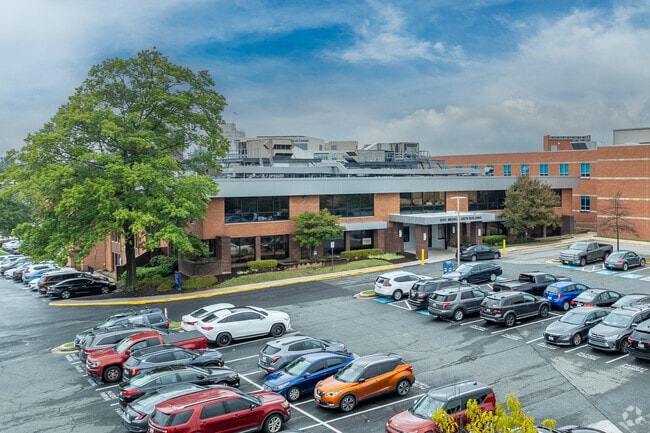
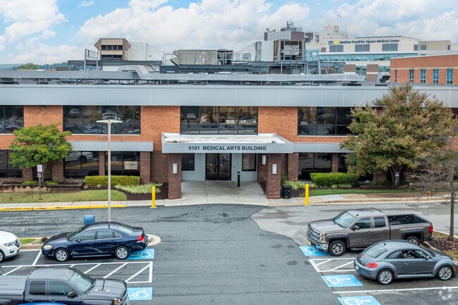
Property Record
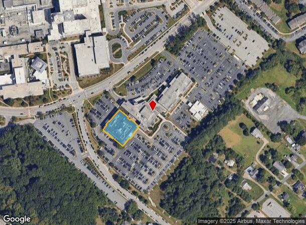
9101 Franklin Square Dr, Rosedale, MD 21237
Current Lease Availabilities
NEARBY LISTINGS FOR SALE OR LEASE
Property Detail
9101 Franklin Square Dr
14-2500003425
Franklin Sq Dr Land Condo
Medicalbuilding
.5695 AC CNDO UNIT 1 FRANKLIN SQ DR LAND COND
X
Baltimore
2400100430H
Maryland
2024
0.57 AC
2025
Baltimore County East
440701
Baltimore
60,492 SF
Baltimore-Columbia-Towson, MD
DEMOGRAPHICS near 9101 Franklin Square Dr
1 Mile
3 Mile
5 Mile
2024 Total Population
10,326
101,898
277,103
2029 Population
10,237
100,462
270,554
Pop Growth 2024-2029
(0.86%)
(1.41%)
(2.36%)
Average Age
38
40
40
2024 Total Households
4,097
39,226
108,542
HH Growth 2024-2029
(0.90%)
(1.51%)
(2.50%)
Median Household Inc
$68,157
$72,437
$72,043
Avg Household Size
2.40
2.50
2.50
2024 Avg HH Vehicles
2.00
2.00
2.00
Median Home Value
$256,957
$251,946
$248,774
Median Year Built
1986
1975
1967
Nearby Places
- Restaurants
- Banks
- Shops
- Fitness
- Groceries
PUBLIC TRANSPORTATION
COMMUTER RAIL
Martin State Airport (PENN - WASHINGTON - Maryland Area Regional Commuter Trains (The MARC), Penn Line - Maryland Area Regional Commuter Trains (The MARC))
DRIVE
WALK
Distance
Martin State Airport (PENN - WASHINGTON - Maryland Area Regional Commuter Trains (The MARC), Penn Line - Maryland Area Regional Commuter Trains (The MARC))
12 min
5.5 mi
AIRPORT
Baltimore/Washington International Thurgood Marshall
DRIVE
WALK
Distance
Baltimore/Washington International Thurgood Marshall
35 min
21.4 mi
Freight Ports
Port of Baltimore
DRIVE
WALK
Distance
Port of Baltimore
21 min
11.8 mi
Nearby Properties
Address
Land Use
TOTAL SIZE
Lot Size
Zoning
Address
Land Use
TOTAL SIZE
Lot Size
Zoning
1,877,670 SF
90.21 AC
Address
Land Use
TOTAL SIZE
Lot Size
Zoning
307,785 SF
30.50 AC
ML
Address
Land Use
TOTAL SIZE
Lot Size
Zoning
119,200 SF
57.12 AC
Address
Land Use
TOTAL SIZE
Lot Size
Zoning
527,364 SF
18.11 AC
BM
Address
Land Use
TOTAL SIZE
Lot Size
Zoning
46.20 AC
DR105
Address
Land Use
TOTAL SIZE
Lot Size
Zoning
474,640 SF
12.42 AC
Address
Land Use
TOTAL SIZE
Lot Size
Zoning
560,700 SF
25.77 AC
Address
Land Use
TOTAL SIZE
Lot Size
Zoning
85,474 SF
22.22 AC
Address
Land Use
TOTAL SIZE
Lot Size
Zoning
584,740 SF
32.61 AC
Address
Land Use
TOTAL SIZE
Lot Size
Zoning
21.74 AC
DR16
Address
Land Use
TOTAL SIZE
Lot Size
Zoning
15.29 AC
Address
Land Use
TOTAL SIZE
Lot Size
Zoning
19.93 AC
Address
Land Use
TOTAL SIZE
Lot Size
Zoning
101,906 SF
13.54 AC
Address
Land Use
TOTAL SIZE
Lot Size
Zoning
105,384 SF
11.52 AC
Address
Land Use
TOTAL SIZE
Lot Size
Zoning
12.20 AC
DR16
Address
Land Use
TOTAL SIZE
Lot Size
Zoning
1,062,672 SF
70.27 AC
MHIM
Address
Land Use
TOTAL SIZE
Lot Size
Zoning
9.27 AC
DR105
Address
Land Use
TOTAL SIZE
Lot Size
Zoning
15.40 AC
DR16
Address
Land Use
TOTAL SIZE
Lot Size
Zoning
7.72 AC
DR5.5
Address
Land Use
TOTAL SIZE
Lot Size
Zoning
427,720 SF
27.55 AC
ML
Address
Land Use
TOTAL SIZE
Lot Size
Zoning
507,600 SF
21.36 AC
MHIM
Address
Land Use
TOTAL SIZE
Lot Size
Zoning
10.51 AC
DR16
Address
Land Use
TOTAL SIZE
Lot Size
Zoning
105,384 SF
15.41 AC
Address
Land Use
TOTAL SIZE
Lot Size
Zoning
12.81 AC
DR16
Address
Land Use
TOTAL SIZE
Lot Size
Zoning
7.38 AC
DR16
Address
Land Use
TOTAL SIZE
Lot Size
Zoning
12.09 AC
DR5.5
Address
Land Use
TOTAL SIZE
Lot Size
Zoning
7.85 AC
DR5.5
Address
Land Use
TOTAL SIZE
Lot Size
Zoning
9.79 AC
DR5.5
Address
Land Use
TOTAL SIZE
Lot Size
Zoning
14.28 AC
DR16
Address
Land Use
TOTAL SIZE
Lot Size
Zoning
271,370 SF
20.11 AC
BM
The World's #1 Commercial Real Estate Marketplace
Connect with us
© 2025 CoStar Group
The information above has been obtained from sources believed reliable. While we do not doubt its accuracy we have not verified it and make no guarantee, warranty or representation about it. It is your responsibility to independently confirm its accuracy and completeness. Any projections, opinions, assumptions, or estimates used are for example only and do not represent the current or future performance of the property. The value of this transaction to you depends on tax and other factors which should be evaluated by your tax, financial, and legal advisors. You and your advisors should conduct a careful, independent investigation of the property to determine to your satisfaction the suitability of the property for your needs.