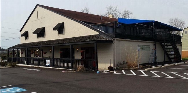
Property Record
9101 Perry Hwy, Pittsburgh, PA 15237
NEARBY LISTINGS FOR SALE OR LEASE
Property Detail
9101 Perry Hwy
Pittsburgh, PA
Melrose Park
0825-S-00397-0000-00
MELROSE PARK/HIGHLAND ROAD UNIFICATION PLAN IRREG UN# LOT = 58.97 X 89.29 X 166.02 X 71.42 X 32.29 X 117 X 8.6 X 44.24 X 93.33
Commercialacreage
Allegheny
X
Pennsylvania
42003C0183H
397
2024
0.55 AC
2025
North Pittsburgh/Rte 19
413201
Pittsburgh
DEMOGRAPHICS near 9101 Perry Hwy
1 Mile
3 Mile
5 Mile
2024 Total Population
7,561
50,176
117,822
2029 Population
7,401
48,715
114,231
Pop Growth 2024-2029
(2.12%)
(2.91%)
(3.05%)
Average Age
44
43
43
2024 Total Households
3,117
20,678
47,888
HH Growth 2024-2029
(2.18%)
(3.10%)
(3.20%)
Median Household Inc
$99,062
$103,394
$105,346
Avg Household Size
2.30
2.30
2.40
2024 Avg HH Vehicles
2.00
2.00
2.00
Median Home Value
$279,380
$287,206
$288,093
Median Year Built
1967
1972
1971
Nearby Places
Map Layers
Map Styles
 Street
 Aerial
- Restaurants
- Banks
- Shops
- Fitness
- Groceries
PUBLIC TRANSPORTATION
AIRPORT
Pittsburgh International
DRIVE
WALK
Distance
Pittsburgh International
34 min
17.5 mi
Freight Ports
Port of Toledo
DRIVE
WALK
Distance
Port of Toledo
254 min
221.2 mi
SALE & LEASE HISTORY
LISTING DATE
SALE/LEASE

Sep 23, 2016
For Sale
Nov 14, 2016
For Sale
May 15, 2018
For Lease
Jun 19, 2019
For Lease
Jun 19, 2019
For Sale
Aug 21, 2019
For Lease
Aug 21, 2019
For Sale
Aug 13, 2018
For Sale
Nearby Properties
Address
Land Use
TOTAL SIZE
Lot Size
Zoning
Address
Land Use
TOTAL SIZE
Lot Size
Zoning
Address
Land Use
TOTAL SIZE
Lot Size
Zoning
117.63 AC
Address
Land Use
TOTAL SIZE
Lot Size
Zoning
24.94 AC
Address
Land Use
TOTAL SIZE
Lot Size
Zoning
43.72 AC
Address
Land Use
TOTAL SIZE
Lot Size
Zoning
1,296 SF
3,074.89 AC
Address
Land Use
TOTAL SIZE
Lot Size
Zoning
75.05 AC
Address
Land Use
TOTAL SIZE
Lot Size
Zoning
9.71 AC
Address
Land Use
TOTAL SIZE
Lot Size
Zoning
1,648 SF
43.30 AC
Address
Land Use
TOTAL SIZE
Lot Size
Zoning
113.59 AC
Address
Land Use
TOTAL SIZE
Lot Size
Zoning
21.56 AC
Address
Land Use
TOTAL SIZE
Lot Size
Zoning
11.35 AC
Address
Land Use
TOTAL SIZE
Lot Size
Zoning
10.51 AC
Address
Land Use
TOTAL SIZE
Lot Size
Zoning
15.05 AC
Address
Land Use
TOTAL SIZE
Lot Size
Zoning
4.51 AC
Address
Land Use
TOTAL SIZE
Lot Size
Zoning
Address
Land Use
TOTAL SIZE
Lot Size
Zoning
Address
Land Use
TOTAL SIZE
Lot Size
Zoning
13.03 AC
Address
Land Use
TOTAL SIZE
Lot Size
Zoning
27.50 AC
Address
Land Use
TOTAL SIZE
Lot Size
Zoning
40.92 AC
Address
Land Use
TOTAL SIZE
Lot Size
Zoning
26.07 AC
Address
Land Use
TOTAL SIZE
Lot Size
Zoning
Address
Land Use
TOTAL SIZE
Lot Size
Zoning
626 SF
51.78 AC
Address
Land Use
TOTAL SIZE
Lot Size
Zoning
Address
Land Use
TOTAL SIZE
Lot Size
Zoning
29.62 AC
Address
Land Use
TOTAL SIZE
Lot Size
Zoning
6.50 AC
Address
Land Use
TOTAL SIZE
Lot Size
Zoning
Address
Land Use
TOTAL SIZE
Lot Size
Zoning
Address
Land Use
TOTAL SIZE
Lot Size
Zoning
Address
Land Use
TOTAL SIZE
Lot Size
Zoning
Address
Land Use
TOTAL SIZE
Lot Size
Zoning
7.21 AC
The World's #1 Commercial Real Estate Marketplace
Connect with us
© 2025 CoStar Group
The information above has been obtained from sources believed reliable. While we do not doubt its accuracy we have not verified it and make no guarantee, warranty or representation about it. It is your responsibility to independently confirm its accuracy and completeness. Any projections, opinions, assumptions, or estimates used are for example only and do not represent the current or future performance of the property. The value of this transaction to you depends on tax and other factors which should be evaluated by your tax, financial, and legal advisors. You and your advisors should conduct a careful, independent investigation of the property to determine to your satisfaction the suitability of the property for your needs.