Property Record
91033 Roberts Rd, Eugene, OR 97408
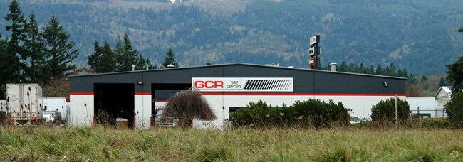
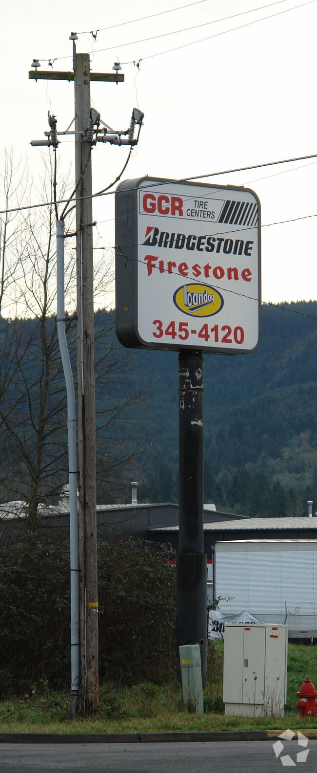
Property Detail
91033 Roberts Rd
Eugene-Springfield, OR
TL 00500
1347887
Lane
Industrialgeneral
Oregon
LI
500
B and X Area of moderate flood hazard, usually the area between the limits of the 100-year and 500-year floods.
1 AC
2025
Lane County
2025
Portland
000300
NEARBY LISTINGS FOR SALE OR LEASE
DEMOGRAPHICS near 91033 Roberts Rd
1 mile
3 mile
5 mile
2024 Total Population
1,527
9,449
63,824
2029 Population
1,525
9,578
63,101
Pop Growth 2024-2029
(0.13%)
+ 1.37%
(1.13%)
Average Age
42
43
43
2024 Total Households
585
3,924
27,322
HH Growth 2024-2029
(0.34%)
+ 1.48%
(1.19%)
Median Household Inc
$92,916
$131,801
$83,502
Avg Household Size
2.60
2.40
2.30
2024 Avg HH Vehicles
2.00
2.00
2.00
Median Home Value
$581,749
$719,188
$484,182
Median Year Built
1977
2002
1980
Nearby Places
Map Layers
Map Styles
 Street
 Aerial
Transit
 Traffic
 Biking
Places
Listings with unknown addresses are not visible on the map
- Restaurants
- Banks
- Shops
- Fitness
- Groceries
PUBLIC TRANSPORTATION
COMMUTER RAIL
Drive
Walk
Distance
13 min
8.2 mi
AIRPORT
Mahlon Sweet Field
Drive
Walk
Distance
Mahlon Sweet Field
23 min
13.9 mi
Nearby Properties
Address
Land Use
TOTAL SIZE
Lot Size
Zoning
Address
Land Use
TOTAL SIZE
Lot Size
Zoning
26.13 AC
E30
Address
Land Use
TOTAL SIZE
Lot Size
Zoning
9.59 AC
R-1
Address
Land Use
TOTAL SIZE
Lot Size
Zoning
15.95 AC
Address
Land Use
TOTAL SIZE
Lot Size
Zoning
14.33 AC
R
Address
Land Use
TOTAL SIZE
Lot Size
Zoning
31.28 AC
R-1
Address
Land Use
TOTAL SIZE
Lot Size
Zoning
2.59 AC
LI
Address
Land Use
TOTAL SIZE
Lot Size
Zoning
Address
Land Use
TOTAL SIZE
Lot Size
Zoning
5.74 AC
R-1
Address
Land Use
TOTAL SIZE
Lot Size
Zoning
15.85 AC
R-1
Address
Land Use
TOTAL SIZE
Lot Size
Zoning
7.62 AC
LI
Address
Land Use
TOTAL SIZE
Lot Size
Zoning
9.28 AC
E30
Address
Land Use
TOTAL SIZE
Lot Size
Zoning
2,048 SF
3.66 AC
AG
Address
Land Use
TOTAL SIZE
Lot Size
Zoning
9.81 AC
Address
Land Use
TOTAL SIZE
Lot Size
Zoning
0.62 AC
R-4
Address
Land Use
TOTAL SIZE
Lot Size
Zoning
14.68 AC
R-1
Address
Land Use
TOTAL SIZE
Lot Size
Zoning
4.17 AC
LI
Address
Land Use
TOTAL SIZE
Lot Size
Zoning
5.42 AC
HC
Address
Land Use
TOTAL SIZE
Lot Size
Zoning
3.22 AC
C-2
Address
Land Use
TOTAL SIZE
Lot Size
Zoning
2.41 AC
R-1
Address
Land Use
TOTAL SIZE
Lot Size
Zoning
Address
Land Use
TOTAL SIZE
Lot Size
Zoning
2.60 AC
R-1
Address
Land Use
TOTAL SIZE
Lot Size
Zoning
Address
Land Use
TOTAL SIZE
Lot Size
Zoning
15.36 AC
Address
Land Use
TOTAL SIZE
Lot Size
Zoning
0.80 AC
R-2
Address
Land Use
TOTAL SIZE
Lot Size
Zoning
3.85 AC
SG
Address
Land Use
TOTAL SIZE
Lot Size
Zoning
2,166 SF
2.31 AC
R-2
Address
Land Use
TOTAL SIZE
Lot Size
Zoning
1.82 AC
LI
Address
Land Use
TOTAL SIZE
Lot Size
Zoning
21,746 SF
1.74 AC
R-2
Address
Land Use
TOTAL SIZE
Lot Size
Zoning
2,133 SF
10.88 AC
E30
Address
Land Use
TOTAL SIZE
Lot Size
Zoning
4.24 AC
HC
The World's #1 Commercial Real Estate Marketplace
Connect with us
© 2026 CoStar Group
The information above has been obtained from sources believed reliable. While we do not doubt its accuracy we have not verified it and make no guarantee, warranty or representation about it. It is your responsibility to independently confirm its accuracy and completeness. Any projections, opinions, assumptions, or estimates used are for example only and do not represent the current or future performance of the property. The value of this transaction to you depends on tax and other factors which should be evaluated by your tax, financial, and legal advisors. You and your advisors should conduct a careful, independent investigation of the property to determine to your satisfaction the suitability of the property for your needs.