Property Record
9107 E Brainerd Rd, Chattanooga, TN 37421


NEARBY LISTINGS FOR SALE OR LEASE
Property Detail
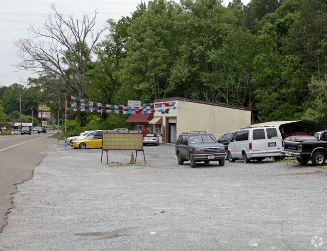
9107 E Brainerd Rd
Chattanooga, TN-GA
Ryall Springs
159M-B-002
PT LTS 44-48 RYALL SPRINGS REV 30-252
Autorepair
Hamilton
AE
Tennessee
47065C0388G
44-48
2025
0.75 AC
2025
Outlying Hamilton County
011323
Chattanooga
3,356 SF
DEMOGRAPHICS near 9107 E Brainerd Rd
1 mile
3 mile
5 mile
2024 Total Population
4,922
42,055
85,867
2029 Population
5,194
44,547
91,053
Pop Growth 2024-2029
+ 5.53%
+ 5.93%
+ 6.04%
Average Age
41
42
41
2024 Total Households
1,800
16,093
33,482
HH Growth 2024-2029
+ 5.67%
+ 6.12%
+ 6.21%
Median Household Inc
$124,494
$94,211
$78,012
Avg Household Size
2.70
2.50
2.40
2024 Avg HH Vehicles
2.00
2.00
2.00
Median Home Value
$282,016
$279,177
$266,148
Median Year Built
1985
1993
1991
Nearby Places
Map Layers
Map Styles
 Street
 Aerial
Transit
 Traffic
 Biking
Places
Listings with unknown addresses are not visible on the map
- Restaurants
- Banks
- Shops
- Fitness
- Groceries
PUBLIC TRANSPORTATION
AIRPORT
Lovell Field
Drive
Walk
Distance
Lovell Field
16 min
6.9 mi
Nearby Properties
Address
Land Use
TOTAL SIZE
Lot Size
Zoning
Address
Land Use
TOTAL SIZE
Lot Size
Zoning
440,611 SF
27.46 AC
C2
Address
Land Use
TOTAL SIZE
Lot Size
Zoning
117,007 SF
23.87 AC
R4
Address
Land Use
TOTAL SIZE
Lot Size
Zoning
4,418 SF
18.01 AC
R3
Address
Land Use
TOTAL SIZE
Lot Size
Zoning
43,488 SF
27.72 AC
R3
Address
Land Use
TOTAL SIZE
Lot Size
Zoning
25,436 SF
21.34 AC
R3
Address
Land Use
TOTAL SIZE
Lot Size
Zoning
43,576 SF
6.66 AC
C2
Address
Land Use
TOTAL SIZE
Lot Size
Zoning
3,472 SF
14.01 AC
Address
Land Use
TOTAL SIZE
Lot Size
Zoning
97,000 SF
18.78 AC
Address
Land Use
TOTAL SIZE
Lot Size
Zoning
25,165 SF
21.90 AC
Address
Land Use
TOTAL SIZE
Lot Size
Zoning
15,808 SF
19.50 AC
R2
Address
Land Use
TOTAL SIZE
Lot Size
Zoning
4,390 SF
36.30 AC
R3
Address
Land Use
TOTAL SIZE
Lot Size
Zoning
110,710 SF
6.69 AC
M1
Address
Land Use
TOTAL SIZE
Lot Size
Zoning
238,806 SF
24.84 AC
Address
Land Use
TOTAL SIZE
Lot Size
Zoning
183,036 SF
11.49 AC
R4
Address
Land Use
TOTAL SIZE
Lot Size
Zoning
66,390 SF
4.37 AC
C2
Address
Land Use
TOTAL SIZE
Lot Size
Zoning
21,280 SF
7.67 AC
Address
Land Use
TOTAL SIZE
Lot Size
Zoning
152,982 SF
24.72 AC
R1
Address
Land Use
TOTAL SIZE
Lot Size
Zoning
117,663 SF
13.51 AC
C4
Address
Land Use
TOTAL SIZE
Lot Size
Zoning
71,293 SF
8.16 AC
C2
Address
Land Use
TOTAL SIZE
Lot Size
Zoning
43.48 AC
R4
Address
Land Use
TOTAL SIZE
Lot Size
Zoning
46,724 SF
2.44 AC
C2
Address
Land Use
TOTAL SIZE
Lot Size
Zoning
90,493 SF
1.88 AC
Address
Land Use
TOTAL SIZE
Lot Size
Zoning
111,196 SF
9.67 AC
C2
Address
Land Use
TOTAL SIZE
Lot Size
Zoning
27,144 SF
5.62 AC
R3
Address
Land Use
TOTAL SIZE
Lot Size
Zoning
57,700 SF
21.13 AC
R1
Address
Land Use
TOTAL SIZE
Lot Size
Zoning
191,461 SF
14.18 AC
Address
Land Use
TOTAL SIZE
Lot Size
Zoning
82,704 SF
3.53 AC
C4
Address
Land Use
TOTAL SIZE
Lot Size
Zoning
147,332 SF
9.44 AC
R4
Address
Land Use
TOTAL SIZE
Lot Size
Zoning
86,931 SF
9.49 AC
C4
Address
Land Use
TOTAL SIZE
Lot Size
Zoning
47,278 SF
20.79 AC
R1
The World's #1 Commercial Real Estate Marketplace
Connect with us
© 2026 CoStar Group
The information above has been obtained from sources believed reliable. While we do not doubt its accuracy we have not verified it and make no guarantee, warranty or representation about it. It is your responsibility to independently confirm its accuracy and completeness. Any projections, opinions, assumptions, or estimates used are for example only and do not represent the current or future performance of the property. The value of this transaction to you depends on tax and other factors which should be evaluated by your tax, financial, and legal advisors. You and your advisors should conduct a careful, independent investigation of the property to determine to your satisfaction the suitability of the property for your needs.