Property Record
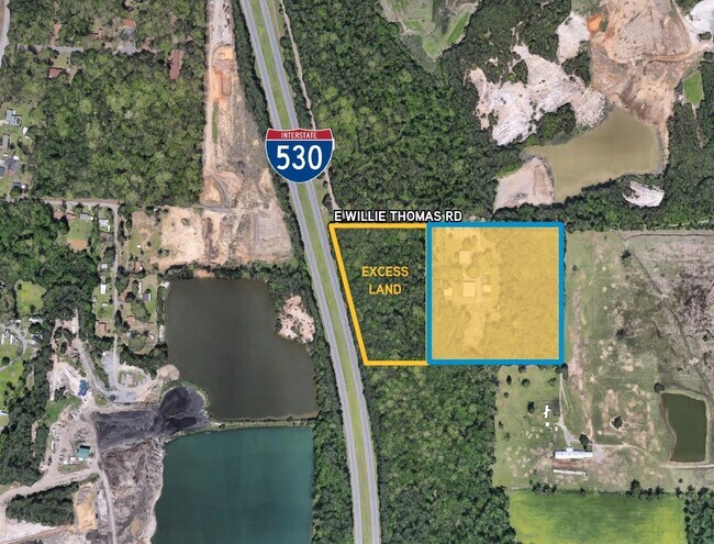
911 E Willie Thomas Rd, Little Rock, AR 72206

NEARBY LISTINGS FOR SALE OR LEASE
-
-
View all Little Rock listings for sale on LoopNet.com
Property Detail
911 E Willie Thomas Rd
35R-002-00-013-02
N1/2 E1/2 FRL NE EXC R/W NEW HWY 65 & EXC COM NE COR TH N88*W660' TO POB S710 64' N89*W408 66' TO E R/W OF SD HWY TH N14*W241 51' N16*W503 74' TH S88*E611.76' TO POB 2-1S-12W
Officebuilding
Pulaski
X
Arkansas
05119C0470G
11.53 AC
2025
Outlying Pulaski County
2025
Little Rock/N Little Rock
004001
Little Rock-North Little Rock-Conway, AR
7,960 SF
DEMOGRAPHICS near 911 E Willie Thomas Rd
1 Mile
3 Mile
5 Mile
2024 Total Population
501
3,743
35,767
2029 Population
509
3,812
36,293
Pop Growth 2024-2029
+ 1.60%
+ 1.84%
+ 1.47%
Average Age
44
43
38
2024 Total Households
192
1,507
14,466
HH Growth 2024-2029
+ 1.56%
+ 1.92%
+ 1.48%
Median Household Inc
$56,153
$44,687
$37,363
Avg Household Size
2.40
2.40
2.40
2024 Avg HH Vehicles
2.00
2.00
2.00
Median Home Value
$167,241
$118,259
$95,255
Median Year Built
1982
1980
1971
Nearby Places
Map Layers
Map Styles
 Street
 Aerial
- Restaurants
- Banks
- Shops
- Fitness
- Groceries
PUBLIC TRANSPORTATION
COMMUTER RAIL
Little Rock Union Station (Texas Eagle - Amtrak)
DRIVE
WALK
Distance
Little Rock Union Station (Texas Eagle - Amtrak)
11 min
7.3 mi
AIRPORT
Bill and Hillary Clinton Ntl/Adams Field
DRIVE
WALK
Distance
Bill and Hillary Clinton Ntl/Adams Field
10 min
6.9 mi
Freight Ports
Port of Shreveport
DRIVE
WALK
Distance
Port of Shreveport
252 min
234.3 mi
SALE & LEASE HISTORY
LISTING DATE
SALE/LEASE

Jul 10, 2020
For Sale
Nearby Properties
Address
Land Use
TOTAL SIZE
Lot Size
Zoning
Address
Land Use
TOTAL SIZE
Lot Size
Zoning
345,000 SF
13.21 AC
Address
Land Use
TOTAL SIZE
Lot Size
Zoning
70,281 SF
20.36 AC
Address
Land Use
TOTAL SIZE
Lot Size
Zoning
14,367 SF
1,257.41 AC
Address
Land Use
TOTAL SIZE
Lot Size
Zoning
Address
Land Use
TOTAL SIZE
Lot Size
Zoning
9,235 SF
10.93 AC
Address
Land Use
TOTAL SIZE
Lot Size
Zoning
63,923 SF
10.49 AC
Address
Land Use
TOTAL SIZE
Lot Size
Zoning
10 SF
7.70 AC
Address
Land Use
TOTAL SIZE
Lot Size
Zoning
4,487 SF
39.87 AC
Address
Land Use
TOTAL SIZE
Lot Size
Zoning
26,770 SF
4.62 AC
Address
Land Use
TOTAL SIZE
Lot Size
Zoning
77.68 AC
Address
Land Use
TOTAL SIZE
Lot Size
Zoning
18,738 SF
16.46 AC
Address
Land Use
TOTAL SIZE
Lot Size
Zoning
23,200 SF
33.98 AC
Address
Land Use
TOTAL SIZE
Lot Size
Zoning
3,230 SF
2.40 AC
Address
Land Use
TOTAL SIZE
Lot Size
Zoning
19,422 SF
207.19 AC
Address
Land Use
TOTAL SIZE
Lot Size
Zoning
12,640 SF
83.54 AC
Address
Land Use
TOTAL SIZE
Lot Size
Zoning
11,160 SF
12.68 AC
Address
Land Use
TOTAL SIZE
Lot Size
Zoning
57.36 AC
Address
Land Use
TOTAL SIZE
Lot Size
Zoning
2,464 SF
4.71 AC
Address
Land Use
TOTAL SIZE
Lot Size
Zoning
2,769 SF
10.73 AC
Address
Land Use
TOTAL SIZE
Lot Size
Zoning
19,306 SF
20 AC
Address
Land Use
TOTAL SIZE
Lot Size
Zoning
Address
Land Use
TOTAL SIZE
Lot Size
Zoning
7,360 SF
8.75 AC
Address
Land Use
TOTAL SIZE
Lot Size
Zoning
Address
Land Use
TOTAL SIZE
Lot Size
Zoning
10,404 SF
40 AC
Address
Land Use
TOTAL SIZE
Lot Size
Zoning
12,882 SF
5.29 AC
Address
Land Use
TOTAL SIZE
Lot Size
Zoning
920 SF
4.43 AC
Address
Land Use
TOTAL SIZE
Lot Size
Zoning
Address
Land Use
TOTAL SIZE
Lot Size
Zoning
3,113 SF
1.96 AC
Address
Land Use
TOTAL SIZE
Lot Size
Zoning
42,593 SF
2.73 AC
Address
Land Use
TOTAL SIZE
Lot Size
Zoning
9,018 SF
37.77 AC
The World's #1 Commercial Real Estate Marketplace
Connect with us
© 2026 CoStar Group
The information above has been obtained from sources believed reliable. While we do not doubt its accuracy we have not verified it and make no guarantee, warranty or representation about it. It is your responsibility to independently confirm its accuracy and completeness. Any projections, opinions, assumptions, or estimates used are for example only and do not represent the current or future performance of the property. The value of this transaction to you depends on tax and other factors which should be evaluated by your tax, financial, and legal advisors. You and your advisors should conduct a careful, independent investigation of the property to determine to your satisfaction the suitability of the property for your needs.