Property Record
911 Highway 178, Pelion, SC 29123

NEARBY LISTINGS FOR SALE OR LEASE
-
-
View all Pelion listings for sale on LoopNet.com
Property Detail
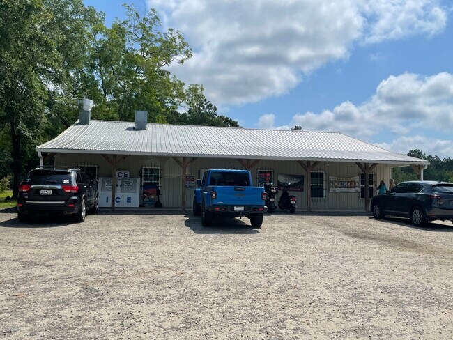
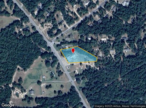
911 Highway 178
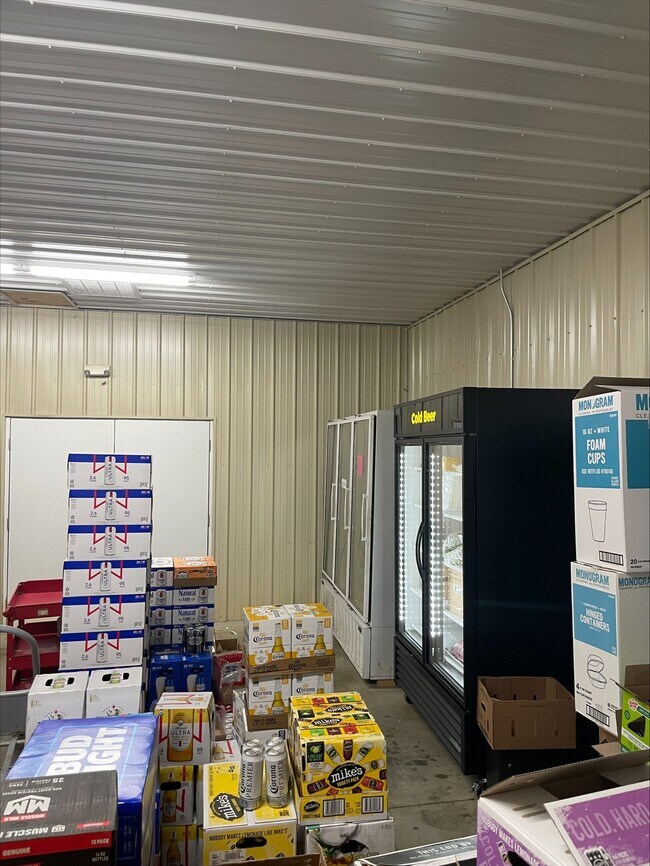
Conveniencestore
Lexington
X
South Carolina
45063C0505J
1.61 AC
2025
Outlying Lexington County
2024
Columbia
020904
Columbia, SC
3,468 SF
012700-01-021
DEMOGRAPHICS near 911 Highway 178
1 Mile
3 Mile
5 Mile
2024 Total Population
389
2,186
6,903
2029 Population
428
2,404
7,597
Pop Growth 2024-2029
+ 10.03%
+ 9.97%
+ 10.05%
Average Age
40
40
40
2024 Total Households
146
834
2,638
HH Growth 2024-2029
+ 10.27%
+ 10.07%
+ 10.20%
Median Household Inc
$69,599
$63,940
$52,205
Avg Household Size
2.50
2.50
2.50
2024 Avg HH Vehicles
2.00
2.00
2.00
Median Home Value
$141,860
$136,554
$116,789
Median Year Built
1994
1993
1992
Nearby Places
Map Layers
Map Styles
 Street
 Aerial
- Restaurants
- Banks
- Shops
- Fitness
- Groceries
PUBLIC TRANSPORTATION
AIRPORT
Columbia Metro
DRIVE
WALK
Distance
Columbia Metro
33 min
18.1 mi
Freight Ports
North Charleston Terminal
DRIVE
WALK
Distance
North Charleston Terminal
120 min
96.6 mi
SALE & LEASE HISTORY
LISTING DATE
SALE/LEASE

May 31, 2023
For Sale
Nearby Properties
Address
Land Use
TOTAL SIZE
Lot Size
Zoning
Address
Land Use
TOTAL SIZE
Lot Size
Zoning
10,650 SF
2.80 AC
LR
Address
Land Use
TOTAL SIZE
Lot Size
Zoning
27,840 SF
3.74 AC
LR
Address
Land Use
TOTAL SIZE
Lot Size
Zoning
54.75 AC
Address
Land Use
TOTAL SIZE
Lot Size
Zoning
9,191 SF
1.50 AC
LR
Address
Land Use
TOTAL SIZE
Lot Size
Zoning
3,660 SF
2.04 AC
C
Address
Land Use
TOTAL SIZE
Lot Size
Zoning
3,550 SF
0.57 AC
LR
Address
Land Use
TOTAL SIZE
Lot Size
Zoning
1,800 SF
2.43 AC
ID
Address
Land Use
TOTAL SIZE
Lot Size
Zoning
2,033 SF
0.29 AC
LR
Address
Land Use
TOTAL SIZE
Lot Size
Zoning
4,058 SF
2.63 AC
Address
Land Use
TOTAL SIZE
Lot Size
Zoning
2,730 SF
2.55 AC
C
Address
Land Use
TOTAL SIZE
Lot Size
Zoning
2,460 SF
0.60 AC
LR
Address
Land Use
TOTAL SIZE
Lot Size
Zoning
8,205 SF
1.60 AC
Address
Land Use
TOTAL SIZE
Lot Size
Zoning
2,200 SF
1 AC
Address
Land Use
TOTAL SIZE
Lot Size
Zoning
5,600 SF
0.88 AC
LR
Address
Land Use
TOTAL SIZE
Lot Size
Zoning
8,908 SF
0.27 AC
Address
Land Use
TOTAL SIZE
Lot Size
Zoning
3,304 SF
1.05 AC
LR
Address
Land Use
TOTAL SIZE
Lot Size
Zoning
30 AC
LR
Address
Land Use
TOTAL SIZE
Lot Size
Zoning
2,324 SF
1.34 AC
Address
Land Use
TOTAL SIZE
Lot Size
Zoning
3,252 SF
0.70 AC
LR
Address
Land Use
TOTAL SIZE
Lot Size
Zoning
1,116 SF
0.51 AC
Address
Land Use
TOTAL SIZE
Lot Size
Zoning
1,655 SF
0.90 AC
R1
Address
Land Use
TOTAL SIZE
Lot Size
Zoning
35.70 AC
LR
Address
Land Use
TOTAL SIZE
Lot Size
Zoning
2,610 SF
0.76 AC
LR
Address
Land Use
TOTAL SIZE
Lot Size
Zoning
2.76 AC
Address
Land Use
TOTAL SIZE
Lot Size
Zoning
21.80 AC
Address
Land Use
TOTAL SIZE
Lot Size
Zoning
5,103 SF
0.14 AC
C
Address
Land Use
TOTAL SIZE
Lot Size
Zoning
1,844 SF
0.29 AC
LR
Address
Land Use
TOTAL SIZE
Lot Size
Zoning
16.33 AC
LR
Address
Land Use
TOTAL SIZE
Lot Size
Zoning
1,800 SF
0.93 AC
LR
The World's #1 Commercial Real Estate Marketplace
Connect with us
© 2026 CoStar Group
The information above has been obtained from sources believed reliable. While we do not doubt its accuracy we have not verified it and make no guarantee, warranty or representation about it. It is your responsibility to independently confirm its accuracy and completeness. Any projections, opinions, assumptions, or estimates used are for example only and do not represent the current or future performance of the property. The value of this transaction to you depends on tax and other factors which should be evaluated by your tax, financial, and legal advisors. You and your advisors should conduct a careful, independent investigation of the property to determine to your satisfaction the suitability of the property for your needs.