Property Record
911 Jacks Valley Rd, Carson City, NV 89705
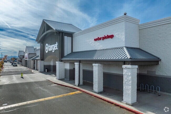

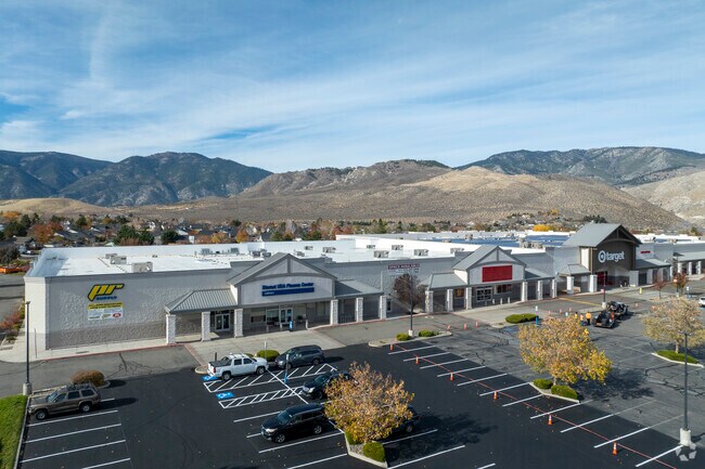
Property Detail
911 Jacks Valley Rd
1420-06-802-004
Douglas
Commercialnec
Nevada
B and X Area of moderate flood hazard, usually the area between the limits of the 100-year and 500-year floods.
9.13 AC
2025
Douglas County
2026
Reno/Sparks
002000
Gardnerville Ranchos, NV-CA
122,492 SF
NEARBY LISTINGS FOR SALE OR LEASE
DEMOGRAPHICS near 911 Jacks Valley Rd
1 mile
3 mile
5 mile
2025 Total Population
4,764
14,510
35,560
2030 Population
4,814
14,574
35,531
Pop Growth 2025-2030
+ 1.05%
+ 0.44%
(0.08%)
Average Age
45
46
46
2025 Total Households
1,915
5,510
14,028
HH Growth 2025-2030
+ 1.25%
+ 0.65%
+ 0.10%
Median Household Inc
$83,612
$83,841
$82,305
Avg Household Size
2.40
2.40
2.30
2025 Avg HH Vehicles
2.00
2.00
2.00
Median Home Value
$505,614
$526,369
$526,368
Median Year Built
1995
1991
1987
Nearby Places
Map Layers
Map Styles
 Street
 Aerial
Layers
 Traffic
 Biking
Places
Listings with unknown addresses are not visible on the map
- Restaurants
- Banks
- Shops
- Fitness
- Groceries
PUBLIC TRANSPORTATION
AIRPORT
Reno/Tahoe International
Drive
Walk
Distance
Reno/Tahoe International
45 min
34.8 mi
Nearby Properties
Address
Land Use
TOTAL SIZE
Lot Size
Zoning
Address
Land Use
TOTAL SIZE
Lot Size
Zoning
395,706 SF
998.20 AC
A-P
Address
Land Use
TOTAL SIZE
Lot Size
Zoning
351,100 SF
22.10 AC
MFA-GC
Address
Land Use
TOTAL SIZE
Lot Size
Zoning
230,573 SF
21.37 AC
Address
Land Use
TOTAL SIZE
Lot Size
Zoning
199,052 SF
7.46 AC
GC
Address
Land Use
TOTAL SIZE
Lot Size
Zoning
224,615 SF
21.47 AC
Address
Land Use
TOTAL SIZE
Lot Size
Zoning
590.48 AC
PR
Address
Land Use
TOTAL SIZE
Lot Size
Zoning
287,038 SF
49.20 AC
P
Address
Land Use
TOTAL SIZE
Lot Size
Zoning
49,959 SF
61.75 AC
Address
Land Use
TOTAL SIZE
Lot Size
Zoning
148,474 SF
16.08 AC
GC
Address
Land Use
TOTAL SIZE
Lot Size
Zoning
60,217 SF
1.84 AC
GC
Address
Land Use
TOTAL SIZE
Lot Size
Zoning
117,028 SF
10.99 AC
Address
Land Use
TOTAL SIZE
Lot Size
Zoning
20,135 SF
8.49 AC
GC
Address
Land Use
TOTAL SIZE
Lot Size
Zoning
48,237 SF
8.64 AC
MFA-GC
Address
Land Use
TOTAL SIZE
Lot Size
Zoning
25,392 SF
3.98 AC
RC
Address
Land Use
TOTAL SIZE
Lot Size
Zoning
39,420 SF
0.44 AC
Address
Land Use
TOTAL SIZE
Lot Size
Zoning
56,378 SF
9 AC
Address
Land Use
TOTAL SIZE
Lot Size
Zoning
92,648 SF
6.08 AC
GC
Address
Land Use
TOTAL SIZE
Lot Size
Zoning
33,271 SF
3.86 AC
RC
Address
Land Use
TOTAL SIZE
Lot Size
Zoning
26,602 SF
3.16 AC
GC
Address
Land Use
TOTAL SIZE
Lot Size
Zoning
1,313 SF
17.75 AC
PR
Address
Land Use
TOTAL SIZE
Lot Size
Zoning
43,800 SF
10.02 AC
PR
Address
Land Use
TOTAL SIZE
Lot Size
Zoning
999.89 AC
CR
Address
Land Use
TOTAL SIZE
Lot Size
Zoning
83,415 SF
5.89 AC
GC
Address
Land Use
TOTAL SIZE
Lot Size
Zoning
49,916 SF
15.62 AC
PR
Address
Land Use
TOTAL SIZE
Lot Size
Zoning
25,333 SF
3.50 AC
RC
Address
Land Use
TOTAL SIZE
Lot Size
Zoning
52,212 SF
4.38 AC
GC
Address
Land Use
TOTAL SIZE
Lot Size
Zoning
21,590 SF
3.80 AC
RC
Address
Land Use
TOTAL SIZE
Lot Size
Zoning
60,702 SF
5.27 AC
GC
The World's #1 Commercial Real Estate Marketplace
Connect with us
© 2026 CoStar Group
The information above has been obtained from sources believed reliable. While we do not doubt its accuracy we have not verified it and make no guarantee, warranty or representation about it. It is your responsibility to independently confirm its accuracy and completeness. Any projections, opinions, assumptions, or estimates used are for example only and do not represent the current or future performance of the property. The value of this transaction to you depends on tax and other factors which should be evaluated by your tax, financial, and legal advisors. You and your advisors should conduct a careful, independent investigation of the property to determine to your satisfaction the suitability of the property for your needs.