Property Record
911 Middle St, Honolulu, HI 96819

NEARBY LISTINGS FOR SALE OR LEASE
Property Detail
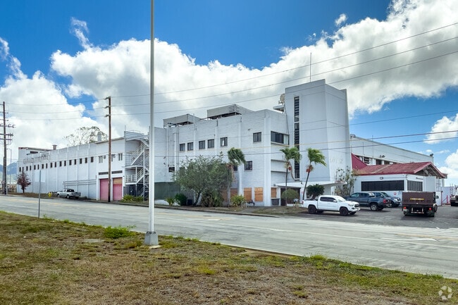
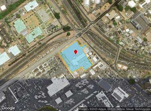
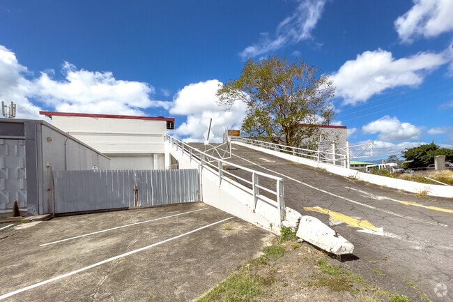
911 Middle St
Urban Honolulu, HI
First Baking Co
1-1-2-016-029-0000
LOT 25 3.023 AC MAP 15 LCAPP 839 TOG/ESMTS
Industrialgeneral
Honolulu
X
Hawaii
15003C0353G
25
2024
3.02 AC
2025
Kalihi
006000
Hawaii
58,639 SF
DEMOGRAPHICS near 911 Middle St
1 Mile
3 Mile
5 Mile
2024 Total Population
28,450
154,171
308,494
2029 Population
27,380
149,349
302,660
Pop Growth 2024-2029
(3.76%)
(3.13%)
(1.89%)
Average Age
39
41
42
2024 Total Households
6,680
50,902
116,927
HH Growth 2024-2029
(4.19%)
(3.30%)
(1.87%)
Median Household Inc
$73,193
$79,649
$76,908
Avg Household Size
3.70
2.80
2.40
2024 Avg HH Vehicles
2.00
2.00
1.00
Median Home Value
$704,015
$754,769
$733,599
Median Year Built
1967
1974
1974
Nearby Places
Map Layers
Map Styles
 Street
 Aerial
- Restaurants
- Banks
- Shops
- Fitness
- Groceries
PUBLIC TRANSPORTATION
AIRPORT
Daniel K Inouye International
DRIVE
WALK
Distance
Daniel K Inouye International
7 min
3.1 mi
Freight Ports
Honolulu Harbor, Oahu
DRIVE
WALK
Distance
Honolulu Harbor, Oahu
10 min
3.9 mi
SALE & LEASE HISTORY
LISTING DATE
SALE/LEASE

May 18, 2021
For Lease
May 18, 2021
For Sale
Nearby Properties
Address
Land Use
TOTAL SIZE
Lot Size
Zoning
Address
Land Use
TOTAL SIZE
Lot Size
Zoning
1,675.63 AC
C/61/60
Address
Land Use
TOTAL SIZE
Lot Size
Zoning
355.21 AC
F-1
Address
Land Use
TOTAL SIZE
Lot Size
Zoning
1,153,381 SF
425.42 AC
R-5
Address
Land Use
TOTAL SIZE
Lot Size
Zoning
254,832 SF
2.92 AC
BMX-4
Address
Land Use
TOTAL SIZE
Lot Size
Zoning
1,725,655 SF
11 AC
I-2
Address
Land Use
TOTAL SIZE
Lot Size
Zoning
1,725,655 SF
11 AC
I-2
Address
Land Use
TOTAL SIZE
Lot Size
Zoning
12,430 SF
86.69 AC
I-3
Address
Land Use
TOTAL SIZE
Lot Size
Zoning
9,272 SF
141.38 AC
P-2
Address
Land Use
TOTAL SIZE
Lot Size
Zoning
163,285 SF
15.08 AC
R-7.5
Address
Land Use
TOTAL SIZE
Lot Size
Zoning
26,537 SF
2,470.86 AC
I-2
Address
Land Use
TOTAL SIZE
Lot Size
Zoning
1,447,909 SF
12.54 AC
IMX-1
Address
Land Use
TOTAL SIZE
Lot Size
Zoning
919,972 SF
14.45 AC
I-2
Address
Land Use
TOTAL SIZE
Lot Size
Zoning
936,400 SF
6.88 AC
Kak
Address
Land Use
TOTAL SIZE
Lot Size
Zoning
386,846 SF
8.76 AC
A-1
Address
Land Use
TOTAL SIZE
Lot Size
Zoning
6.20 AC
I-2
Address
Land Use
TOTAL SIZE
Lot Size
Zoning
960 SF
71.97 AC
P-2
Address
Land Use
TOTAL SIZE
Lot Size
Zoning
158,215 SF
1.83 AC
BMX-4
Address
Land Use
TOTAL SIZE
Lot Size
Zoning
204,596 SF
0.12 AC
BMX-4
Address
Land Use
TOTAL SIZE
Lot Size
Zoning
16.46 AC
I-2
Address
Land Use
TOTAL SIZE
Lot Size
Zoning
49,330 SF
50 AC
I-3
Address
Land Use
TOTAL SIZE
Lot Size
Zoning
10.84 AC
B-2
Address
Land Use
TOTAL SIZE
Lot Size
Zoning
13.77 AC
U/34/30
Address
Land Use
TOTAL SIZE
Lot Size
Zoning
40.76 AC
F-1
Address
Land Use
TOTAL SIZE
Lot Size
Zoning
415,924 SF
0.12 AC
BMX-4
Address
Land Use
TOTAL SIZE
Lot Size
Zoning
10.26 AC
B-2
Address
Land Use
TOTAL SIZE
Lot Size
Zoning
187,487 SF
0.46 AC
BMX-3
Address
Land Use
TOTAL SIZE
Lot Size
Zoning
10.98 AC
P-2
Address
Land Use
TOTAL SIZE
Lot Size
Zoning
116,230 SF
1.42 AC
BMX-4
Address
Land Use
TOTAL SIZE
Lot Size
Zoning
11.75 AC
U/34/30
Address
Land Use
TOTAL SIZE
Lot Size
Zoning
659,629 SF
1.58 AC
BMX-4
The World's #1 Commercial Real Estate Marketplace
Connect with us
© 2025 CoStar Group
The information above has been obtained from sources believed reliable. While we do not doubt its accuracy we have not verified it and make no guarantee, warranty or representation about it. It is your responsibility to independently confirm its accuracy and completeness. Any projections, opinions, assumptions, or estimates used are for example only and do not represent the current or future performance of the property. The value of this transaction to you depends on tax and other factors which should be evaluated by your tax, financial, and legal advisors. You and your advisors should conduct a careful, independent investigation of the property to determine to your satisfaction the suitability of the property for your needs.