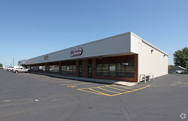
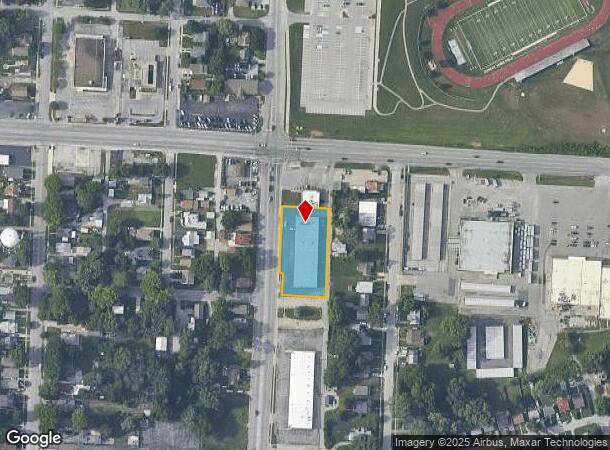
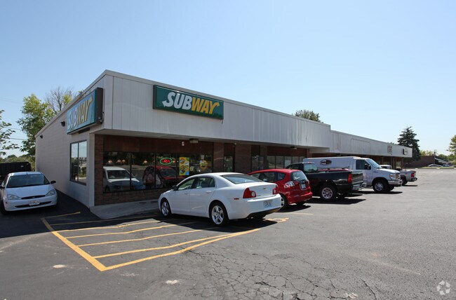
Property Record
911 N Noland Rd, Independence, MO 64050
NEARBY LISTINGS FOR SALE OR LEASE
Property Detail
911 N Noland Rd
Kansas City, MO-KS
Martin Heights
26-210-04-33-00-0-00-000
MARTIN HEIGHTS PT LOT 10 DAF: BEG NE COR LOT 10 TH S 19.5 T H W 136.98 TH N 212.47 TH E 137.21 TO POB & ALL LOTS 11-1 5 (EX PT IN RD) 11 THRU 15 (EX PT IN RD)
Regionalshoppingcenterormallwithanchorstore
Jackson
X
Missouri
29095C0281G
10
2024
0.89 AC
2025
East Jackson County
011502
Kansas City
13,440 SF
DEMOGRAPHICS near 911 N Noland Rd
1 Mile
3 Mile
5 Mile
2024 Total Population
9,486
62,081
127,199
2029 Population
9,443
61,752
126,224
Pop Growth 2024-2029
(0.45%)
(0.53%)
(0.77%)
Average Age
41
40
40
2024 Total Households
4,176
25,888
51,901
HH Growth 2024-2029
(0.57%)
(0.70%)
(0.92%)
Median Household Inc
$43,311
$49,601
$56,369
Avg Household Size
2.20
2.30
2.40
2024 Avg HH Vehicles
2.00
2.00
2.00
Median Home Value
$147,849
$134,712
$154,025
Median Year Built
1957
1959
1965
Nearby Places
Map Layers
Map Styles
 Street
 Aerial
- Restaurants
- Banks
- Shops
- Fitness
- Groceries
PUBLIC TRANSPORTATION
COMMUTER RAIL
Independence Amtrak Station (Lincoln Service Missouri River Runner - Amtrak, Missouri River Runner - Amtrak)
DRIVE
WALK
Distance
Independence Amtrak Station (Lincoln Service Missouri River Runner - Amtrak, Missouri River Runner - Amtrak)
5 min
2.0 mi
AIRPORT
Kansas City International
DRIVE
WALK
Distance
Kansas City International
42 min
29.9 mi
Freight Ports
Tulsa Port Of Catoosa
DRIVE
WALK
Distance
Tulsa Port Of Catoosa
280 min
246.9 mi
SALE & LEASE HISTORY
LISTING DATE
SALE/LEASE

Sep 24, 2016
For Lease
Sep 24, 2016
For Sale
May 12, 2017
For Lease
Jun 27, 2022
For Lease
Nearby Properties
Address
Land Use
TOTAL SIZE
Lot Size
Zoning
Address
Land Use
TOTAL SIZE
Lot Size
Zoning
519,315 SF
28.47 AC
Address
Land Use
TOTAL SIZE
Lot Size
Zoning
250,196 SF
39.50 AC
Address
Land Use
TOTAL SIZE
Lot Size
Zoning
455,100 SF
42.02 AC
Address
Land Use
TOTAL SIZE
Lot Size
Zoning
123,305 SF
15.51 AC
Address
Land Use
TOTAL SIZE
Lot Size
Zoning
64,318 SF
32.40 AC
Address
Land Use
TOTAL SIZE
Lot Size
Zoning
1 SF
1.44 AC
Address
Land Use
TOTAL SIZE
Lot Size
Zoning
Address
Land Use
TOTAL SIZE
Lot Size
Zoning
213,615 SF
15.50 AC
Address
Land Use
TOTAL SIZE
Lot Size
Zoning
157,666 SF
18.54 AC
Address
Land Use
TOTAL SIZE
Lot Size
Zoning
157,429 SF
36.60 AC
Address
Land Use
TOTAL SIZE
Lot Size
Zoning
13,227 SF
287 AC
Address
Land Use
TOTAL SIZE
Lot Size
Zoning
111,445 SF
8 AC
Address
Land Use
TOTAL SIZE
Lot Size
Zoning
71,339 SF
0.68 AC
Address
Land Use
TOTAL SIZE
Lot Size
Zoning
113,667 SF
6.31 AC
Address
Land Use
TOTAL SIZE
Lot Size
Zoning
190,810 SF
26.90 AC
Address
Land Use
TOTAL SIZE
Lot Size
Zoning
55,985 SF
20.93 AC
Address
Land Use
TOTAL SIZE
Lot Size
Zoning
36,883 SF
14.60 AC
Address
Land Use
TOTAL SIZE
Lot Size
Zoning
286,490 SF
37.30 AC
Address
Land Use
TOTAL SIZE
Lot Size
Zoning
66,168 SF
44.98 AC
Address
Land Use
TOTAL SIZE
Lot Size
Zoning
45,870 SF
2.01 AC
Address
Land Use
TOTAL SIZE
Lot Size
Zoning
104,740 SF
7.25 AC
Address
Land Use
TOTAL SIZE
Lot Size
Zoning
158,109 SF
2.77 AC
Address
Land Use
TOTAL SIZE
Lot Size
Zoning
153,774 SF
Address
Land Use
TOTAL SIZE
Lot Size
Zoning
39,120 SF
1.87 AC
Address
Land Use
TOTAL SIZE
Lot Size
Zoning
101,268 SF
13.09 AC
Address
Land Use
TOTAL SIZE
Lot Size
Zoning
48,330 SF
12.31 AC
Address
Land Use
TOTAL SIZE
Lot Size
Zoning
246,652 SF
5.07 AC
Address
Land Use
TOTAL SIZE
Lot Size
Zoning
50,900 SF
13.80 AC
Address
Land Use
TOTAL SIZE
Lot Size
Zoning
58,946 SF
0.98 AC
Address
Land Use
TOTAL SIZE
Lot Size
Zoning
67,282 SF
4 AC
The World's #1 Commercial Real Estate Marketplace
Connect with us
© 2025 CoStar Group
The information above has been obtained from sources believed reliable. While we do not doubt its accuracy we have not verified it and make no guarantee, warranty or representation about it. It is your responsibility to independently confirm its accuracy and completeness. Any projections, opinions, assumptions, or estimates used are for example only and do not represent the current or future performance of the property. The value of this transaction to you depends on tax and other factors which should be evaluated by your tax, financial, and legal advisors. You and your advisors should conduct a careful, independent investigation of the property to determine to your satisfaction the suitability of the property for your needs.