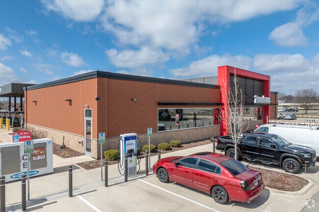
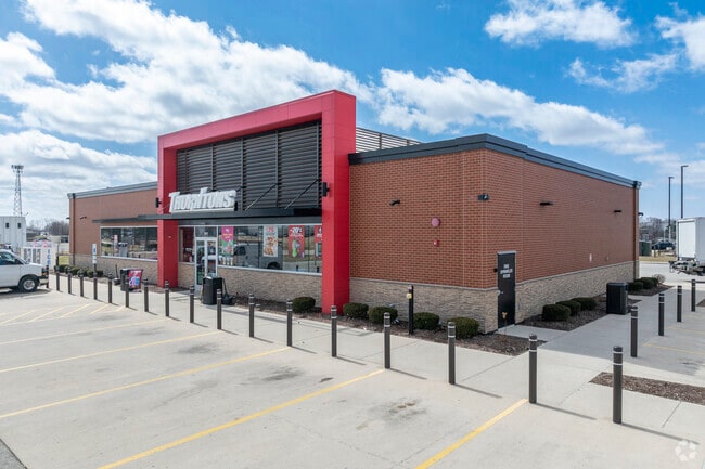
Property Record
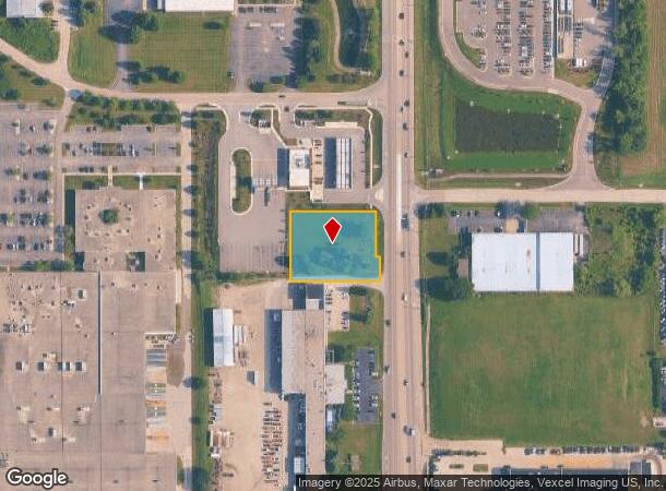
944 Il Route 31 Dr, Crystal Lake, IL 60014

NEARBY LISTINGS FOR SALE OR LEASE
Property Detail
944 Il Route 31 Dr
Chicago-Naperville-Elgin, IL-IN-WI
Tek 31 Sub
19-10-376-016
DOC 2024R0017653 LT 2 TEK 31 SUB
Industrialgeneral
McHenry
X
Illinois
17111C0335J
2
2024
4.99 AC
2024
Far Northwest
871301
Chicago
DEMOGRAPHICS near 944 Il Route 31 Dr
1 Mile
3 Mile
5 Mile
2024 Total Population
3,732
51,382
132,054
2029 Population
3,800
51,579
132,266
Pop Growth 2024-2029
+ 1.82%
+ 0.38%
+ 0.16%
Average Age
41
40
41
2024 Total Households
1,385
19,261
48,196
HH Growth 2024-2029
+ 1.95%
+ 0.40%
+ 0.18%
Median Household Inc
$81,792
$83,811
$100,583
Avg Household Size
2.70
2.60
2.70
2024 Avg HH Vehicles
2.00
2.00
2.00
Median Home Value
$194,552
$238,858
$268,824
Median Year Built
1996
1979
1987
Nearby Places
Map Layers
Map Styles
 Street
 Aerial
- Restaurants
- Banks
- Shops
- Fitness
- Groceries
PUBLIC TRANSPORTATION
COMMUTER RAIL
Pingree Road Station (Union Pacific Northwest Line - Northeast Illinois Regional Commuter Railroad (Metra))
DRIVE
WALK
Distance
Pingree Road Station (Union Pacific Northwest Line - Northeast Illinois Regional Commuter Railroad (Metra))
6 min
2.0 mi
Cary Station (Union Pacific Northwest Line - Northeast Illinois Regional Commuter Railroad (Metra))
DRIVE
WALK
Distance
Cary Station (Union Pacific Northwest Line - Northeast Illinois Regional Commuter Railroad (Metra))
6 min
3.0 mi
AIRPORT
Chicago O'Hare International
DRIVE
WALK
Distance
Chicago O'Hare International
48 min
33.1 mi
Freight Ports
Port Milwaukee
DRIVE
WALK
Distance
Port Milwaukee
98 min
74.8 mi
SALE & LEASE HISTORY
LISTING DATE
SALE/LEASE

Oct 13, 2020
For Sale
Nearby Properties
Address
Land Use
TOTAL SIZE
Lot Size
Zoning
Address
Land Use
TOTAL SIZE
Lot Size
Zoning
Address
Land Use
TOTAL SIZE
Lot Size
Zoning
28.48 AC
Address
Land Use
TOTAL SIZE
Lot Size
Zoning
449,650 SF
25 AC
Address
Land Use
TOTAL SIZE
Lot Size
Zoning
15.94 AC
Address
Land Use
TOTAL SIZE
Lot Size
Zoning
147,496 SF
11.81 AC
Address
Land Use
TOTAL SIZE
Lot Size
Zoning
Address
Land Use
TOTAL SIZE
Lot Size
Zoning
Address
Land Use
TOTAL SIZE
Lot Size
Zoning
64,269 SF
5.08 AC
Address
Land Use
TOTAL SIZE
Lot Size
Zoning
20.81 AC
Address
Land Use
TOTAL SIZE
Lot Size
Zoning
217,182 SF
22.43 AC
Address
Land Use
TOTAL SIZE
Lot Size
Zoning
Address
Land Use
TOTAL SIZE
Lot Size
Zoning
173,572 SF
17.03 AC
Address
Land Use
TOTAL SIZE
Lot Size
Zoning
71,703 SF
0.50 AC
Address
Land Use
TOTAL SIZE
Lot Size
Zoning
362,936 SF
6.08 AC
Address
Land Use
TOTAL SIZE
Lot Size
Zoning
125,187 SF
10.59 AC
Address
Land Use
TOTAL SIZE
Lot Size
Zoning
86,400 SF
5.87 AC
Address
Land Use
TOTAL SIZE
Lot Size
Zoning
66,594 SF
5.22 AC
Address
Land Use
TOTAL SIZE
Lot Size
Zoning
47,164 SF
0.70 AC
Address
Land Use
TOTAL SIZE
Lot Size
Zoning
504,206 SF
11.06 AC
Address
Land Use
TOTAL SIZE
Lot Size
Zoning
51,909 SF
0.50 AC
Address
Land Use
TOTAL SIZE
Lot Size
Zoning
34,448 SF
2 AC
Address
Land Use
TOTAL SIZE
Lot Size
Zoning
Address
Land Use
TOTAL SIZE
Lot Size
Zoning
72,173 SF
5.23 AC
Address
Land Use
TOTAL SIZE
Lot Size
Zoning
127,059 SF
16.84 AC
Address
Land Use
TOTAL SIZE
Lot Size
Zoning
122,668 SF
9.73 AC
Address
Land Use
TOTAL SIZE
Lot Size
Zoning
161,610 SF
15.03 AC
Address
Land Use
TOTAL SIZE
Lot Size
Zoning
35,452 SF
105.76 AC
Address
Land Use
TOTAL SIZE
Lot Size
Zoning
124,301 SF
8.80 AC
Address
Land Use
TOTAL SIZE
Lot Size
Zoning
10.48 AC
The World's #1 Commercial Real Estate Marketplace
Connect with us
© 2025 CoStar Group
The information above has been obtained from sources believed reliable. While we do not doubt its accuracy we have not verified it and make no guarantee, warranty or representation about it. It is your responsibility to independently confirm its accuracy and completeness. Any projections, opinions, assumptions, or estimates used are for example only and do not represent the current or future performance of the property. The value of this transaction to you depends on tax and other factors which should be evaluated by your tax, financial, and legal advisors. You and your advisors should conduct a careful, independent investigation of the property to determine to your satisfaction the suitability of the property for your needs.