Property Record
9115 Circle Dr, Austin, TX 78736
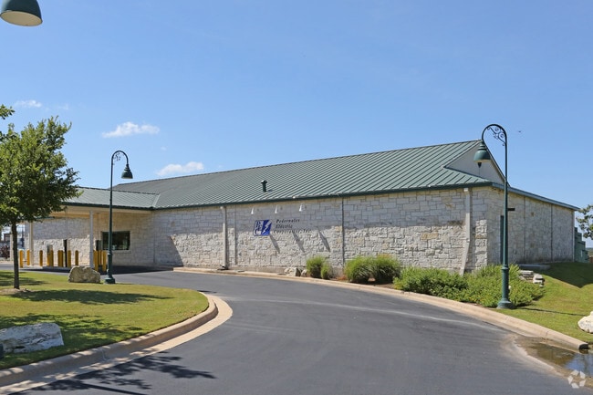

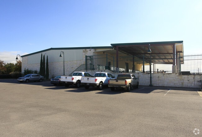
Property Detail
9115 Circle Dr
Austin-Round Rock-San Marcos, TX
LOT 1 BLK A PEDERNALES ELECTRIC COOPERATIVE CIRCLE DRIVE AUSTIN SUBD
734302
Travis
Officebuilding
Texas
A Areas with a 1% annual chance of flooding and a 26% chance of flooding over the life of a 30-year mortgage.
1
2025
21.64 AC
2025
Southwest
036600
Austin
20,681 SF
NEARBY LISTINGS FOR SALE OR LEASE
DEMOGRAPHICS near 9115 Circle Dr
1 mile
3 mile
5 mile
2025 Total Population
3,029
28,562
89,434
2030 Population
3,138
29,546
93,385
Pop Growth 2025-2030
+ 3.60%
+ 3.45%
+ 4.42%
Average Age
43
40
40
2025 Total Households
1,214
11,293
34,830
HH Growth 2025-2030
+ 4.20%
+ 4.14%
+ 5.11%
Median Household Inc
$117,846
$122,116
$138,754
Avg Household Size
2.50
2.50
2.50
2025 Avg HH Vehicles
2.00
2.00
2.00
Median Home Value
$735,894
$725,819
$753,654
Median Year Built
2002
2001
2000
Nearby Places
Map Layers
Map Styles
 Street
 Aerial
Transit
 Traffic
 Biking
Places
Listings with unknown addresses are not visible on the map
- Restaurants
- Banks
- Shops
- Fitness
- Groceries
PUBLIC TRANSPORTATION
AIRPORT
Austin-Bergstrom International
Drive
Walk
Distance
Austin-Bergstrom International
33 min
18.6 mi
Nearby Properties
Address
Land Use
TOTAL SIZE
Lot Size
Zoning
Address
Land Use
TOTAL SIZE
Lot Size
Zoning
355,651 SF
31.86 AC
Address
Land Use
TOTAL SIZE
Lot Size
Zoning
258,600 SF
36.81 AC
Address
Land Use
TOTAL SIZE
Lot Size
Zoning
267,928 SF
18.13 AC
Address
Land Use
TOTAL SIZE
Lot Size
Zoning
339,456 SF
32.70 AC
Address
Land Use
TOTAL SIZE
Lot Size
Zoning
253,902 SF
28.21 AC
Address
Land Use
TOTAL SIZE
Lot Size
Zoning
278,740 SF
44.30 AC
Address
Land Use
TOTAL SIZE
Lot Size
Zoning
240,640 SF
14.36 AC
Address
Land Use
TOTAL SIZE
Lot Size
Zoning
262,421 SF
33.65 AC
Address
Land Use
TOTAL SIZE
Lot Size
Zoning
150,975 SF
35.79 AC
Address
Land Use
TOTAL SIZE
Lot Size
Zoning
267,156 SF
45.30 AC
Address
Land Use
TOTAL SIZE
Lot Size
Zoning
82,326 SF
53.78 AC
Address
Land Use
TOTAL SIZE
Lot Size
Zoning
199,816 SF
20.10 AC
Address
Land Use
TOTAL SIZE
Lot Size
Zoning
194,230 SF
11.25 AC
Address
Land Use
TOTAL SIZE
Lot Size
Zoning
129,313 SF
7.45 AC
Address
Land Use
TOTAL SIZE
Lot Size
Zoning
148,331 SF
19.98 AC
Address
Land Use
TOTAL SIZE
Lot Size
Zoning
82,730 SF
53.28 AC
Address
Land Use
TOTAL SIZE
Lot Size
Zoning
1,469 SF
51.57 AC
Address
Land Use
TOTAL SIZE
Lot Size
Zoning
158,255 SF
11.91 AC
Address
Land Use
TOTAL SIZE
Lot Size
Zoning
4,868 SF
21.77 AC
Address
Land Use
TOTAL SIZE
Lot Size
Zoning
111,368 SF
9.95 AC
Address
Land Use
TOTAL SIZE
Lot Size
Zoning
105,392 SF
7.30 AC
Address
Land Use
TOTAL SIZE
Lot Size
Zoning
88,556 SF
23.15 AC
Address
Land Use
TOTAL SIZE
Lot Size
Zoning
107,654 SF
8.89 AC
Address
Land Use
TOTAL SIZE
Lot Size
Zoning
60,000 SF
5.83 AC
Address
Land Use
TOTAL SIZE
Lot Size
Zoning
42.18 AC
Address
Land Use
TOTAL SIZE
Lot Size
Zoning
93,398 SF
7.33 AC
Address
Land Use
TOTAL SIZE
Lot Size
Zoning
14,316 SF
15.09 AC
Address
Land Use
TOTAL SIZE
Lot Size
Zoning
308,500 SF
40 AC
Address
Land Use
TOTAL SIZE
Lot Size
Zoning
37,680 SF
6.16 AC
Address
Land Use
TOTAL SIZE
Lot Size
Zoning
294.23 AC
The World's #1 Commercial Real Estate Marketplace
Connect with us
© 2026 CoStar Group
The information above has been obtained from sources believed reliable. While we do not doubt its accuracy we have not verified it and make no guarantee, warranty or representation about it. It is your responsibility to independently confirm its accuracy and completeness. Any projections, opinions, assumptions, or estimates used are for example only and do not represent the current or future performance of the property. The value of this transaction to you depends on tax and other factors which should be evaluated by your tax, financial, and legal advisors. You and your advisors should conduct a careful, independent investigation of the property to determine to your satisfaction the suitability of the property for your needs.