Property Record
9120 Airport Blvd, Mobile, AL 36608


Property Detail
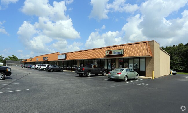
9120 Airport Blvd
27-07-26-0-000-050.04
COM AT THE NW COR OF SEC 26 T4S R3W TH RUN N 89 DEG 52 MIN 50 SEC E ALG THE N/L COM AT THE NW COR OF SEC 26 T4S R3W TH RUN N
Storesoffices
Mobile
B and X Area of moderate flood hazard, usually the area between the limits of the 100-year and 500-year floods.
Alabama
2025
4.20 AC
2025
Outlying Mobile County
006403
Mobile
20,502 SF
Mobile, AL
NEARBY LISTINGS FOR SALE OR LEASE
DEMOGRAPHICS near 9120 Airport Blvd
1 mile
3 mile
5 mile
2025 Total Population
3,757
29,712
81,987
2030 Population
3,607
29,153
80,428
Pop Growth 2025-2030
(3.99%)
(1.88%)
(1.90%)
Average Age
38
39
38
2025 Total Households
1,432
11,205
31,962
HH Growth 2025-2030
(3.98%)
(1.97%)
(2.03%)
Median Household Inc
$71,032
$73,572
$66,560
Avg Household Size
2.60
2.60
2.40
2025 Avg HH Vehicles
2.00
2.00
2.00
Median Home Value
$179,180
$242,463
$247,156
Median Year Built
1990
1995
1991
Nearby Places
Map Layers
Map Styles
 Street
 Aerial
Transit
 Traffic
 Biking
Places
Listings with unknown addresses are not visible on the map
- Restaurants
- Banks
- Shops
- Fitness
- Groceries
PUBLIC TRANSPORTATION
AIRPORT
Mobile Regional
Drive
Walk
Distance
Mobile Regional
12 min
4.4 mi
Mobile International
Drive
Walk
Distance
Mobile International
27 min
15.3 mi
Freight Ports
Port of Mobile
Drive
Walk
Distance
Port of Mobile
28 min
15.1 mi
SALE & LEASE HISTORY
LISTING DATE
SALE/LEASE

Sep 25, 2016
For Lease
Feb 09, 2017
For Lease
Aug 24, 2017
For Lease
Nearby Properties
Address
Land Use
TOTAL SIZE
Lot Size
Zoning
Address
Land Use
TOTAL SIZE
Lot Size
Zoning
32,394 SF
40 AC
Address
Land Use
TOTAL SIZE
Lot Size
Zoning
230,009 SF
97.56 AC
Address
Land Use
TOTAL SIZE
Lot Size
Zoning
250,368 SF
317 AC
Address
Land Use
TOTAL SIZE
Lot Size
Zoning
6,172 SF
23.43 AC
Address
Land Use
TOTAL SIZE
Lot Size
Zoning
26,400 SF
256.19 AC
Address
Land Use
TOTAL SIZE
Lot Size
Zoning
105,921 SF
17.90 AC
Address
Land Use
TOTAL SIZE
Lot Size
Zoning
88,588 SF
13.01 AC
Address
Land Use
TOTAL SIZE
Lot Size
Zoning
Address
Land Use
TOTAL SIZE
Lot Size
Zoning
179,142 SF
17.12 AC
Address
Land Use
TOTAL SIZE
Lot Size
Zoning
200,001 SF
20 AC
Address
Land Use
TOTAL SIZE
Lot Size
Zoning
10,256 SF
17.90 AC
Address
Land Use
TOTAL SIZE
Lot Size
Zoning
63,550 SF
88 AC
Address
Land Use
TOTAL SIZE
Lot Size
Zoning
160,006 SF
118 AC
Address
Land Use
TOTAL SIZE
Lot Size
Zoning
280.05 AC
Address
Land Use
TOTAL SIZE
Lot Size
Zoning
185,520 SF
50.74 AC
Address
Land Use
TOTAL SIZE
Lot Size
Zoning
4,958 SF
14.09 AC
Address
Land Use
TOTAL SIZE
Lot Size
Zoning
116,624 SF
26.60 AC
Address
Land Use
TOTAL SIZE
Lot Size
Zoning
60,138 SF
10.45 AC
Address
Land Use
TOTAL SIZE
Lot Size
Zoning
15,756 SF
6.20 AC
Address
Land Use
TOTAL SIZE
Lot Size
Zoning
159,221 SF
24.12 AC
Address
Land Use
TOTAL SIZE
Lot Size
Zoning
122,601 SF
9.90 AC
Address
Land Use
TOTAL SIZE
Lot Size
Zoning
48,442 SF
7.25 AC
Address
Land Use
TOTAL SIZE
Lot Size
Zoning
37,894 SF
40 AC
Address
Land Use
TOTAL SIZE
Lot Size
Zoning
12,576 SF
26 AC
Address
Land Use
TOTAL SIZE
Lot Size
Zoning
74,969 SF
3.52 AC
Address
Land Use
TOTAL SIZE
Lot Size
Zoning
112,773 SF
12.70 AC
Address
Land Use
TOTAL SIZE
Lot Size
Zoning
89,042 SF
8.04 AC
Address
Land Use
TOTAL SIZE
Lot Size
Zoning
71,122 SF
10.91 AC
Address
Land Use
TOTAL SIZE
Lot Size
Zoning
131,700 SF
2.38 AC
Address
Land Use
TOTAL SIZE
Lot Size
Zoning
78,119 SF
20 AC
The World's #1 Commercial Real Estate Marketplace
Connect with us
© 2026 CoStar Group
The information above has been obtained from sources believed reliable. While we do not doubt its accuracy we have not verified it and make no guarantee, warranty or representation about it. It is your responsibility to independently confirm its accuracy and completeness. Any projections, opinions, assumptions, or estimates used are for example only and do not represent the current or future performance of the property. The value of this transaction to you depends on tax and other factors which should be evaluated by your tax, financial, and legal advisors. You and your advisors should conduct a careful, independent investigation of the property to determine to your satisfaction the suitability of the property for your needs.