Property Record
9120 Nw 13Th St, Gainesville, FL 32653

NEARBY LISTINGS FOR SALE OR LEASE
Property Detail
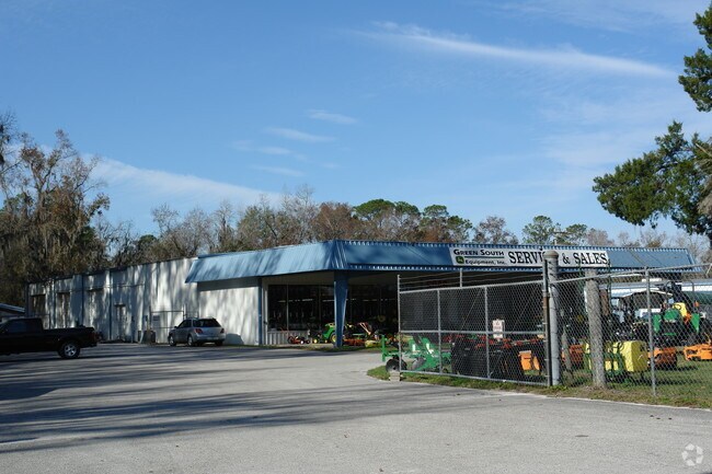
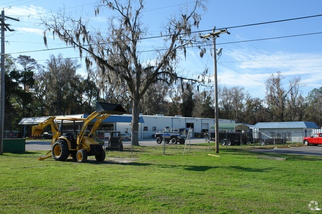
9120 Nw 13Th St
05978-003-000
Turkey Creek Condo
Vehiclerentalsvehiclesales
COM AT INT WLY R/W US-441 & A LINE THAT IS 1161.60 FT S OF N LINE SEC 2 INSIDE GRANT NWLY ALONG R/W 630 FT POB CONTINUE N 40 DEG W ALONG WLY R/W 363.64 FT S 61 DEG W 482 FT TO CENTERLINE OF CREEK SLY ALONG CREEK CENTERLINE 242 FT TO INTERSECTION CREE
A
Alachua
12001C0282E
Florida
2025
3.20 AC
2025
Gainesville
001803
Other Market Areas
11,375 SF
Gainesville, FL
DEMOGRAPHICS near 9120 Nw 13Th St
1 Mile
3 Mile
5 Mile
2024 Total Population
1,520
17,133
51,972
2029 Population
1,596
17,995
54,644
Pop Growth 2024-2029
+ 5.00%
+ 5.03%
+ 5.14%
Average Age
44
42
42
2024 Total Households
660
7,367
23,155
HH Growth 2024-2029
+ 5.00%
+ 5.14%
+ 5.23%
Median Household Inc
$54,431
$79,108
$73,835
Avg Household Size
2.30
2.30
2.20
2024 Avg HH Vehicles
2.00
2.00
2.00
Median Home Value
$186,335
$226,044
$231,356
Median Year Built
1991
1987
1985
Nearby Places
Map Layers
Map Styles
 Street
 Aerial
- Restaurants
- Banks
- Shops
- Fitness
- Groceries
PUBLIC TRANSPORTATION
AIRPORT
Gainesville Regional
DRIVE
WALK
Distance
Gainesville Regional
18 min
8.9 mi
Freight Ports
Jacksonville Port
DRIVE
WALK
Distance
Jacksonville Port
104 min
78.7 mi
Nearby Properties
Address
Land Use
TOTAL SIZE
Lot Size
Zoning
Address
Land Use
TOTAL SIZE
Lot Size
Zoning
969.87 AC
PS
Address
Land Use
TOTAL SIZE
Lot Size
Zoning
385,880 SF
21.51 AC
PD
Address
Land Use
TOTAL SIZE
Lot Size
Zoning
188,858 SF
15 AC
ED
Address
Land Use
TOTAL SIZE
Lot Size
Zoning
74,722 SF
9.71 AC
PD
Address
Land Use
TOTAL SIZE
Lot Size
Zoning
69,139 SF
2.18 AC
I1
Address
Land Use
TOTAL SIZE
Lot Size
Zoning
16,430 SF
137.27 AC
PS
Address
Land Use
TOTAL SIZE
Lot Size
Zoning
109,946 SF
24.56 AC
I2
Address
Land Use
TOTAL SIZE
Lot Size
Zoning
145,289 SF
9.66 AC
MU2
Address
Land Use
TOTAL SIZE
Lot Size
Zoning
77,330 SF
5 AC
BI
Address
Land Use
TOTAL SIZE
Lot Size
Zoning
79,550 SF
3.07 AC
CI
Address
Land Use
TOTAL SIZE
Lot Size
Zoning
81,359 SF
67.46 AC
RMF6
Address
Land Use
TOTAL SIZE
Lot Size
Zoning
16,784 SF
31.50 AC
PS
Address
Land Use
TOTAL SIZE
Lot Size
Zoning
1,512 SF
52.41 AC
MH
Address
Land Use
TOTAL SIZE
Lot Size
Zoning
13,312 SF
520 AC
A
Address
Land Use
TOTAL SIZE
Lot Size
Zoning
188,880 SF
1.65 AC
I2
Address
Land Use
TOTAL SIZE
Lot Size
Zoning
39,958 SF
1.89 AC
I1
Address
Land Use
TOTAL SIZE
Lot Size
Zoning
52,889 SF
3.29 AC
RMF7
Address
Land Use
TOTAL SIZE
Lot Size
Zoning
41,100 SF
3.28 AC
RMF7
Address
Land Use
TOTAL SIZE
Lot Size
Zoning
10,872 SF
1.30 AC
MU1
Address
Land Use
TOTAL SIZE
Lot Size
Zoning
29,694 SF
2.30 AC
PD
Address
Land Use
TOTAL SIZE
Lot Size
Zoning
51,187 SF
10.12 AC
I1
Address
Land Use
TOTAL SIZE
Lot Size
Zoning
36,329 SF
2.25 AC
MU2
Address
Land Use
TOTAL SIZE
Lot Size
Zoning
15,243 SF
1.35 AC
PD
Address
Land Use
TOTAL SIZE
Lot Size
Zoning
38,358 SF
17.94 AC
OF
Address
Land Use
TOTAL SIZE
Lot Size
Zoning
94,220 SF
5.71 AC
BI
Address
Land Use
TOTAL SIZE
Lot Size
Zoning
45,516 SF
11 AC
PD
Address
Land Use
TOTAL SIZE
Lot Size
Zoning
41,761 SF
5.11 AC
MU1
Address
Land Use
TOTAL SIZE
Lot Size
Zoning
3.92 AC
PS
Address
Land Use
TOTAL SIZE
Lot Size
Zoning
13,260 SF
2.85 AC
PD
The World's #1 Commercial Real Estate Marketplace
Connect with us
© 2025 CoStar Group
The information above has been obtained from sources believed reliable. While we do not doubt its accuracy we have not verified it and make no guarantee, warranty or representation about it. It is your responsibility to independently confirm its accuracy and completeness. Any projections, opinions, assumptions, or estimates used are for example only and do not represent the current or future performance of the property. The value of this transaction to you depends on tax and other factors which should be evaluated by your tax, financial, and legal advisors. You and your advisors should conduct a careful, independent investigation of the property to determine to your satisfaction the suitability of the property for your needs.