Property Record
9130 N Skyview Ave, Kansas City, MO 64154


NEARBY LISTINGS FOR SALE OR LEASE
Property Detail
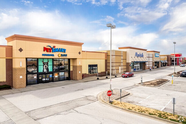
9130 N Skyview Ave
Kansas City, MO-KS
Tiffany Springs Marketcenter
19-30-06-300-001-006-000
TIFFANY SPRINGS MARKETCENTER LOT 6
Storebuilding
Platte
X
Missouri
29095C0043G
6
2024
10.13 AC
2025
I-29 Corridor
030210
Kansas City
104,706 SF
DEMOGRAPHICS near 9130 N Skyview Ave
1 Mile
3 Mile
5 Mile
2024 Total Population
9,217
43,731
102,607
2029 Population
10,239
48,057
111,309
Pop Growth 2024-2029
+ 11.09%
+ 9.89%
+ 8.48%
Average Age
37
39
39
2024 Total Households
4,076
18,246
41,913
HH Growth 2024-2029
+ 11.09%
+ 10.07%
+ 8.64%
Median Household Inc
$79,379
$80,601
$78,984
Avg Household Size
2.20
2.30
2.40
2024 Avg HH Vehicles
2.00
2.00
2.00
Median Home Value
$349,034
$278,025
$265,221
Median Year Built
2002
1993
1990
Nearby Places
Map Layers
Map Styles
 Street
 Aerial
- Restaurants
- Banks
- Shops
- Fitness
- Groceries
PUBLIC TRANSPORTATION
AIRPORT
Kansas City International
DRIVE
WALK
Distance
Kansas City International
12 min
6.8 mi
Freight Ports
Tulsa Port Of Catoosa
DRIVE
WALK
Distance
Tulsa Port Of Catoosa
282 min
249.9 mi
SALE & LEASE HISTORY
LISTING DATE
SALE/LEASE

Sep 25, 2016
For Lease
Jul 21, 2025
For Lease
Nearby Properties
Address
Land Use
TOTAL SIZE
Lot Size
Zoning
Address
Land Use
TOTAL SIZE
Lot Size
Zoning
1,837,323 SF
62.61 AC
Address
Land Use
TOTAL SIZE
Lot Size
Zoning
404,594 SF
40.87 AC
Address
Land Use
TOTAL SIZE
Lot Size
Zoning
738,848 SF
56.87 AC
Address
Land Use
TOTAL SIZE
Lot Size
Zoning
374,876 SF
28.92 AC
Address
Land Use
TOTAL SIZE
Lot Size
Zoning
627,957 SF
27.41 AC
Address
Land Use
TOTAL SIZE
Lot Size
Zoning
421,339 SF
16.91 AC
Address
Land Use
TOTAL SIZE
Lot Size
Zoning
675,632 SF
16.14 AC
Address
Land Use
TOTAL SIZE
Lot Size
Zoning
417,393 SF
22.13 AC
Address
Land Use
TOTAL SIZE
Lot Size
Zoning
437,830 SF
17.60 AC
Address
Land Use
TOTAL SIZE
Lot Size
Zoning
245,190 SF
25.40 AC
Address
Land Use
TOTAL SIZE
Lot Size
Zoning
349,586 SF
29.58 AC
Address
Land Use
TOTAL SIZE
Lot Size
Zoning
274,843 SF
9.97 AC
EZ
Address
Land Use
TOTAL SIZE
Lot Size
Zoning
231,778 SF
22.12 AC
Address
Land Use
TOTAL SIZE
Lot Size
Zoning
218,070 SF
12.79 AC
Address
Land Use
TOTAL SIZE
Lot Size
Zoning
700,700 SF
156.83 AC
Address
Land Use
TOTAL SIZE
Lot Size
Zoning
183,994 SF
12.12 AC
Address
Land Use
TOTAL SIZE
Lot Size
Zoning
26,370 SF
14.55 AC
Address
Land Use
TOTAL SIZE
Lot Size
Zoning
280,535 SF
22 AC
Address
Land Use
TOTAL SIZE
Lot Size
Zoning
453,968 SF
4.66 AC
Address
Land Use
TOTAL SIZE
Lot Size
Zoning
199,858 SF
22.28 AC
Address
Land Use
TOTAL SIZE
Lot Size
Zoning
342,570 SF
30.01 AC
Address
Land Use
TOTAL SIZE
Lot Size
Zoning
491,028 SF
16.35 AC
Address
Land Use
TOTAL SIZE
Lot Size
Zoning
235,392 SF
21.32 AC
Address
Land Use
TOTAL SIZE
Lot Size
Zoning
255,096 SF
24.86 AC
Address
Land Use
TOTAL SIZE
Lot Size
Zoning
205,694 SF
20.02 AC
Address
Land Use
TOTAL SIZE
Lot Size
Zoning
239,208 SF
5.43 AC
EZ
Address
Land Use
TOTAL SIZE
Lot Size
Zoning
276,956 SF
1.68 AC
Address
Land Use
TOTAL SIZE
Lot Size
Zoning
90,000 SF
17.42 AC
Address
Land Use
TOTAL SIZE
Lot Size
Zoning
165,610 SF
18.07 AC
The World's #1 Commercial Real Estate Marketplace
Connect with us
© 2026 CoStar Group
The information above has been obtained from sources believed reliable. While we do not doubt its accuracy we have not verified it and make no guarantee, warranty or representation about it. It is your responsibility to independently confirm its accuracy and completeness. Any projections, opinions, assumptions, or estimates used are for example only and do not represent the current or future performance of the property. The value of this transaction to you depends on tax and other factors which should be evaluated by your tax, financial, and legal advisors. You and your advisors should conduct a careful, independent investigation of the property to determine to your satisfaction the suitability of the property for your needs.