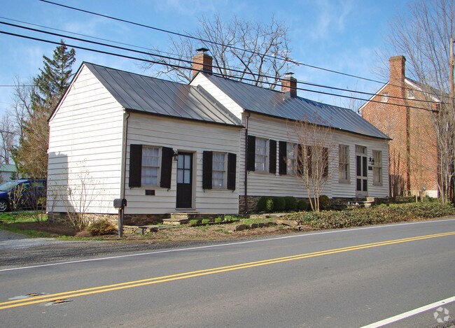
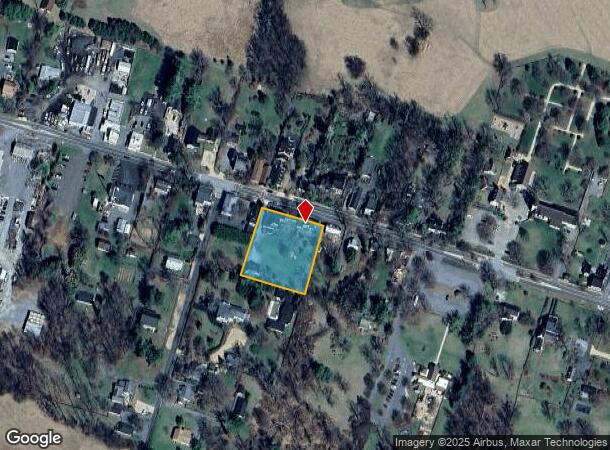
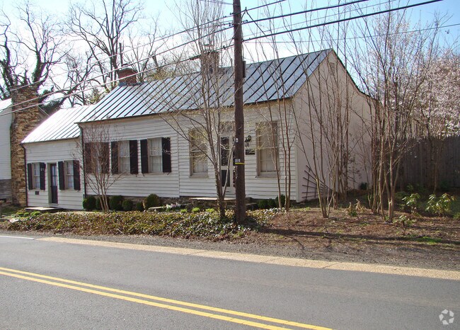
Property Record
9139 John S Mosby Hwy, Upperville, VA 20184

NEARBY LISTINGS FOR SALE OR LEASE
-
-
View all Upperville listings for sale on LoopNet.com
Property Detail
9139 John S Mosby Hwy
6054-75-9516
NOT PROVIDED. PARCEL NUMBER 3901
Commercialofficeresidentialmixeduse
Fauquier
X
Virginia
51061C0075D
1 AC
2025
Fauquier County/Vint Hill
2025
Washington, DC
930101
Washington-Arlington-Alexandria, DC-VA-MD-WV
1,368 SF
DEMOGRAPHICS near 9139 John S Mosby Hwy
1 Mile
3 Mile
5 Mile
2024 Total Population
205
560
1,596
2029 Population
212
587
1,688
Pop Growth 2024-2029
+ 3.41%
+ 4.82%
+ 5.76%
Average Age
47
47
46
2024 Total Households
89
237
662
HH Growth 2024-2029
+ 4.49%
+ 4.64%
+ 5.74%
Median Household Inc
$98,957
$102,941
$105,247
Avg Household Size
2.30
2.30
2.40
2024 Avg HH Vehicles
2.00
2.00
2.00
Median Home Value
$789,062
$790,760
$722,449
Median Year Built
1950
1955
1971
Nearby Places
Map Layers
Map Styles
 Street
 Aerial
- Restaurants
- Banks
- Shops
- Fitness
- Groceries
PUBLIC TRANSPORTATION
AIRPORT
Washington Dulles International
DRIVE
WALK
Distance
Washington Dulles International
56 min
30.2 mi
Freight Ports
Port of Baltimore
DRIVE
WALK
Distance
Port of Baltimore
129 min
88.2 mi
Nearby Properties
Address
Land Use
TOTAL SIZE
Lot Size
Zoning
Address
Land Use
TOTAL SIZE
Lot Size
Zoning
2,984 SF
44.55 AC
AGRICULTUR
Address
Land Use
TOTAL SIZE
Lot Size
Zoning
10,391 SF
2.68 AC
RES VILLAG
Address
Land Use
TOTAL SIZE
Lot Size
Zoning
1,440 SF
261.05 AC
AGRICULTUR
Address
Land Use
TOTAL SIZE
Lot Size
Zoning
82.27 AC
AR2
Address
Land Use
TOTAL SIZE
Lot Size
Zoning
6,424 SF
9.19 AC
RES VILLAG
Address
Land Use
TOTAL SIZE
Lot Size
Zoning
1,260 SF
4.66 AC
COMMERCIAL
Address
Land Use
TOTAL SIZE
Lot Size
Zoning
4,581 SF
1.33 AC
RES VILLAG
Address
Land Use
TOTAL SIZE
Lot Size
Zoning
52.14 AC
AGRICULTUR
Address
Land Use
TOTAL SIZE
Lot Size
Zoning
3,244 SF
2.40 AC
RES VILLAG
Address
Land Use
TOTAL SIZE
Lot Size
Zoning
6,415 SF
0.63 AC
RES VILLAG
Address
Land Use
TOTAL SIZE
Lot Size
Zoning
2,302 SF
0.64 AC
COMMERCIAL
Address
Land Use
TOTAL SIZE
Lot Size
Zoning
3,132 SF
0.97 AC
RES VILLAG
Address
Land Use
TOTAL SIZE
Lot Size
Zoning
2,728 SF
2.82 AC
RES VILLAG
Address
Land Use
TOTAL SIZE
Lot Size
Zoning
3,324 SF
1.22 AC
INDUSTRIAL
Address
Land Use
TOTAL SIZE
Lot Size
Zoning
4,700 SF
1.19 AC
RES VILLAG
Address
Land Use
TOTAL SIZE
Lot Size
Zoning
3,518 SF
0.43 AC
RES VILLAG
Address
Land Use
TOTAL SIZE
Lot Size
Zoning
3,265 SF
0.97 AC
RES VILLAG
Address
Land Use
TOTAL SIZE
Lot Size
Zoning
2,864 SF
0.67 AC
AR2
Address
Land Use
TOTAL SIZE
Lot Size
Zoning
4,359 SF
1.40 AC
COMMERCIAL
Address
Land Use
TOTAL SIZE
Lot Size
Zoning
32.25 AC
AGRICULTUR
Address
Land Use
TOTAL SIZE
Lot Size
Zoning
2,432 SF
1 AC
COMMERCIAL
Address
Land Use
TOTAL SIZE
Lot Size
Zoning
7,520 SF
1.14 AC
COMMERCIAL
Address
Land Use
TOTAL SIZE
Lot Size
Zoning
2,487 SF
1.69 AC
AGRICULTUR
Address
Land Use
TOTAL SIZE
Lot Size
Zoning
1,696 SF
0.45 AC
COMMERCIAL
Address
Land Use
TOTAL SIZE
Lot Size
Zoning
1,762 SF
0.40 AC
COMMERCIAL
Address
Land Use
TOTAL SIZE
Lot Size
Zoning
1,384 SF
0.84 AC
RES VILLAG
Address
Land Use
TOTAL SIZE
Lot Size
Zoning
11.50 AC
CONSERVATI
Address
Land Use
TOTAL SIZE
Lot Size
Zoning
1,328 SF
1.11 AC
INDUSTRIAL
Address
Land Use
TOTAL SIZE
Lot Size
Zoning
812 SF
2.05 AC
RES, 1 DWE
The World's #1 Commercial Real Estate Marketplace
Connect with us
© 2025 CoStar Group
The information above has been obtained from sources believed reliable. While we do not doubt its accuracy we have not verified it and make no guarantee, warranty or representation about it. It is your responsibility to independently confirm its accuracy and completeness. Any projections, opinions, assumptions, or estimates used are for example only and do not represent the current or future performance of the property. The value of this transaction to you depends on tax and other factors which should be evaluated by your tax, financial, and legal advisors. You and your advisors should conduct a careful, independent investigation of the property to determine to your satisfaction the suitability of the property for your needs.