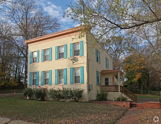
Property Record
9140 Baltimore St, Savage, MD 20763

NEARBY LISTINGS FOR SALE OR LEASE
Property Detail
9140 Baltimore St
06-430392
LOT 2 4 .165 A 9140 BALTIMORE ST SAVAGE
Apartment
Howard
X
Maryland
24027C0165D
2
2024
0.16 AC
2025
Savage-Guilford
606905
Baltimore
2,946 SF
Baltimore-Columbia-Towson, MD
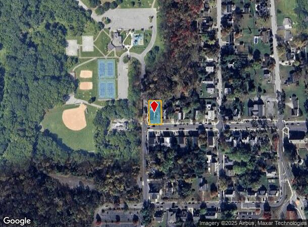
DEMOGRAPHICS near 9140 Baltimore St
1 Mile
3 Mile
5 Mile
2024 Total Population
9,945
71,187
206,289
2029 Population
10,225
72,723
209,815
Pop Growth 2024-2029
+ 2.82%
+ 2.16%
+ 1.71%
Average Age
37
37
37
2024 Total Households
3,695
26,487
75,271
HH Growth 2024-2029
+ 2.81%
+ 2.05%
+ 1.59%
Median Household Inc
$121,952
$113,570
$111,207
Avg Household Size
2.70
2.60
2.70
2024 Avg HH Vehicles
2.00
2.00
2.00
Median Home Value
$401,342
$394,913
$410,584
Median Year Built
1986
1989
1988
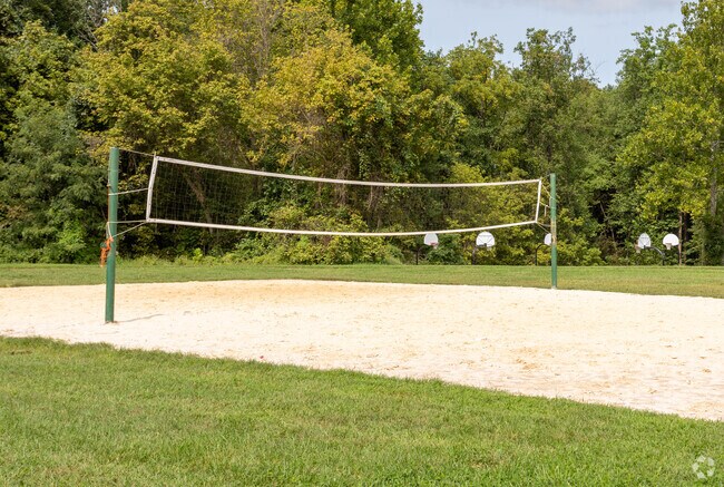
Nearby Places
Map Layers
Map Styles
 Street
 Aerial
- Restaurants
- Banks
- Shops
- Fitness
- Groceries
PUBLIC TRANSPORTATION
COMMUTER RAIL
Savage (Camden Line - Maryland Area Regional Commuter Trains (The MARC))
DRIVE
WALK
Distance
Savage (Camden Line - Maryland Area Regional Commuter Trains (The MARC))
7 min
2.9 mi
Laurel Racetrack (CAMDEN - WASHINGTON - Maryland Area Regional Commuter Trains (The MARC), Camden Line - Maryland Area Regional Commuter Trains (The MARC))
DRIVE
WALK
Distance
Laurel Racetrack (CAMDEN - WASHINGTON - Maryland Area Regional Commuter Trains (The MARC), Camden Line - Maryland Area Regional Commuter Trains (The MARC))
8 min
3.1 mi
AIRPORT
Baltimore/Washington International Thurgood Marshall
DRIVE
WALK
Distance
Baltimore/Washington International Thurgood Marshall
22 min
13.4 mi
Ronald Reagan Washington Ntl
DRIVE
WALK
Distance
Ronald Reagan Washington Ntl
48 min
28.5 mi
Freight Ports
Port of Baltimore
DRIVE
WALK
Distance
Port of Baltimore
28 min
17.5 mi
Nearby Properties
Address
Land Use
TOTAL SIZE
Lot Size
Zoning
Address
Land Use
TOTAL SIZE
Lot Size
Zoning
594.68 AC
R1
Address
Land Use
TOTAL SIZE
Lot Size
Zoning
238,700 SF
7.43 AC
TOD
Address
Land Use
TOTAL SIZE
Lot Size
Zoning
853,520 SF
47.33 AC
M2
Address
Land Use
TOTAL SIZE
Lot Size
Zoning
796,368 SF
11.80 AC
R5
Address
Land Use
TOTAL SIZE
Lot Size
Zoning
279,320 SF
15.25 AC
R15
Address
Land Use
TOTAL SIZE
Lot Size
Zoning
261,969 SF
12.13 AC
R5R10
Address
Land Use
TOTAL SIZE
Lot Size
Zoning
295,684 SF
33.25 AC
RSCMX
Address
Land Use
TOTAL SIZE
Lot Size
Zoning
14.84 AC
R-15
Address
Land Use
TOTAL SIZE
Lot Size
Zoning
256,156 SF
14.56 AC
M1
Address
Land Use
TOTAL SIZE
Lot Size
Zoning
539,758 SF
48.32 AC
M1
Address
Land Use
TOTAL SIZE
Lot Size
Zoning
16,016 SF
19.95 AC
RA15
Address
Land Use
TOTAL SIZE
Lot Size
Zoning
12,936 SF
19.50 AC
RA15
Address
Land Use
TOTAL SIZE
Lot Size
Zoning
364,609 SF
8.57 AC
R22
Address
Land Use
TOTAL SIZE
Lot Size
Zoning
291,250 SF
30.09 AC
CECLI
Address
Land Use
TOTAL SIZE
Lot Size
Zoning
149,990 SF
10.41 AC
PEC
Address
Land Use
TOTAL SIZE
Lot Size
Zoning
91,666 SF
39.10 AC
RED
Address
Land Use
TOTAL SIZE
Lot Size
Zoning
149,990 SF
9.70 AC
PEC
Address
Land Use
TOTAL SIZE
Lot Size
Zoning
6,201 SF
71.87 AC
M 2
Address
Land Use
TOTAL SIZE
Lot Size
Zoning
304,575 SF
33.71 AC
TOD
Address
Land Use
TOTAL SIZE
Lot Size
Zoning
125,480 SF
11.30 AC
W1
Address
Land Use
TOTAL SIZE
Lot Size
Zoning
236,935 SF
37.08 AC
M1
Address
Land Use
TOTAL SIZE
Lot Size
Zoning
21.07 AC
MXD-E
Address
Land Use
TOTAL SIZE
Lot Size
Zoning
13,624 SF
17.08 AC
RA15
Address
Land Use
TOTAL SIZE
Lot Size
Zoning
155,446 SF
10.76 AC
PEC
Address
Land Use
TOTAL SIZE
Lot Size
Zoning
242,910 SF
32.60 AC
NT
Address
Land Use
TOTAL SIZE
Lot Size
Zoning
208,800 SF
6.58 AC
CACLI
Address
Land Use
TOTAL SIZE
Lot Size
Zoning
489,896 SF
73.65 AC
M2
Address
Land Use
TOTAL SIZE
Lot Size
Zoning
56,148 SF
8.24 AC
PEC
Address
Land Use
TOTAL SIZE
Lot Size
Zoning
149,990 SF
6.40 AC
PEC
Address
Land Use
TOTAL SIZE
Lot Size
Zoning
61,198 SF
10.10 AC
PEC
The World's #1 Commercial Real Estate Marketplace
Connect with us
© 2025 CoStar Group
The information above has been obtained from sources believed reliable. While we do not doubt its accuracy we have not verified it and make no guarantee, warranty or representation about it. It is your responsibility to independently confirm its accuracy and completeness. Any projections, opinions, assumptions, or estimates used are for example only and do not represent the current or future performance of the property. The value of this transaction to you depends on tax and other factors which should be evaluated by your tax, financial, and legal advisors. You and your advisors should conduct a careful, independent investigation of the property to determine to your satisfaction the suitability of the property for your needs.