Property Record
9111 E University Dr, Mesa, AZ 85207


NEARBY LISTINGS FOR SALE OR LEASE
Property Detail
9111 E University Dr
Phoenix
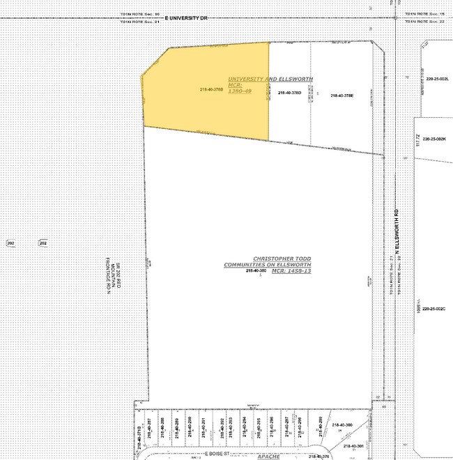
University And Ellsworth
Phoenix-Mesa-Scottsdale, AZ
UNIVERSITY AND ELLSWORTH MCR 1380-49
218-40-378B
Maricopa
Residentialacreage
Arizona
2025
1
2025
2.11 AC
420105
Red Mountain/Mesa
DEMOGRAPHICS near 9111 E University Dr
1 Mile
3 Mile
5 Mile
2024 Total Population
13,418
98,029
238,754
2029 Population
13,981
103,069
253,029
Pop Growth 2024-2029
+ 4.20%
+ 5.14%
+ 5.98%
Average Age
42
44
45
2024 Total Households
5,399
39,731
98,198
HH Growth 2024-2029
+ 4.20%
+ 5.43%
+ 6.33%
Median Household Inc
$65,060
$73,231
$77,398
Avg Household Size
2.40
2.40
2.40
2024 Avg HH Vehicles
2.00
2.00
2.00
Median Home Value
$245,975
$350,991
$390,037
Median Year Built
1990
1994
1994
Nearby Places
Map Layers
Map Styles
 Street
 Aerial
- Restaurants
- Banks
- Shops
- Fitness
- Groceries
PUBLIC TRANSPORTATION
AIRPORT
Phoenix Sky Harbor International
DRIVE
WALK
Distance
Phoenix Sky Harbor International
33 min
25.3 mi
Freight Ports
Port of San Diego
DRIVE
WALK
Distance
Port of San Diego
429 min
384.1 mi
Nearby Properties
Address
Land Use
TOTAL SIZE
Lot Size
Zoning
Address
Land Use
TOTAL SIZE
Lot Size
Zoning
493,357 SF
46.94 AC
C-N
Address
Land Use
TOTAL SIZE
Lot Size
Zoning
330,352 SF
28.30 AC
PF
Address
Land Use
TOTAL SIZE
Lot Size
Zoning
57.25 AC
PF
Address
Land Use
TOTAL SIZE
Lot Size
Zoning
324,534 SF
50.86 AC
PF
Address
Land Use
TOTAL SIZE
Lot Size
Zoning
271,098 SF
142.75 AC
PF
Address
Land Use
TOTAL SIZE
Lot Size
Zoning
390,917 SF
15.82 AC
RM4
Address
Land Use
TOTAL SIZE
Lot Size
Zoning
422,427 SF
18.21 AC
C-C
Address
Land Use
TOTAL SIZE
Lot Size
Zoning
4.77 AC
LC
Address
Land Use
TOTAL SIZE
Lot Size
Zoning
345,968 SF
14.65 AC
RM4
Address
Land Use
TOTAL SIZE
Lot Size
Zoning
244,351 SF
18.46 AC
RS43
Address
Land Use
TOTAL SIZE
Lot Size
Zoning
162,260 SF
7.62 AC
Address
Land Use
TOTAL SIZE
Lot Size
Zoning
140,141 SF
37.70 AC
PF
Address
Land Use
TOTAL SIZE
Lot Size
Zoning
172,756 SF
8.52 AC
LC
Address
Land Use
TOTAL SIZE
Lot Size
Zoning
82,772 SF
131.12 AC
PF
Address
Land Use
TOTAL SIZE
Lot Size
Zoning
267,380 SF
17.08 AC
M-H
Address
Land Use
TOTAL SIZE
Lot Size
Zoning
190,630 SF
6.61 AC
M-H
Address
Land Use
TOTAL SIZE
Lot Size
Zoning
80,180 SF
6.44 AC
R-43
Address
Land Use
TOTAL SIZE
Lot Size
Zoning
201,114 SF
11.66 AC
M-H
Address
Land Use
TOTAL SIZE
Lot Size
Zoning
142,817 SF
11.44 AC
RS43
Address
Land Use
TOTAL SIZE
Lot Size
Zoning
163,562 SF
16.34 AC
Address
Land Use
TOTAL SIZE
Lot Size
Zoning
124,850 SF
12.09 AC
RM4
Address
Land Use
TOTAL SIZE
Lot Size
Zoning
308,103 SF
14.78 AC
M-H
Address
Land Use
TOTAL SIZE
Lot Size
Zoning
138,077 SF
15.17 AC
C-G
Address
Land Use
TOTAL SIZE
Lot Size
Zoning
87,423 SF
9.43 AC
C-G
Address
Land Use
TOTAL SIZE
Lot Size
Zoning
222,228 SF
6.66 AC
RM4
Address
Land Use
TOTAL SIZE
Lot Size
Zoning
377,250 SF
7.41 AC
Address
Land Use
TOTAL SIZE
Lot Size
Zoning
52,500 SF
16.04 AC
PF
Address
Land Use
TOTAL SIZE
Lot Size
Zoning
105,700 SF
10.54 AC
C-G
Address
Land Use
TOTAL SIZE
Lot Size
Zoning
105,417 SF
12.18 AC
C-G
Address
Land Use
TOTAL SIZE
Lot Size
Zoning
209,177 SF
12.13 AC
RM-3
The World's #1 Commercial Real Estate Marketplace
Connect with us
© 2025 CoStar Group
The information above has been obtained from sources believed reliable. While we do not doubt its accuracy we have not verified it and make no guarantee, warranty or representation about it. It is your responsibility to independently confirm its accuracy and completeness. Any projections, opinions, assumptions, or estimates used are for example only and do not represent the current or future performance of the property. The value of this transaction to you depends on tax and other factors which should be evaluated by your tax, financial, and legal advisors. You and your advisors should conduct a careful, independent investigation of the property to determine to your satisfaction the suitability of the property for your needs.