Property Record
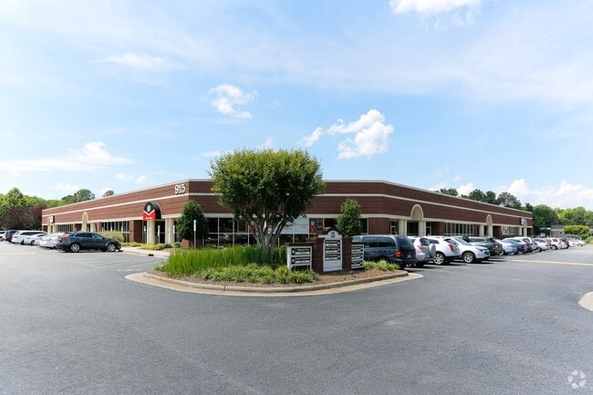
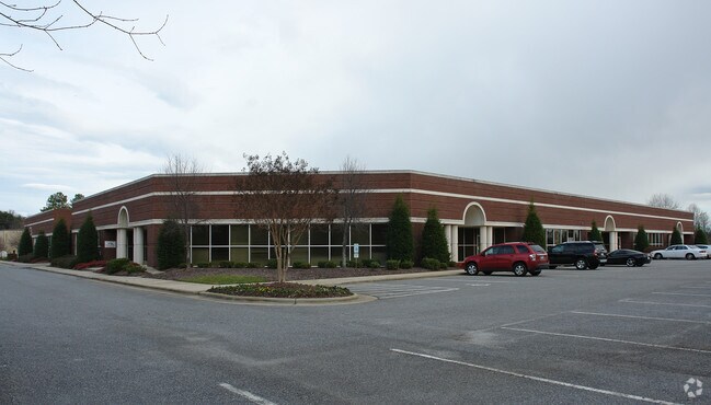
915 Tate Blvd Se, Hickory, NC 28602

NEARBY LISTINGS FOR SALE OR LEASE
Property Detail
915 Tate Blvd Se
Hickory-Lenoir-Morganton, NC
Westover Development Corp
3712051990270000
LOT 3 PLAT 26-162
Medicalbuilding
Catawba
X
North Carolina
3710371200J
3
2024
5.27 AC
2025
Catawba County
011000
Charlotte
57,427 SF
DEMOGRAPHICS near 915 Tate Blvd Se
1 Mile
3 Mile
5 Mile
2024 Total Population
4,303
39,133
72,631
2029 Population
4,467
40,996
75,704
Pop Growth 2024-2029
+ 3.81%
+ 4.76%
+ 4.23%
Average Age
40
40
41
2024 Total Households
1,684
16,553
29,880
HH Growth 2024-2029
+ 3.74%
+ 4.77%
+ 4.23%
Median Household Inc
$37,268
$49,777
$56,288
Avg Household Size
2.20
2.20
2.30
2024 Avg HH Vehicles
2.00
2.00
2.00
Median Home Value
$106,996
$175,450
$186,113
Median Year Built
1962
1977
1979
Nearby Places
Map Layers
Map Styles
 Street
 Aerial
- Restaurants
- Banks
- Shops
- Fitness
- Groceries
SALE & LEASE HISTORY
LISTING DATE
SALE/LEASE

Mar 23, 2018
For Lease
Jul 09, 2024
For Lease
Dec 18, 2020
For Lease
Nearby Properties
Address
Land Use
TOTAL SIZE
Lot Size
Zoning
Address
Land Use
TOTAL SIZE
Lot Size
Zoning
10,422 SF
4.23 AC
OI
Address
Land Use
TOTAL SIZE
Lot Size
Zoning
30,725 SF
17.17 AC
PD
Address
Land Use
TOTAL SIZE
Lot Size
Zoning
57.59 AC
OI
Address
Land Use
TOTAL SIZE
Lot Size
Zoning
8,492 SF
15.83 AC
R-4
Address
Land Use
TOTAL SIZE
Lot Size
Zoning
29,600 SF
19.05 AC
PD
Address
Land Use
TOTAL SIZE
Lot Size
Zoning
31,111 SF
8.79 AC
PD
Address
Land Use
TOTAL SIZE
Lot Size
Zoning
14,125 SF
16.76 AC
PD
Address
Land Use
TOTAL SIZE
Lot Size
Zoning
16,594 SF
7.22 AC
PD
Address
Land Use
TOTAL SIZE
Lot Size
Zoning
19.87 AC
OI
Address
Land Use
TOTAL SIZE
Lot Size
Zoning
27,008 SF
12.02 AC
R-3
Address
Land Use
TOTAL SIZE
Lot Size
Zoning
27.56 AC
OI
Address
Land Use
TOTAL SIZE
Lot Size
Zoning
94,152 SF
14.46 AC
IND
Address
Land Use
TOTAL SIZE
Lot Size
Zoning
7,722 SF
10.01 AC
R-4
Address
Land Use
TOTAL SIZE
Lot Size
Zoning
19,444 SF
8.84 AC
PD
Address
Land Use
TOTAL SIZE
Lot Size
Zoning
57,658 SF
10.64 AC
OI
Address
Land Use
TOTAL SIZE
Lot Size
Zoning
326,813 SF
37.87 AC
IND
Address
Land Use
TOTAL SIZE
Lot Size
Zoning
8,436 SF
13.28 AC
R-4
Address
Land Use
TOTAL SIZE
Lot Size
Zoning
31,854 SF
24.55 AC
PD
Address
Land Use
TOTAL SIZE
Lot Size
Zoning
353,092 SF
35.72 AC
IND
Address
Land Use
TOTAL SIZE
Lot Size
Zoning
9,376 SF
0.75 AC
C-1
Address
Land Use
TOTAL SIZE
Lot Size
Zoning
311,263 SF
37.58 AC
IND
Address
Land Use
TOTAL SIZE
Lot Size
Zoning
125,920 SF
19.53 AC
C-3
Address
Land Use
TOTAL SIZE
Lot Size
Zoning
30,415 SF
1.59 AC
C-1
Address
Land Use
TOTAL SIZE
Lot Size
Zoning
1,726 SF
15.93 AC
PD
Address
Land Use
TOTAL SIZE
Lot Size
Zoning
234,541 SF
9.07 AC
C-3
Address
Land Use
TOTAL SIZE
Lot Size
Zoning
8,992 SF
11.66 AC
R-4
Address
Land Use
TOTAL SIZE
Lot Size
Zoning
146,932 SF
27.08 AC
C-3
Address
Land Use
TOTAL SIZE
Lot Size
Zoning
90,440 SF
5.17 AC
OI
Address
Land Use
TOTAL SIZE
Lot Size
Zoning
9,950 SF
9.42 AC
R-3
Address
Land Use
TOTAL SIZE
Lot Size
Zoning
123,778 SF
19.99 AC
C-3
The World's #1 Commercial Real Estate Marketplace
Connect with us
© 2026 CoStar Group
The information above has been obtained from sources believed reliable. While we do not doubt its accuracy we have not verified it and make no guarantee, warranty or representation about it. It is your responsibility to independently confirm its accuracy and completeness. Any projections, opinions, assumptions, or estimates used are for example only and do not represent the current or future performance of the property. The value of this transaction to you depends on tax and other factors which should be evaluated by your tax, financial, and legal advisors. You and your advisors should conduct a careful, independent investigation of the property to determine to your satisfaction the suitability of the property for your needs.