Property Record
9160 Main St, Clarence, NY 14031


NEARBY LISTINGS FOR SALE OR LEASE
Property Detail
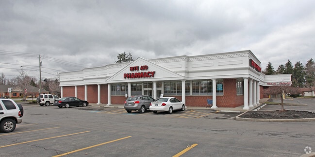
9160 Main St
Buffalo-Cheektowaga-Niagara Falls, NY
Holland Land Companys Survey
143200-071-130-0002-006-000
INT N/L MAIN & W/L SHERIDAN FL 6 TP 12
Storebuilding
Erie
X
New York
36029C0232H
6.000
2025
2.72 AC
2024
Outlying Erie County
014601
Buffalo/Niagara Falls
12,423 SF
DEMOGRAPHICS near 9160 Main St
1 Mile
3 Mile
5 Mile
2024 Total Population
2,558
27,926
94,138
2029 Population
2,567
28,041
94,173
Pop Growth 2024-2029
+ 0.35%
+ 0.41%
+ 0.04%
Average Age
43
44
44
2024 Total Households
1,006
11,170
38,947
HH Growth 2024-2029
+ 0.20%
+ 0.32%
(0.04%)
Median Household Inc
$97,058
$97,514
$90,995
Avg Household Size
2.50
2.40
2.30
2024 Avg HH Vehicles
2.00
2.00
2.00
Median Home Value
$273,106
$295,854
$279,524
Median Year Built
1967
1986
1977
Nearby Places
Map Layers
Map Styles
 Street
 Aerial
- Restaurants
- Banks
- Shops
- Fitness
- Groceries
PUBLIC TRANSPORTATION
COMMUTER RAIL
DRIVE
WALK
Distance
15 min
7.8 mi
DRIVE
WALK
Distance
16 min
8.3 mi
AIRPORT
Buffalo Niagara International
DRIVE
WALK
Distance
Buffalo Niagara International
11 min
5.6 mi
Niagara Falls International
DRIVE
WALK
Distance
Niagara Falls International
37 min
20.9 mi
SALE & LEASE HISTORY
LISTING DATE
SALE/LEASE

Mar 21, 2023
For Sale
Nearby Properties
Address
Land Use
TOTAL SIZE
Lot Size
Zoning
Address
Land Use
TOTAL SIZE
Lot Size
Zoning
868,362 SF
135.20 AC
Address
Land Use
TOTAL SIZE
Lot Size
Zoning
24,600 SF
19.20 AC
00000
Address
Land Use
TOTAL SIZE
Lot Size
Zoning
176,108 SF
20.04 AC
GB
Address
Land Use
TOTAL SIZE
Lot Size
Zoning
12,576 SF
18.15 AC
Address
Land Use
TOTAL SIZE
Lot Size
Zoning
196,113 SF
21.09 AC
Address
Land Use
TOTAL SIZE
Lot Size
Zoning
19,558 SF
11.07 AC
Address
Land Use
TOTAL SIZE
Lot Size
Zoning
11,439 SF
6.64 AC
Address
Land Use
TOTAL SIZE
Lot Size
Zoning
320,945 SF
62.80 AC
RES
Address
Land Use
TOTAL SIZE
Lot Size
Zoning
8,347 SF
14.04 AC
Address
Land Use
TOTAL SIZE
Lot Size
Zoning
163,016 SF
14.07 AC
Address
Land Use
TOTAL SIZE
Lot Size
Zoning
123,868 SF
25.41 AC
RB
Address
Land Use
TOTAL SIZE
Lot Size
Zoning
5,912 SF
8.35 AC
Address
Land Use
TOTAL SIZE
Lot Size
Zoning
206,912 SF
26.41 AC
Address
Land Use
TOTAL SIZE
Lot Size
Zoning
134,702 SF
10.70 AC
00000
Address
Land Use
TOTAL SIZE
Lot Size
Zoning
113,828 SF
9.04 AC
Address
Land Use
TOTAL SIZE
Lot Size
Zoning
71,739 SF
7.58 AC
Address
Land Use
TOTAL SIZE
Lot Size
Zoning
60,268 SF
5 AC
Address
Land Use
TOTAL SIZE
Lot Size
Zoning
110,712 SF
17.80 AC
Address
Land Use
TOTAL SIZE
Lot Size
Zoning
115,179 SF
8.80 AC
OB
Address
Land Use
TOTAL SIZE
Lot Size
Zoning
64,710 SF
6.22 AC
Address
Land Use
TOTAL SIZE
Lot Size
Zoning
176,610 SF
23.40 AC
Address
Land Use
TOTAL SIZE
Lot Size
Zoning
175,268 SF
25.99 AC
N00
Address
Land Use
TOTAL SIZE
Lot Size
Zoning
90,013 SF
3.69 AC
Address
Land Use
TOTAL SIZE
Lot Size
Zoning
157,468 SF
15.83 AC
MA
Address
Land Use
TOTAL SIZE
Lot Size
Zoning
84,940 SF
18.58 AC
RB
Address
Land Use
TOTAL SIZE
Lot Size
Zoning
126,152 SF
34.21 AC
Address
Land Use
TOTAL SIZE
Lot Size
Zoning
852 SF
4.23 AC
C
Address
Land Use
TOTAL SIZE
Lot Size
Zoning
195,246 SF
37.40 AC
Address
Land Use
TOTAL SIZE
Lot Size
Zoning
759,013 SF
71.44 AC
Address
Land Use
TOTAL SIZE
Lot Size
Zoning
18,228 SF
13.55 AC
GC
The World's #1 Commercial Real Estate Marketplace
Connect with us
© 2026 CoStar Group
The information above has been obtained from sources believed reliable. While we do not doubt its accuracy we have not verified it and make no guarantee, warranty or representation about it. It is your responsibility to independently confirm its accuracy and completeness. Any projections, opinions, assumptions, or estimates used are for example only and do not represent the current or future performance of the property. The value of this transaction to you depends on tax and other factors which should be evaluated by your tax, financial, and legal advisors. You and your advisors should conduct a careful, independent investigation of the property to determine to your satisfaction the suitability of the property for your needs.