Property Record
9165 Cahill Ave, Inver Grove Heights, MN 55076
NEARBY LISTINGS FOR SALE OR LEASE
-
-
View all Inver Grove Heights listings for sale on LoopNet.com
Property Detail
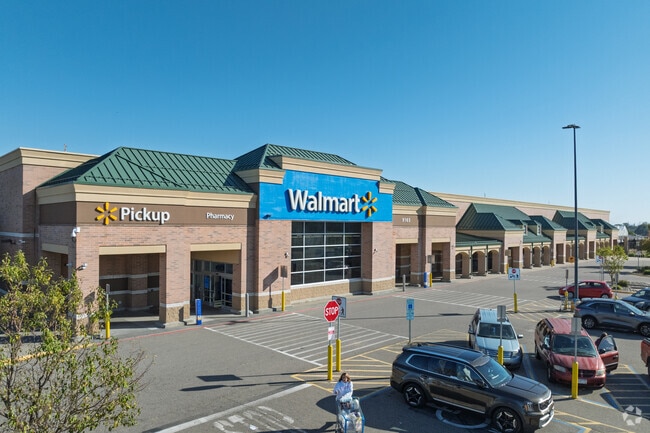
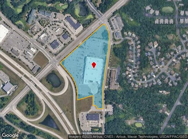
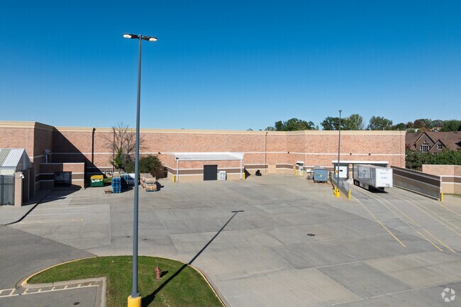
9165 Cahill Ave
Minneapolis-St. Paul-Bloomington, MN-WI
Arbor Pointe Commons
20-11900-01-010
ARBOR POINTE COMMONS 1 1
Commercialnec
Dakota
X
Minnesota
27037C0110E
10
2024
16.79 AC
2024
Eagan
060509
Minneapolis/St Paul
141,090 SF
DEMOGRAPHICS near 9165 Cahill Ave
1 Mile
3 Mile
5 Mile
2024 Total Population
4,312
25,576
92,351
2029 Population
4,360
26,242
96,135
Pop Growth 2024-2029
+ 1.11%
+ 2.60%
+ 4.10%
Average Age
44
42
40
2024 Total Households
1,911
10,058
34,711
HH Growth 2024-2029
+ 1.05%
+ 2.48%
+ 4.00%
Median Household Inc
$104,953
$91,865
$95,937
Avg Household Size
2.20
2.50
2.60
2024 Avg HH Vehicles
2.00
2.00
2.00
Median Home Value
$362,475
$320,386
$328,051
Median Year Built
1996
1989
1987
Nearby Places
Map Layers
Map Styles
 Street
 Aerial
- Restaurants
- Banks
- Shops
- Fitness
- Groceries
PUBLIC TRANSPORTATION
AIRPORT
Minneapolis-St Paul International/Wold-Chamberlain
DRIVE
WALK
Distance
Minneapolis-St Paul International/Wold-Chamberlain
20 min
12.7 mi
Freight Ports
Port Milwaukee
DRIVE
WALK
Distance
Port Milwaukee
369 min
333.5 mi
Nearby Properties
Address
Land Use
TOTAL SIZE
Lot Size
Zoning
Address
Land Use
TOTAL SIZE
Lot Size
Zoning
Address
Land Use
TOTAL SIZE
Lot Size
Zoning
6,566 SF
48.32 AC
Address
Land Use
TOTAL SIZE
Lot Size
Zoning
605,774 SF
44.50 AC
Address
Land Use
TOTAL SIZE
Lot Size
Zoning
228,810 SF
6.30 AC
Address
Land Use
TOTAL SIZE
Lot Size
Zoning
212,331 SF
9.27 AC
Address
Land Use
TOTAL SIZE
Lot Size
Zoning
169,237 SF
23.38 AC
Address
Land Use
TOTAL SIZE
Lot Size
Zoning
138,609 SF
3.76 AC
Address
Land Use
TOTAL SIZE
Lot Size
Zoning
150,469 SF
10.73 AC
Address
Land Use
TOTAL SIZE
Lot Size
Zoning
28,461 SF
16.13 AC
Address
Land Use
TOTAL SIZE
Lot Size
Zoning
128,798 SF
4.22 AC
Address
Land Use
TOTAL SIZE
Lot Size
Zoning
97,792 SF
16.39 AC
Address
Land Use
TOTAL SIZE
Lot Size
Zoning
95,693 SF
3.64 AC
Address
Land Use
TOTAL SIZE
Lot Size
Zoning
108,000 SF
6.44 AC
Address
Land Use
TOTAL SIZE
Lot Size
Zoning
72,350 SF
1.86 AC
Address
Land Use
TOTAL SIZE
Lot Size
Zoning
96,000 SF
6.41 AC
Address
Land Use
TOTAL SIZE
Lot Size
Zoning
76,452 SF
13.76 AC
Address
Land Use
TOTAL SIZE
Lot Size
Zoning
134,918 SF
15.19 AC
Address
Land Use
TOTAL SIZE
Lot Size
Zoning
85,104 SF
11.75 AC
Address
Land Use
TOTAL SIZE
Lot Size
Zoning
48,987 SF
5.04 AC
Address
Land Use
TOTAL SIZE
Lot Size
Zoning
71,296 SF
4.99 AC
Address
Land Use
TOTAL SIZE
Lot Size
Zoning
86,363 SF
22.51 AC
Address
Land Use
TOTAL SIZE
Lot Size
Zoning
479,206 SF
24.35 AC
Address
Land Use
TOTAL SIZE
Lot Size
Zoning
47,122 SF
2.44 AC
Address
Land Use
TOTAL SIZE
Lot Size
Zoning
68,980 SF
9.07 AC
Address
Land Use
TOTAL SIZE
Lot Size
Zoning
91,338 SF
12.21 AC
Address
Land Use
TOTAL SIZE
Lot Size
Zoning
Address
Land Use
TOTAL SIZE
Lot Size
Zoning
46,128 SF
25.93 AC
Address
Land Use
TOTAL SIZE
Lot Size
Zoning
129,600 SF
8.49 AC
Address
Land Use
TOTAL SIZE
Lot Size
Zoning
25,618 SF
1.84 AC
The World's #1 Commercial Real Estate Marketplace
Connect with us
© 2025 CoStar Group
The information above has been obtained from sources believed reliable. While we do not doubt its accuracy we have not verified it and make no guarantee, warranty or representation about it. It is your responsibility to independently confirm its accuracy and completeness. Any projections, opinions, assumptions, or estimates used are for example only and do not represent the current or future performance of the property. The value of this transaction to you depends on tax and other factors which should be evaluated by your tax, financial, and legal advisors. You and your advisors should conduct a careful, independent investigation of the property to determine to your satisfaction the suitability of the property for your needs.