Property Record
917 N Us Highway 27/441 St, Lady Lake, FL 32159
NEARBY LISTINGS FOR SALE OR LEASE
Property Detail
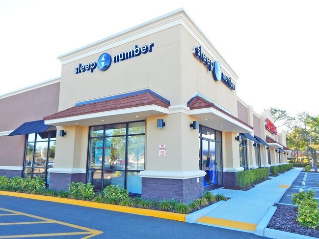
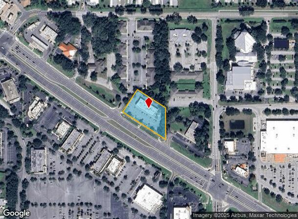
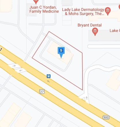
917 N Us Highway 27/441 St
07-18-24-0004-000-02700
BEG AT INTERSECTION OF E LINE OF W 1/2 OF E 1/2 OF N 1/2 OF GOV LOT 8 WITH NLY R/W LINE OF US HWY 441 SAID POINT BEING ON A CURVE CONCAVE NELY HAVING A RADIUS OF 11359.20 FT & A CENTRAL ANGLE OF 01-47-46 THENCE NWLY ALONG THE ARC OF SAID CURVE TO THE
Stripcommercialcenter
Lake
X
Florida
12119C0087D
8
2024
1.27 AC
2026
Lake County
030411
Orlando
8,520 SF
Orlando-Kissimmee-Sanford, FL
DEMOGRAPHICS near 917 N Us Highway 27/441 St
1 Mile
3 Mile
5 Mile
2024 Total Population
6,514
37,257
92,329
2029 Population
7,640
44,923
112,658
Pop Growth 2024-2029
+ 17.29%
+ 20.58%
+ 22.02%
Average Age
69
65
66
2024 Total Households
3,889
20,657
50,337
HH Growth 2024-2029
+ 17.31%
+ 20.94%
+ 22.65%
Median Household Inc
$41,740
$55,257
$60,818
Avg Household Size
1.60
1.80
1.80
2024 Avg HH Vehicles
1.00
1.00
1.00
Median Home Value
$216,165
$254,046
$272,765
Median Year Built
1991
1996
2002
Nearby Places
Map Layers
Map Styles
 Street
 Aerial
- Restaurants
- Banks
- Shops
- Fitness
- Groceries
SALE & LEASE HISTORY
LISTING DATE
SALE/LEASE

Sep 27, 2019
For Lease
Oct 30, 2017
For Sale
Mar 11, 2022
For Sale
Jan 12, 2018
For Sale
Apr 14, 2017
For Lease
Apr 04, 2017
For Sale
Nearby Properties
Address
Land Use
TOTAL SIZE
Lot Size
Zoning
Address
Land Use
TOTAL SIZE
Lot Size
Zoning
404,584 SF
29.32 AC
MF12
Address
Land Use
TOTAL SIZE
Lot Size
Zoning
344,318 SF
25.73 AC
MF18
Address
Land Use
TOTAL SIZE
Lot Size
Zoning
344,823 SF
17.53 AC
Address
Land Use
TOTAL SIZE
Lot Size
Zoning
836 SF
44.92 AC
Address
Land Use
TOTAL SIZE
Lot Size
Zoning
58,955 SF
6.85 AC
Address
Land Use
TOTAL SIZE
Lot Size
Zoning
171,544 SF
15.78 AC
CP
Address
Land Use
TOTAL SIZE
Lot Size
Zoning
71,467 SF
9.31 AC
Address
Land Use
TOTAL SIZE
Lot Size
Zoning
182,128 SF
13.25 AC
MF12
Address
Land Use
TOTAL SIZE
Lot Size
Zoning
30,641 SF
103.82 AC
CT
Address
Land Use
TOTAL SIZE
Lot Size
Zoning
165,197 SF
16.74 AC
HC
Address
Land Use
TOTAL SIZE
Lot Size
Zoning
75,108 SF
3.29 AC
Address
Land Use
TOTAL SIZE
Lot Size
Zoning
28,844 SF
12.90 AC
Address
Land Use
TOTAL SIZE
Lot Size
Zoning
60,998 SF
5 AC
Address
Land Use
TOTAL SIZE
Lot Size
Zoning
94,208 SF
12.72 AC
CP
Address
Land Use
TOTAL SIZE
Lot Size
Zoning
90,064 SF
8.12 AC
A
Address
Land Use
TOTAL SIZE
Lot Size
Zoning
101,064 SF
7.64 AC
CP
Address
Land Use
TOTAL SIZE
Lot Size
Zoning
191,879 SF
26.11 AC
PUD
Address
Land Use
TOTAL SIZE
Lot Size
Zoning
47,741 SF
1.50 AC
Address
Land Use
TOTAL SIZE
Lot Size
Zoning
78,586 SF
1.61 AC
CP
Address
Land Use
TOTAL SIZE
Lot Size
Zoning
29,018 SF
2.43 AC
HC
Address
Land Use
TOTAL SIZE
Lot Size
Zoning
57,545 SF
8.80 AC
Address
Land Use
TOTAL SIZE
Lot Size
Zoning
45,553 SF
12.86 AC
Address
Land Use
TOTAL SIZE
Lot Size
Zoning
91,762 SF
3.24 AC
Address
Land Use
TOTAL SIZE
Lot Size
Zoning
69,101 SF
9.69 AC
CP
Address
Land Use
TOTAL SIZE
Lot Size
Zoning
169,950 SF
18.74 AC
A
Address
Land Use
TOTAL SIZE
Lot Size
Zoning
101,154 SF
19.35 AC
PFD
Address
Land Use
TOTAL SIZE
Lot Size
Zoning
103,632 SF
9.59 AC
Address
Land Use
TOTAL SIZE
Lot Size
Zoning
106,910 SF
10.40 AC
CP
Address
Land Use
TOTAL SIZE
Lot Size
Zoning
43,686 SF
1.23 AC
CP
Address
Land Use
TOTAL SIZE
Lot Size
Zoning
67,350 SF
1.52 AC
CP
The World's #1 Commercial Real Estate Marketplace
Connect with us
© 2025 CoStar Group
The information above has been obtained from sources believed reliable. While we do not doubt its accuracy we have not verified it and make no guarantee, warranty or representation about it. It is your responsibility to independently confirm its accuracy and completeness. Any projections, opinions, assumptions, or estimates used are for example only and do not represent the current or future performance of the property. The value of this transaction to you depends on tax and other factors which should be evaluated by your tax, financial, and legal advisors. You and your advisors should conduct a careful, independent investigation of the property to determine to your satisfaction the suitability of the property for your needs.